
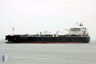
MARAN ATLAS
Crude Oil Tanker
Current Trip
| Time Travelled | 16 days |
|---|---|
| Remaining Time | 3 h, 41 mins |
| Distance Travelled | 298.46 nm |
| Remaining Distance | 40.01 nm |
| AVG Speed | 9.1 Knots |
| MAX Speed | 12 Knots |
| AVG Wind | 9.4 knots |
| MAX Wind | 26 knots |
| MIN Temp | -1.4°C / 29.48°F |
| MAX Temp | 13.8°C / 56.84°F |
| Dybgang | 9.5 m |
| Position Modtaget | Nu |
Current Position
| Longitude | 13.18995° |
|---|---|
| Latitude | 45.23062° |
| Status | Under way using engine |
| Fart | 10.3 Knots |
| Kurs | 342° |
| Område | Adriatic Sea |
| Station | T-AIS |
| Position Modtaget | Nu |
Info
Information
The current position of MARAN ATLAS is in Adriatic Sea with coordinates 45.23062° / 13.18995° as reported on 2025-02-27 17:40 by AIS to our vessel tracker app. The vessel's current speed is 10.3 Knots and is heading at the port of TRIESTE. The estimated time of arrival as calculated by MyShipTracking vessel tracking app is 2025-02-27 21:21 LT
The vessel MARAN ATLAS (IMO: 9414022, MMSI: 240891000) is a Crude Oil Tanker that was built in 2009 ( 16 år gamle ). It's sailing under the flag of [GR] Greece.
In this page you can find informations about the vessels current position, last detected port calls, and current voyage information. If the vessels is not in coverage by AIS you will find the latest position.
The current position of MARAN ATLAS is detected by our AIS receivers and we are not responsible for the reliability of the data. The last position was recorded while the vessel was in Coverage by the Ais receivers of our vessel tracking app.
The current draught of MARAN ATLAS as reported by AIS is 9.5 meters
Weather
| Temperature | 10.4°C / 50.72°F |
|---|---|
| Wind Speed | 9 knots |
| Direction | 24° NNE |
| Pressure | 1016.4 hPa |
| Humidity | 73.4 % |
| Cloud Coverage | 58 % |
Featured Company
Last Port Calls
| Port | Arrival | Departure | Time In Port |
|---|---|---|---|
| 2025-02-10 14:25 | 2025-02-11 09:09 | 18 h | |
| 2025-01-24 21:09 | 2025-01-25 15:33 | 18 h | |
| 2025-01-14 08:12 | 2025-01-15 17:45 | 1 d | |
| 2025-01-04 05:47 | 2025-01-05 09:48 | 1 d | |
| 2024-12-23 08:35 | 2024-12-24 16:00 | 1 d | |
| 2024-12-16 21:01 | 2024-12-17 15:16 | 18 h | |
| 2024-12-04 15:58 | 2024-12-05 23:58 | 1 d |
Last Trips
| Origin | Departure | Destination | Arrival | Distance | |
|---|---|---|---|---|---|
| 2025-01-25 18:33 | 2025-02-10 15:25 | 1449.58 nm | |||
| 2025-01-15 18:45 | 2025-01-25 00:09 | 1530.04 nm | |||
| 2025-01-05 10:48 | 2025-01-14 09:12 | 1969.02 nm | |||
| 2024-12-24 17:00 | 2025-01-04 06:47 | 2063.88 nm | |||
| 2024-12-17 18:16 | 2024-12-23 09:35 | 1441.07 nm | |||
| 2024-12-06 00:58 | 2024-12-17 00:01 | 1653.85 nm | |||
| 2024-11-17 16:51 | 2024-12-04 16:58 | 2332.87 nm |
Events
| Tid | Hændelsen | Detaljer | Position / Dest | Info |
|---|---|---|---|---|
| 2025-02-27 10:15 | ETA er ændret | 2025/02/27 23:00 2025/02/25 06:00 |
44.21267 / 14.04213
IT TRS
|
Fart: 9.3 kn Kurs: 325° |
| 2025-02-27 10:14 | Status er ændret | Under way using engine Default |
44.21092 / 14.04383
IT TRS
|
Fart: 9.5 kn Kurs: 326° |
| 2025-02-27 10:14 | Indenfor Dækning |
44.21267 / 14.04213
Adriatic Sea
IT TRS
|
Fart: 9.3 kn Kurs: 325° |
|
| 2025-02-27 07:02 | START Sejllads | 18.92 nm, South West of BRBINJ |
43.93447 / 14.60987
IT TRS
|
Fart: 8 kn Kurs: 285° |
| 2025-02-20 17:13 | STOP Sejllads | 17.98 nm, South West of BRBINJ |
43.93063 / 14.63768
IT TRS
|
Fart: 0.3 kn Kurs: 330° |
| 2025-02-20 16:11 | START Sejllads | 21.24 nm, South West of ZVERNAC |
43.93562 / 14.53600
IT TRS
|
Fart: 6.8 kn Kurs: 97° |
| 2025-02-20 11:56 | STOP Sejllads | 20.81 nm, South West of ZVERNAC |
43.96068 / 14.52172
IT TRS
|
Fart: 0.3 kn Kurs: 314° |
| 2025-02-20 10:11 | START Sejllads | 20.37 nm, South West of ZVERNAC |
43.95257 / 14.54272
IT TRS
|
Fart: 3.5 kn Kurs: 49° |
| 2025-02-19 17:28 | STOP Sejllads | 19.99 nm, South West of IST |
44.01792 / 14.46455
IT TRS
|
Fart: 0.3 kn Kurs: 19° |
| 2025-02-19 12:51 | START Sejllads | 19.52 nm, South West of IST |
44.01883 / 14.47990
IT TRS
|
Fart: 3.3 kn Kurs: 318° |