
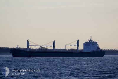
RUDDY
Bulk Carrier
Current Trip
| Time Travelled | 9 days |
|---|---|
| Remaining Time | 24 mins |
| Distance Travelled | 2747.27 nm |
| Remaining Distance | 5.20 nm |
| AVG Speed | 11.1 Noeuds |
| MAX Speed | 13.7 Noeuds |
| AVG Wind | 9.8 knots |
| MAX Wind | 22 knots |
| MIN Temp | -1.7°C / 28.94°F |
| MAX Temp | 16.9°C / 62.42°F |
| Tirant d eau | 6.1 m |
| Position reçue | Maintenant |
Current Position
| Longitude | -1.22815° |
|---|---|
| Latitude | 46.08633° |
| Etat | Under way using engine |
| Vitesse | 1.8 Noeuds |
| Parcours | 88° |
| Zone | Bay of Biscay |
| Station | T-AIS |
| Position reçue | Maintenant |
Info
Information
The current position of RUDDY is in Bay of Biscay with coordinates 46.08633° / -1.22815° as reported on 2025-02-27 20:46 by AIS to our vessel tracker app. The vessel's current speed is 1.8 Noeuds and is heading at the port of LA PALLICE. The estimated time of arrival as calculated by MyShipTracking vessel tracking app is 2025-02-27 21:11 LT
The vessel RUDDY (IMO: 9459981, MMSI: 212215000) is a Bulk Carrier that was built in 2009 ( 16 Age ). It's sailing under the flag of [CY] Cyprus.
In this page you can find informations about the vessels current position, last detected port calls, and current voyage information. If the vessels is not in coverage by AIS you will find the latest position.
The current position of RUDDY is detected by our AIS receivers and we are not responsible for the reliability of the data. The last position was recorded while the vessel was in Coverage by the Ais receivers of our vessel tracking app.
The current draught of RUDDY as reported by AIS is 6.1 meters
Weather
| Temperature | 9°C / 48.2°F |
|---|---|
| Wind Speed | 10 knots |
| Direction | 45° NE |
| Pressure | 1024 hPa |
| Humidity | 72.9 % |
| Cloud Coverage | 100 % |
Featured Company
Last Port Calls
| Port | Arrival | Departure | Time In Port |
|---|---|---|---|
| 2025-02-13 19:46 | 2025-02-18 00:58 | 4 d | |
| 2025-01-15 09:52 | |||
| 2025-01-07 10:51 | 2025-01-07 17:15 | 6 h | |
| 2024-12-03 04:41 |
Most Visited Ports (Last year)
| Port | Arrivals | |
|---|---|---|
| 2 | ||
| 2 | ||
| 2 | ||
| 2 | ||
| 2 | ||
| 1 |
Last Trips
| Origin | Departure | Destination | Arrival | Distance | |
|---|---|---|---|---|---|
| 2025-01-15 04:52 | 2025-02-13 20:46 | 5352.94 nm | |||
| 2024-12-03 05:41 | 2025-01-07 05:51 | 6814.44 nm |
Events
| Heure | Evenement | Détails | Position/ Destination | Info |
|---|---|---|---|---|
| 2025-02-27 19:53 | Changement d'ETA | 2025/02/27 21:00 2025/02/27 17:40 |
46.09914 / -1.34773
FR LPE
|
Vitesse: 9.5 kn Parcours: 98.5° |
| 2025-02-27 19:20 | Etat Changé | Under way using engine Default |
46.11013 / -1.47098
FR LPE
|
Vitesse: 9.9 kn Parcours: 100° |
| 2025-02-27 19:11 | Etat Changé | Default Under way using engine |
46.11306 / -1.50817
FR LPE
|
Vitesse: 9.9 kn Parcours: 99.2° |
| 2025-02-27 18:54 | Changement de zone | French part of the Bay of Biscay Portuguese part of the North Atlantic Ocean |
46.12038 / -1.57736
Bay of Biscay
FR LPE
|
Vitesse: 10.7 kn Parcours: 98.3° |
| 2025-02-27 18:54 | Dans la zone couverte |
46.12038 / -1.57736
Bay of Biscay
FR LPE
|
Vitesse: 10.7 kn Parcours: 98.3° |
|
| 2025-02-25 12:41 | Etat Changé | Default Under way using engine |
39.57079 / -9.82565
FR LPE
|
Vitesse: 10.2 kn Parcours: 2.3° |
| 2025-02-25 12:36 | Hors de la zone couverte |
39.55515 / -9.82638
North Atlantic Ocean
FR LPE
|
Vitesse: 10.2 kn Parcours: 2.3° |
|
| 2025-02-25 12:25 | Etat Changé | Under way using engine Default |
39.52415 / -9.82762
FR LPE
|
Vitesse: 10.4 kn Parcours: 0° |
| 2025-02-25 12:22 | Etat Changé | Default Under way using engine |
39.51530 / -9.82789
FR LPE
|
Vitesse: 10.2 kn Parcours: 4.3° |
| 2025-02-25 08:37 | Etat Changé | Under way using engine Default |
38.87156 / -9.83722
FR LPE
|
Vitesse: 10.2 kn Parcours: 359° |