
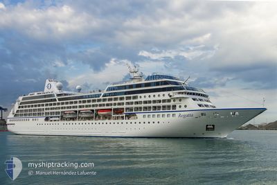
REGATTA
Passengers Ship
Current Trip
| Time Travelled | 12 h, 26 mins |
|---|---|
| Remaining Time | 4 h, 51 mins |
| Distance Travelled | 196.48 nm |
| Remaining Distance | 71.85 nm |
| AVG Speed | 16 Knopen |
| MAX Speed | 17.3 Knopen |
| AVG Wind | 8.5 knots |
| MAX Wind | 13 knots |
| MIN Temp | 15.3°C / 59.54°F |
| MAX Temp | 18.7°C / 65.66°F |
| Diepgang | 5.9 M |
| Positie ontvangen | Nu |
Current Position
| Lengtegraad | 174.89117° |
|---|---|
| Breedtegraat | -41.55268° |
| Status | Under way using engine |
| Snelheid | 13.9 Knopen |
| Koers | 301.2° |
| Gebied | Tasman Sea |
| Station | T-AIS |
| Positie ontvangen | Nu |
Info
Information
The current position of REGATTA is in Tasman Sea with coordinates -41.55268° / 174.89117° as reported on 2025-02-27 16:38 by AIS to our vessel tracker app. The vessel's current speed is 13.9 Knopen and is heading at the port of PICTON. The estimated time of arrival as calculated by MyShipTracking vessel tracking app is 2025-02-28 10:29 LT
The vessel REGATTA (IMO: 9156474, MMSI: 538001664) is a Passengers Ship that was built in 1998 ( 27 Jaar oud ). It's sailing under the flag of [MH] Marshall Is.
In this page you can find informations about the vessels current position, last detected port calls, and current voyage information. If the vessels is not in coverage by AIS you will find the latest position.
The current position of REGATTA is detected by our AIS receivers and we are not responsible for the reliability of the data. The last position was recorded while the vessel was in Coverage by the Ais receivers of our vessel tracking app.
The current draught of REGATTA as reported by AIS is 5.9 meters
Weather
| Temperature | 15.3°C / 59.54°F |
|---|---|
| Wind Speed | 8 knots |
| Direction | 63° ENE |
| Pressure | 1023.1 hPa |
| Humidity | 83.8 % |
| Cloud Coverage | 33 % |
Featured Company
Last Port Calls
| Port | Arrival | Departure | Time In Port |
|---|---|---|---|
| 2025-02-27 06:12 | 2025-02-27 17:12 | 10 h | |
| 2025-02-25 08:11 | 2025-02-25 19:35 | 11 h | |
| 2025-02-24 05:24 | 2025-02-24 19:29 | 14 h | |
| 2025-02-23 08:33 | 2025-02-23 17:50 | 9 h | |
| 2025-02-21 09:04 | 2025-02-21 19:24 | 10 h | |
| 2025-02-20 06:17 | 2025-02-20 17:10 | 10 h | |
| 2025-02-19 07:15 | 2025-02-19 18:59 | 11 h | |
| 2025-02-18 10:57 | 2025-02-18 20:19 | 9 h | |
| 2025-02-14 11:35 | 2025-02-14 20:53 | 9 h | |
| 2025-02-13 07:55 | 2025-02-13 16:16 | 8 h |
Last Trips
| Origin | Departure | Destination | Arrival | Distance | |
|---|---|---|---|---|---|
| 2025-02-25 19:35 | 2025-02-27 06:12 | 324.87 nm | |||
| 2025-02-24 19:29 | 2025-02-25 08:11 | 152.43 nm | |||
| 2025-02-23 17:50 | 2025-02-24 05:24 | 150.92 nm | |||
| 2025-02-21 19:24 | 2025-02-23 08:33 | 328.11 nm | |||
| 2025-02-20 17:10 | 2025-02-21 09:04 | 224.56 nm | |||
| 2025-02-19 18:59 | 2025-02-20 06:17 | 174.34 nm | |||
| 2025-02-18 20:19 | 2025-02-19 07:15 | 130.17 nm | |||
| 2025-02-14 20:53 | 2025-02-18 10:57 | 1212.22 nm | |||
| 2025-02-13 16:16 | 2025-02-14 11:35 | 326.14 nm | |||
| 2025-02-12 17:06 | 2025-02-13 07:55 | 220.35 nm |
Events
| Tijd | Evenement | Details | Positie / Bestemming | Info |
|---|---|---|---|---|
| 2025-02-27 16:03 | Destination Changed | NZ PCN NZ GIS |
-41.61993 / 175.03260
NZ PCN
|
Snelheid: 13.8 kn Koers: 299.8° |
| 2025-02-27 16:03 | ETA Changed | 2025/02/27 20:30 2025/02/25 20:00 |
-41.61993 / 175.03260
NZ PCN
|
Snelheid: 13.8 kn Koers: 299.8° |
| 2025-02-27 15:56 | Wijzig zee gebeid | New Zealand part of the Tasman Sea New Zealand part of the South Pacific Ocean |
-41.63494 / 175.06821
Tasman Sea
|
Snelheid: 14.2 kn Koers: 299.2° |
| 2025-02-27 15:45 | Status Changed | Under way using engine Default |
-41.65441 / 175.11819
NZ GIS
|
Snelheid: 13.8 kn Koers: 296° |
| 2025-02-27 15:44 | Status Changed | Default Under way using engine |
-41.65580 / 175.12204
NZ GIS
|
Snelheid: 13.6 kn Koers: 286.8° |
| 2025-02-27 15:35 | Status Changed | Under way using engine Default |
-41.66643 / 175.16352
NZ GIS
|
Snelheid: 13.5 kn Koers: 284° |
| 2025-02-27 15:19 | Status Changed | Default Under way using engine |
-41.67869 / 175.24080
NZ GIS
|
Snelheid: 13.1 kn Koers: 269.9° |
| 2025-02-27 15:06 | Status Changed | Under way using engine Default |
-41.67746 / 175.30424
NZ GIS
|
Snelheid: 13.2 kn Koers: 259° |
| 2025-02-27 15:04 | Status Changed | Default Under way using engine |
-41.67666 / 175.31230
NZ GIS
|
Snelheid: 15.8 kn Koers: 254.1° |
| 2025-02-27 14:59 | Status Changed | Under way using engine Default |
-41.67062 / 175.34223
NZ GIS
|
Snelheid: 16 kn Koers: 255° |