
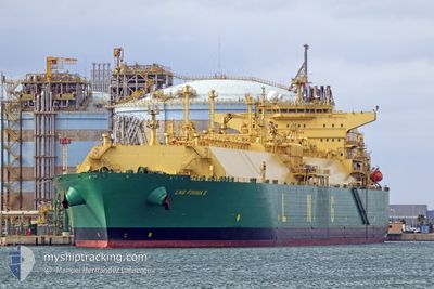
LNG FINIMA II
Tanker A
Current Trip
| Time Travelled | 21 days |
|---|---|
| Remaining Time | --- |
| Distance Travelled | 6288.52 nm |
| Remaining Distance | --- |
| AVG Speed | 12.1 Knop |
| MAX Speed | 16.3 Knop |
| AVG Wind | 14.1 knots |
| MAX Wind | 29.9 knots |
| MIN Temp | 5.4°C / 41.72°F |
| MAX Temp | 28.2°C / 82.76°F |
| Djupgående | 11.6 m |
| Position mottagen | 18 m sen |
Current Position
| Longitud | 3.51000° |
|---|---|
| Latitude | 52.02050° |
| Status | At anchor |
| Fart | 0.2 Knop |
| Kurs | 352° |
| Område | North Sea |
| Station | T-AIS |
| Position mottagen | 18 m sen |
Info
Information
The current position of LNG FINIMA II is in North Sea with coordinates 52.02050° / 3.51000° as reported on 2025-02-27 09:45 by AIS to our vessel tracker app. The vessel's current speed is 0.2 Knop
The vessel LNG FINIMA II (IMO: 9690145, MMSI: 310722000) is a Tanker A It's sailing under the flag of [BM] Bermuda.
In this page you can find informations about the vessels current position, last detected port calls, and current voyage information. If the vessels is not in coverage by AIS you will find the latest position.
The current position of LNG FINIMA II is detected by our AIS receivers and we are not responsible for the reliability of the data. The last position was recorded while the vessel was in Coverage by the Ais receivers of our vessel tracking app.
The current draught of LNG FINIMA II as reported by AIS is 11.6 meters
Weather
| Temperature | 5.7°C / 42.26°F |
|---|---|
| Wind Speed | 15 knots |
| Direction | 287° WNW |
| Pressure | 1014.7 hPa |
| Humidity | 83.8 % |
| Cloud Coverage | 67 % |
Featured Company
Most Visited Ports (Last year)
| Port | Arrivals | |
|---|---|---|
| 2 | ||
| 2 | ||
| 2 | ||
| 1 | ||
| 1 | ||
| 1 |
Events
| Tid | Event | Detaljer | Position / Dest | Information |
|---|---|---|---|---|
| 2025-02-27 09:51 | Status ändrad | Default At anchor |
52.02056 / 3.51051
GATE, ROTTERDAM
|
Fart: 0.2 kn Kurs: 352° |
| 2025-02-27 09:45 | Status ändrad | At anchor Default |
52.02050 / 3.51000
GATE, ROTTERDAM
|
Fart: 0.1 kn Kurs: 1° |
| 2025-02-27 09:45 | I täckningsområde |
52.02050 / 3.51000
North Sea
GATE, ROTTERDAM
|
Fart: 0.2 kn Kurs: 75° |
|
| 2025-02-27 07:31 | Status ändrad | Default At anchor |
52.02030 / 3.50824
GATE, ROTTERDAM
|
Fart: 0.1 kn Kurs: 5° |
| 2025-02-27 07:27 | UTANFÖR täckningsområde |
52.02036 / 3.50829
North Sea
GATE, ROTTERDAM
|
Fart: 0.1 kn Kurs: 200.6° |
|
| 2025-02-27 07:24 | Status ändrad | At anchor Default |
52.02045 / 3.50834
GATE, ROTTERDAM
|
Fart: 0.1 kn Kurs: 358° |
| 2025-02-27 07:16 | Status ändrad | Default At anchor |
52.02069 / 3.50861
GATE, ROTTERDAM
|
Fart: 0.1 kn Kurs: 355° |
| 2025-02-27 07:03 | Status ändrad | At anchor Default |
52.02062 / 3.50942
GATE, ROTTERDAM
|
Fart: 0.1 kn Kurs: 332° |
| 2025-02-27 06:27 | Status ändrad | Default At anchor |
52.02104 / 3.51215
GATE, ROTTERDAM
|
Fart: 0.1 kn Kurs: 305° |
| 2025-02-27 06:15 | Status ändrad | At anchor Default |
52.02163 / 3.51289
GATE, ROTTERDAM
|
Fart: 0.1 kn Kurs: 300° |