
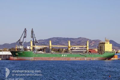
AAL MERKUR
General Cargo
Current Trip
| Time Travelled | 11 days |
|---|---|
| Remaining Time | 11 days |
| Distance Travelled | 3294.69 nm |
| Remaining Distance | 3682.53 nm |
| AVG Speed | 12.3 Knots |
| MAX Speed | 14.1 Knots |
| AVG Wind | 11.7 knots |
| MAX Wind | 22 knots |
| MIN Temp | 11.5°C / 52.7°F |
| MAX Temp | 28.5°C / 83.3°F |
| Dybgang | 7.7 m |
| Position Modtaget | 5 d siden |
Current Position
| Longitude | -15.17462° |
|---|---|
| Latitude | 27.70981° |
| Status | Under way using engine |
| Fart | 13.3 Knots |
| Kurs | 202.9° |
| Område | North Atlantic Ocean |
| Station | T-AIS |
| Position Modtaget | 5 d siden |
Info
Information
The current position of AAL MERKUR is in North Atlantic Ocean with coordinates 27.70981° / -15.17462° as reported on 2025-02-05 16:10 by AIS to our vessel tracker app. The vessel's current speed is 13.3 Knots and is heading at the port of DURBAN. The estimated time of arrival as calculated by MyShipTracking vessel tracking app is 2025-02-22 17:28 LT
The vessel AAL MERKUR (IMO: 9509695, MMSI: 636016912) is a General Cargo that was built in 2010 ( 15 år gamle ). It's sailing under the flag of [LR] Liberia.
In this page you can find informations about the vessels current position, last detected port calls, and current voyage information. If the vessels is not in coverage by AIS you will find the latest position.
The current position of AAL MERKUR is detected by our AIS receivers and we are not responsible for the reliability of the data. The last position was recorded while the vessel was in Coverage by the Ais receivers of our vessel tracking app.
The current draught of AAL MERKUR as reported by AIS is 7.7 meters
Weather
| Temperature | 28.1°C / 82.58°F |
|---|---|
| Wind Speed | 5 knots |
| Direction | 316° NW |
| Pressure | 1008.2 hPa |
| Humidity | 74.7 % |
| Cloud Coverage | 100 % |
Featured Company
Most Visited Ports (Last year)
| Port | Arrivals | |
|---|---|---|
| 2 | ||
| 2 | ||
| 1 | ||
| 1 | ||
| 1 | ||
| 1 |
Events
| Tid | Hændelsen | Detaljer | Position / Dest | Info |
|---|---|---|---|---|
| 2025-02-05 16:11 | Status er ændret | Default Under way using engine |
27.70530 / -15.17689
ZADUR
|
Fart: 13.3 kn Kurs: 202.9° |
| 2025-02-05 16:10 | Status er ændret | Under way using engine Default |
27.70981 / -15.17462
ZADUR
|
Fart: 13.2 kn Kurs: 200° |
| 2025-02-05 16:10 | Udenfor Dækning |
27.70981 / -15.17462
North Atlantic Ocean
ZADUR
|
Fart: 13.3 kn Kurs: 202.9° |
|
| 2025-02-05 16:07 | Status er ændret | Default Under way using engine |
27.72010 / -15.17006
ZADUR
|
Fart: 13.2 kn Kurs: 199.7° |
| 2025-02-05 13:48 | ETA er ændret | 2025/02/23 04:00 2025/02/22 22:00 |
28.19078 / -14.97922
ZADUR
|
Fart: 12.8 kn Kurs: 200.4° |
| 2025-02-05 11:19 | Ændre havområde | Spanish (Canary Islands) part of the North Atlantic Ocean Spanish part of the Strait of Gibraltar |
28.63338 / -14.66454
North Atlantic Ocean
ZADUR
|
Fart: 12.7 kn Kurs: 218.7° |
| 2025-02-05 11:17 | Indenfor Dækning |
28.63338 / -14.66454
North Atlantic Ocean
ZADUR
|
Fart: 12.7 kn Kurs: 218.7° |
|
| 2025-02-05 11:14 | Status er ændret | Under way using engine Default |
28.64829 / -14.65082
ZADUR
|
Fart: 12.7 kn Kurs: 218° |
| 2025-02-03 10:06 | Status er ændret | Default Under way using engine |
35.85892 / -5.99618
ZADUR
|
Fart: 10.4 kn Kurs: 229.6° |
| 2025-02-03 10:02 | Udenfor Dækning |
35.86716 / -5.98426
Strait of Gibraltar
ZADUR
|
Fart: 10.4 kn Kurs: 229.6° |