
ACTION
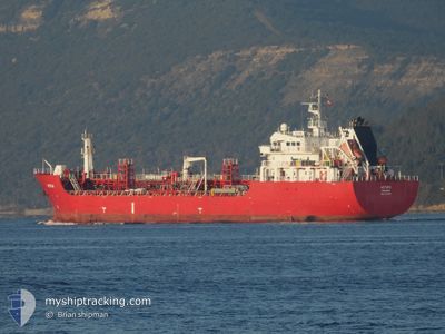
Asphalt/Bitumen Tanker
Current Trip
| Time Travelled | 3 days |
|---|---|
| Remaining Time | 1 day |
| Distance Travelled | 443.48 nm |
| Remaining Distance | 298.15 nm |
| AVG Speed | 8.8 Knots |
| MAX Speed | 11.4 Knots |
| AVG Wind | 9.8 knots |
| MAX Wind | 18 knots |
| MIN Temp | 11.7°C / 53.06°F |
| MAX Temp | 18.5°C / 65.3°F |
| Dybgang | 5 m |
| Position Modtaget | 1 m siden |
Current Position
| Longitude | -9.84907° |
|---|---|
| Latitude | 39.39616° |
| Status | Under way using engine |
| Fart | 10.7 Knots |
| Kurs | 0.8° |
| Område | North Atlantic Ocean |
| Station | T-AIS |
| Position Modtaget | 1 m siden |
Info
Information
The current position of ACTION is in North Atlantic Ocean with coordinates 39.39616° / -9.84907° as reported on 2025-02-15 02:51 by AIS to our vessel tracker app. The vessel's current speed is 10.7 Knots and is heading at the port of CORUNA. The estimated time of arrival as calculated by MyShipTracking vessel tracking app is 2025-02-16 05:48 LT
The vessel ACTION (IMO: 9507984, MMSI: 255917000) is a Asphalt/Bitumen Tanker that was built in 2010 ( 15 år gamle ). It's sailing under the flag of [PT] Portugal.
In this page you can find informations about the vessels current position, last detected port calls, and current voyage information. If the vessels is not in coverage by AIS you will find the latest position.
The current position of ACTION is detected by our AIS receivers and we are not responsible for the reliability of the data. The last position was recorded while the vessel was in Coverage by the Ais receivers of our vessel tracking app.
The current draught of ACTION as reported by AIS is 5 meters
Weather
| Temperature | 14.4°C / 57.92°F |
|---|---|
| Wind Speed | 18 knots |
| Direction | 161° SSE |
| Pressure | 1012 hPa |
| Humidity | 86.2 % |
| Cloud Coverage | 100 % |
Featured Company
Last Port Calls
| Port | Arrival | Departure | Time In Port |
|---|---|---|---|
| 2025-02-09 11:42 | 2025-02-11 14:28 | 2 d | |
| 2025-02-02 18:49 | 2025-02-03 17:07 | 22 h | |
| 2025-01-21 08:23 | 2025-01-22 07:05 | 22 h | |
| 2025-01-18 21:59 | 2025-01-19 06:03 | 8 h | |
| 2025-01-16 13:43 | 2025-01-18 02:03 | 1 d | |
| 2025-01-09 16:29 | 2025-01-10 17:00 | 1 d | |
| 2025-01-03 14:12 | 2025-01-05 14:11 | 1 d | |
| 2024-12-29 22:09 | 2024-12-30 23:53 | 1 d | |
| 2024-12-23 07:07 | 2024-12-24 12:33 | 1 d | |
| 2024-12-18 23:53 | 2024-12-19 21:13 | 21 h |
Most Visited Ports (Last year)
| Port | Arrivals | |
|---|---|---|
| 18 | ||
| 16 | ||
| 9 | ||
| 5 | ||
| 4 | ||
| 4 |
Last Trips
| Origin | Departure | Destination | Arrival | Distance | |
|---|---|---|---|---|---|
| 2025-02-03 18:07 | 2025-02-09 12:42 | 940.47 nm | |||
| 2025-01-22 08:05 | 2025-02-02 19:49 | 1441.86 nm | |||
| 2025-01-19 07:03 | 2025-01-21 09:23 | 492.66 nm | |||
| 2025-01-18 03:03 | 2025-01-18 22:59 | 200.24 nm | |||
| 2025-01-10 18:00 | 2025-01-16 14:43 | 1011.01 nm | |||
| 2025-01-05 15:11 | 2025-01-09 17:29 | 936.22 nm | |||
| 2024-12-31 00:53 | 2025-01-03 15:12 | 687.80 nm | |||
| 2024-12-24 13:33 | 2024-12-29 23:09 | 693.85 nm | |||
| 2024-12-19 22:13 | 2024-12-23 08:07 | 698.07 nm | |||
| 2024-12-17 11:22 | 2024-12-19 00:53 | 7.80 nm |
Events
| Tid | Hændelsen | Detaljer | Position / Dest | Info |
|---|---|---|---|---|
| 2025-02-14 19:09 | START Sejllads | 1.95 nm, West of ALMADA |
38.68678 / -9.18646
ESLCG
|
Fart: 5.8 kn Kurs: 297.5° |
| 2025-02-14 19:04 | ETA er ændret | 2025/02/16 09:00 2025/02/14 10:00 |
38.68573 / -9.18484
ESLCG
|
Fart: 0.6 kn Kurs: 88° |
| 2025-02-14 18:59 | Status er ændret | Under way using engine At anchor |
38.68579 / -9.18562
ESLCG
|
Fart: 0.1 kn Kurs: 72° |
| 2025-02-14 18:59 | Destination er ændret | ESLCG PTLIS |
38.68584 / -9.18578
ESLCG
|
Fart: 0.1 kn Kurs: 72° |
| 2025-02-14 10:44 | Status er ændret | At anchor Under way using engine |
38.68543 / -9.18593
PTLIS
|
Fart: 1 kn Kurs: 58° |
| 2025-02-14 10:40 | STOP Sejllads | 1.88 nm, West of ALMADA |
38.68547 / -9.18488
PTLIS
|
Fart: 0.3 kn Kurs: 78° |
| 2025-02-14 08:17 | START Sejllads | 8.7 nm, South West of OEIRAS |
38.54328 / -9.39261
PTLIS
|
Fart: 3.7 kn Kurs: 138° |
| 2025-02-14 08:07 | STOP Sejllads | 8.6 nm, South West of OEIRAS |
38.54509 / -9.39272
PTLIS
|
Fart: 0.3 kn Kurs: 157° |
| 2025-02-14 01:06 | ETA er ændret | 2025/02/14 10:00 2025/02/14 00:01 |
37.52609 / -9.36547
PTLIS
|
Fart: 9.3 kn Kurs: 357.7° |
| 2025-02-14 00:51 | Status er ændret | Under way using engine Default |
37.48841 / -9.36413
PTLIS
|
Fart: 9 kn Kurs: 359° |