
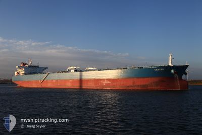
ADVANTAGE SUGAR
Crude Oil Tanker
Current Trip
| Time Travelled | 34 mins |
|---|---|
| Remaining Time | --- |
| Distance Travelled | 3.38 nm |
| Remaining Distance | --- |
| AVG Speed | 9.8 Knots |
| MAX Speed | 11.1 Knots |
| AVG Wind | 5.3 knots |
| MAX Wind | 7 knots |
| MIN Temp | 12°C / 53.6°F |
| MAX Temp | 13°C / 55.4°F |
| Dybgang | 15.9 m |
| Position Modtaget | 4 d siden |
Current Position
| Longitude | 15.40195° |
|---|---|
| Latitude | 37.15192° |
| Status | Under way using engine |
| Fart | 6.8 Knots |
| Kurs | 103.4° |
| Område | Ionian Sea |
| Station | T-AIS |
| Position Modtaget | 4 d siden |
Info
Information
The current position of ADVANTAGE SUGAR is in Ionian Sea with coordinates 37.15192° / 15.40195° as reported on 2025-02-02 18:16 by AIS to our vessel tracker app. The vessel's current speed is 6.8 Knots
The vessel ADVANTAGE SUGAR (IMO: 9410973, MMSI: 538010579) is a Crude Oil Tanker that was built in 2011 ( 14 år gamle ). It's sailing under the flag of [MH] Marshall Is.
In this page you can find informations about the vessels current position, last detected port calls, and current voyage information. If the vessels is not in coverage by AIS you will find the latest position.
The current position of ADVANTAGE SUGAR is detected by our AIS receivers and we are not responsible for the reliability of the data. The last position was recorded while the vessel was in Coverage by the Ais receivers of our vessel tracking app.
The current draught of ADVANTAGE SUGAR as reported by AIS is 15.9 meters
Weather
| Temperature | 12.7°C / 54.86°F |
|---|---|
| Wind Speed | 5 knots |
| Direction | 62° ENE |
| Pressure | 1027.2 hPa |
| Humidity | 68.2 % |
| Cloud Coverage | 84 % |
Featured Company
Last Port Calls
| Port | Arrival | Departure | Time In Port |
|---|---|---|---|
| 2025-02-04 07:05 | 2025-02-07 06:29 | 2 d | |
| 2025-01-24 11:36 | 2025-01-24 12:53 | 1 h | |
| 2024-12-20 08:53 | 2024-12-22 20:37 | 2 d |
Most Visited Ports (Last year)
| Port | Arrivals | |
|---|---|---|
| 3 | ||
| 2 | ||
| 1 | ||
| 1 | ||
| 1 | ||
| 1 |
Last Trips
| Origin | Departure | Destination | Arrival | Distance | |
|---|---|---|---|---|---|
| 2025-01-24 15:53 | 2025-02-04 08:05 | 904.44 nm | |||
| 2024-12-22 21:37 | 2025-01-24 14:36 | 2685.04 nm | |||
| 2024-10-27 02:25 | 2024-12-20 09:53 | 8125.20 nm |
Events
| Tid | Hændelsen | Detaljer | Position / Dest | Info |
|---|---|---|---|---|
| 2025-02-07 06:29 | START Sejllads | 0.37 nm, North of SANTA PANAGIA |
37.11948 / 15.26855
RU NVS > IT SPA
|
Fart: 4.2 kn Kurs: 2° |
| 2025-02-07 06:29 | Afsejlet fra sidste havn |
|
37.11948 / 15.26855
RU NVS > IT SPA
|
Fart: 0.3 kn Kurs: 48° |
| 2025-02-04 07:05 | Skibe i havn |
|
37.11610 / 15.26688
[IT] SANTA PANAGIA
|
Fart: 1.6 kn Kurs: 60° |
| 2025-02-03 09:05 | STOP Sejllads | 1.13 nm, North East of SANTA PANAGIA |
37.12653 / 15.28322
RU NVS > IT SPA
|
Fart: 0.2 kn Kurs: 269° |
| 2025-02-03 08:29 | START Sejllads | 2.99 nm, North East of SANTA PANAGIA |
37.14740 / 15.31183
RU NVS > IT SPA
|
Fart: 3.7 kn Kurs: 242° |
| 2025-02-03 07:09 | STOP Sejllads | 3.65 nm, North East of SANTA PANAGIA |
37.15359 / 15.32343
RU NVS > IT SPA
|
Fart: 0.3 kn Kurs: 96° |
| 2025-02-03 05:25 | START Sejllads | 6.66 nm, East of SANTA PANAGIA |
37.12740 / 15.40371
RU NVS > IT SPA
|
Fart: 3.9 kn Kurs: 284° |
| 2025-02-02 19:29 | STOP Sejllads | 8.43 nm, North East of SIRACUSA |
37.13007 / 15.44191
RU NVS > IT SPA
|
Fart: 0.3 kn Kurs: 210° |
| 2025-02-02 18:21 | Status er ændret | Default Under way using engine |
37.14995 / 15.41403
RU NVS > IT SPA
|
Fart: 6.8 kn Kurs: 103.4° |
| 2025-02-02 18:16 | Udenfor Dækning |
37.15192 / 15.40195
Ionian Sea
|
Fart: 6.8 kn Kurs: 103.4° |