
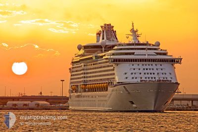
ADVENTURE OF THE SEA
Passengers Ship
Current Trip
| Time Travelled | 9 h, 55 mins |
|---|---|
| Remaining Time | 2 h, 33 mins |
| Distance Travelled | 90.12 nm |
| Remaining Distance | 25.94 nm |
| AVG Speed | 9.2 Knots |
| MAX Speed | 9.9 Knots |
| AVG Wind | 20 knots |
| MAX Wind | 22 knots |
| MIN Temp | 24°C / 75.2°F |
| MAX Temp | 26.1°C / 78.98°F |
| Dybgang | 9.1 m |
| Position Modtaget | 2 m siden |
Current Position
| Longitude | -63.44978° |
|---|---|
| Latitude | 17.98132° |
| Status | Under way using engine |
| Fart | 8.7 Knots |
| Kurs | 89.3° |
| Område | Caribbean Sea |
| Station | T-AIS |
| Position Modtaget | 2 m siden |
Info
Information
The current position of ADVENTURE OF THE SEA is in Caribbean Sea with coordinates 17.98132° / -63.44978° as reported on 2025-02-12 08:01 by AIS to our vessel tracker app. The vessel's current speed is 8.7 Knots and is heading at the port of PHILIPSBURG. The estimated time of arrival as calculated by MyShipTracking vessel tracking app is 2025-02-12 06:36 LT
The vessel ADVENTURE OF THE SEA (IMO: 9167227, MMSI: 311263000) is a Passengers Ship that was built in 2001 ( 24 år gamle ). It's sailing under the flag of [BS] Bahamas.
In this page you can find informations about the vessels current position, last detected port calls, and current voyage information. If the vessels is not in coverage by AIS you will find the latest position.
The current position of ADVENTURE OF THE SEA is detected by our AIS receivers and we are not responsible for the reliability of the data. The last position was recorded while the vessel was in Coverage by the Ais receivers of our vessel tracking app.
The current draught of ADVENTURE OF THE SEA as reported by AIS is 9.1 meters
Weather
| Temperature | 25.5°C / 77.9°F |
|---|---|
| Wind Speed | 20 knots |
| Direction | 79° E |
| Pressure | 1016.2 hPa |
| Humidity | 71.9 % |
| Cloud Coverage | --- |
Featured Company
Last Port Calls
| Port | Arrival | Departure | Time In Port |
|---|---|---|---|
| 2025-02-11 07:23 | 2025-02-11 18:08 | 10 h | |
| 2025-02-10 09:31 | 2025-02-10 19:39 | 10 h | |
| 2025-02-09 08:57 | 2025-02-09 18:00 | 9 h | |
| 2025-02-07 05:06 | 2025-02-07 17:15 | 12 h | |
| 2025-02-04 08:41 | 2025-02-04 17:29 | 8 h | |
| 2025-02-03 06:43 | 2025-02-03 16:03 | 9 h | |
| 2025-02-01 04:42 | 2025-02-01 16:33 | 11 h | |
| 2025-01-29 06:38 | 2025-01-29 19:11 | 12 h | |
| 2025-01-28 07:32 | 2025-01-28 18:06 | 10 h | |
| 2025-01-27 09:43 | 2025-01-27 21:18 | 11 h |
Most Visited Ports (Last year)
| Port | Arrivals | |
|---|---|---|
| 48 | ||
| 23 | ||
| 15 | ||
| 12 | ||
| 11 | ||
| 9 |
Last Trips
| Origin | Departure | Destination | Arrival | Distance | |
|---|---|---|---|---|---|
| 2025-02-10 19:39 | 2025-02-11 07:23 | 112.53 nm | |||
| 2025-02-09 18:00 | 2025-02-10 09:31 | 276.54 nm | |||
| 2025-02-07 17:15 | 2025-02-09 08:57 | 763.44 nm | |||
| 2025-02-04 17:29 | 2025-02-07 05:06 | 905.42 nm | |||
| 2025-02-03 16:03 | 2025-02-04 08:41 | 314.80 nm | |||
| 2025-02-01 16:33 | 2025-02-03 06:43 | 715.71 nm | |||
| 2025-01-29 19:11 | 2025-02-01 04:42 | 1156.36 nm | |||
| 2025-01-28 18:06 | 2025-01-29 06:38 | 114.17 nm | |||
| 2025-01-27 21:18 | 2025-01-28 07:32 | 114.34 nm | |||
| 2025-01-24 16:37 | 2025-01-27 09:43 | 1014.69 nm |
Events
| Tid | Hændelsen | Detaljer | Position / Dest | Info |
|---|---|---|---|---|
| 2025-02-12 07:10 | Fundet i havområde | Saint-Martin part of the Caribbean Sea |
17.97089 / -63.58210
Caribbean Sea
SXM
|
Fart: 9 kn Kurs: 86.6° |
| 2025-02-12 06:52 | Destination er ændret | SXM VIFRD |
17.96835 / -63.63059
SXM
|
Fart: 9 kn Kurs: 86.3° |
| 2025-02-12 06:52 | ETA er ændret | 2025/02/12 10:30 2025/02/11 11:00 |
17.96835 / -63.63059
SXM
|
Fart: 9 kn Kurs: 86.3° |
| 2025-02-12 06:30 | Fundet i havområde | Anguilla part of the Caribbean Sea |
17.96381 / -63.68745
Caribbean Sea
|
Fart: 8.9 kn Kurs: 82.1° |
| 2025-02-12 06:30 | Status er ændret | Under way using engine Default |
17.96381 / -63.68745
VIFRD
|
Fart: 8.9 kn Kurs: 82° |
| 2025-02-12 06:30 | Indenfor Dækning |
17.96381 / -63.68745
Caribbean Sea
|
Fart: 8.9 kn Kurs: 82.1° |
|
| 2025-02-11 22:08 | Afsejlet fra sidste havn |
|
17.72321 / -64.90462
VIFRD
|
Fart: 3.7 kn Kurs: 78° |
| 2025-02-11 21:59 | START Sejllads |
17.71297 / -64.89059
[VI] FREDERIKSTED
|
Fart: 3.7 kn Kurs: 78° |
|
| 2025-02-11 18:26 | Status er ændret | Default Moored |
17.71377 / -64.88737
[VI] FREDERIKSTED
|
Fart: Kurs: 83° |
| 2025-02-11 18:14 | Udenfor Dækning |
17.71377 / -64.88737
Caribbean Sea
[VI] FREDERIKSTED
|
Fart: Kurs: 35.1° |