
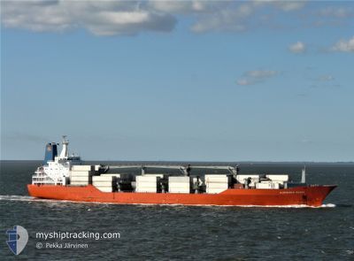
ALBEMARLE ISLAND
Reefer
Current Trip
| Time Travelled | 1 day |
|---|---|
| Remaining Time | 8 days |
| Distance Travelled | 337.64 nm |
| Remaining Distance | 3336.93 nm |
| AVG Speed | 16.5 Knots |
| MAX Speed | 19.1 Knots |
| AVG Wind | 15.8 knots |
| MAX Wind | 24 knots |
| MIN Temp | 7.6°C / 45.68°F |
| MAX Temp | 12.5°C / 54.5°F |
| Dybgang | 8.4 m |
| Position Modtaget | 12 h, 50 m siden |
Current Position
| Longitude | -4.17079° |
|---|---|
| Latitude | 49.57775° |
| Status | Under way using engine |
| Fart | 16.9 Knots |
| Kurs | 242.4° |
| Område | English Channel |
| Station | T-AIS |
| Position Modtaget | 12 h, 50 m siden |
Info
Information
The current position of ALBEMARLE ISLAND is in English Channel with coordinates 49.57775° / -4.17079° as reported on 2025-03-08 12:36 by AIS to our vessel tracker app. The vessel's current speed is 16.9 Knots and is heading at the port of POINTE A PITRE. The estimated time of arrival as calculated by MyShipTracking vessel tracking app is 2025-03-17 08:03 LT
The vessel ALBEMARLE ISLAND (IMO: 9059602, MMSI: 308511000) is a Reefer that was built in 1993 ( 32 år gamle ). It's sailing under the flag of [BS] Bahamas.
In this page you can find informations about the vessels current position, last detected port calls, and current voyage information. If the vessels is not in coverage by AIS you will find the latest position.
The current position of ALBEMARLE ISLAND is detected by our AIS receivers and we are not responsible for the reliability of the data. The last position was recorded while the vessel was in Coverage by the Ais receivers of our vessel tracking app.
The current draught of ALBEMARLE ISLAND as reported by AIS is 8.4 meters
Weather
| Temperature | 12.2°C / 53.96°F |
|---|---|
| Wind Speed | 32 knots |
| Direction | 94° E |
| Pressure | 989.8 hPa |
| Humidity | 92.3 % |
| Cloud Coverage | 100 % |
Featured Company
Last Port Calls
| Port | Arrival | Departure | Time In Port |
|---|---|---|---|
| 2025-03-07 13:08 | 2025-03-08 00:59 | 11 h | |
| 2025-03-04 02:11 | 2025-03-06 19:57 | 2 d | |
| 2025-03-03 05:39 | 2025-03-03 18:51 | 13 h | |
| 2025-02-16 02:52 | 2025-02-16 11:31 | 8 h | |
| 2025-02-11 13:08 | 2025-02-14 08:53 | 2 d | |
| 2025-02-01 12:18 | 2025-02-02 10:10 | 21 h | |
| 2025-01-30 08:07 | 2025-01-31 20:51 | 1 d | |
| 2025-01-28 09:01 | 2025-01-28 16:59 | 7 h | |
| 2025-01-27 09:59 | 2025-01-27 17:41 | 7 h | |
| 2025-01-17 13:22 | 2025-01-17 21:54 | 8 h |
Most Visited Ports (Last year)
| Port | Arrivals | |
|---|---|---|
| 9 | ||
| 8 | ||
| 8 | ||
| 8 | ||
| 8 | ||
| 7 |
Last Trips
| Origin | Departure | Destination | Arrival | Distance | |
|---|---|---|---|---|---|
| 2025-03-06 20:57 | 2025-03-07 14:08 | 253.69 nm | |||
| 2025-03-03 18:51 | 2025-03-04 03:11 | 96.57 nm | |||
| 2025-02-16 06:31 | 2025-03-03 05:39 | 5621.16 nm | |||
| 2025-02-14 03:53 | 2025-02-15 21:52 | 322.25 nm | |||
| 2025-02-02 06:10 | 2025-02-11 08:08 | 2369.94 nm | |||
| 2025-01-31 17:51 | 2025-02-01 08:18 | 219.08 nm | |||
| 2025-01-28 12:59 | 2025-01-30 05:07 | 646.91 nm | |||
| 2025-01-27 13:41 | 2025-01-28 05:01 | 128.13 nm | |||
| 2025-01-17 22:54 | 2025-01-27 05:59 | 3680.83 nm | |||
| 2025-01-16 23:43 | 2025-01-17 14:22 | 252.18 nm |
Events
| Tid | Hændelsen | Detaljer | Position / Dest | Info |
|---|---|---|---|---|
| 2025-03-08 12:44 | Status er ændret | Default Under way using engine |
49.56152 / -4.21857
GPPTP
|
Fart: 16.9 kn Kurs: 242.4° |
| 2025-03-08 12:36 | Udenfor Dækning |
49.57775 / -4.17079
English Channel
GPPTP
|
Fart: 16.9 kn Kurs: 242.4° |
|
| 2025-03-08 10:48 | Status er ændret | Under way using engine Default |
49.81228 / -3.47112
GPPTP
|
Fart: 17.3 kn Kurs: 242° |
| 2025-03-08 10:48 | Status er ændret | Default Under way using engine |
49.81333 / -3.46791
GPPTP
|
Fart: 17.4 kn Kurs: 243.2° |
| 2025-03-08 09:50 | Ændre havområde | United Kingdom part of the English Channel Guernsey part of the English Channel |
49.93626 / -3.08132
English Channel
GPPTP
|
Fart: 17.7 kn Kurs: 243.2° |
| 2025-03-08 08:08 | Destination er ændret | GPPTP FRRAD |
50.08571 / -2.30993
GPPTP
|
Fart: 18.7 kn Kurs: 269.7° |
| 2025-03-08 07:54 | Status er ændret | Under way using engine Default |
50.08156 / -2.18729
FRRAD
|
Fart: 19.1 kn Kurs: 273° |
| 2025-03-08 07:48 | Status er ændret | Default Under way using engine |
50.07970 / -2.13850
FRRAD
|
Fart: 19.1 kn Kurs: 274° |
| 2025-03-08 07:42 | Ændre havområde | Guernsey part of the English Channel French part of the English Channel |
50.07792 / -2.09500
English Channel
FRRAD
|
Fart: 19.1 kn Kurs: 274° |
| 2025-03-08 07:42 | Status er ændret | Under way using engine Default |
50.07792 / -2.09500
FRRAD
|
Fart: 19.2 kn Kurs: 274° |