
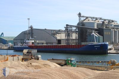
AMADEUS
General Cargo
Current Trip
EL FERROL
| Time Travelled | 3 h, 24 mins |
|---|---|
| Remaining Time | --- |
| Distance Travelled | 16.58 nm |
| Remaining Distance | --- |
| AVG Speed | 6.7 Knots |
| MAX Speed | 8.2 Knots |
| AVG Wind | 6.6 knots |
| MAX Wind | 9 knots |
| MIN Temp | 14.9°C / 58.82°F |
| MAX Temp | 15.3°C / 59.54°F |
| Dybgang | 3.9 m |
| Position Modtaget | 1 h, 1 m siden |
Current Position
| Longitude | -8.38678° |
|---|---|
| Latitude | 43.62149° |
| Status | Under way using engine |
| Fart | 5.7 Knots |
| Kurs | 63.6° |
| Område | North Atlantic Ocean |
| Station | T-AIS |
| Position Modtaget | 1 h, 1 m siden |
Info
Information
The current position of AMADEUS is in North Atlantic Ocean with coordinates 43.62149° / -8.38678° as reported on 2025-02-14 18:05 by AIS to our vessel tracker app. The vessel's current speed is 5.7 Knots
The vessel AMADEUS (IMO: 9232498, MMSI: 376205000) is a General Cargo that was built in 2001 ( 24 år gamle ). It's sailing under the flag of [VC] St Vincent Grenadines.
In this page you can find informations about the vessels current position, last detected port calls, and current voyage information. If the vessels is not in coverage by AIS you will find the latest position.
The current position of AMADEUS is detected by our AIS receivers and we are not responsible for the reliability of the data. The last position was recorded while the vessel was in Coverage by the Ais receivers of our vessel tracking app.
The current draught of AMADEUS as reported by AIS is 3.9 meters
Weather
| Temperature | 14.5°C / 58.1°F |
|---|---|
| Wind Speed | 7 knots |
| Direction | 112° ESE |
| Pressure | 1014.3 hPa |
| Humidity | 75.1 % |
| Cloud Coverage | 100 % |
Featured Company
Last Port Calls
| Port | Arrival | Departure | Time In Port |
|---|---|---|---|
| 2025-02-14 06:46 | 2025-02-14 15:43 | 8 h | |
| 2025-02-09 14:50 | 2025-02-11 18:08 | 2 d | |
| 2025-02-04 10:40 | 2025-02-06 23:39 | 2 d | |
| 2025-01-22 14:51 | 2025-01-24 11:09 | 1 d | |
| 2025-01-21 08:55 | 2025-01-22 14:37 | 1 d | |
| 2025-01-13 17:26 | 2025-01-15 18:05 | 2 d | |
| 2025-01-06 14:36 | 2025-01-08 14:28 | 1 d | |
| 2024-12-20 15:56 | 2025-01-04 06:21 | 14 d | |
| 2024-12-18 22:07 | 2024-12-20 13:38 | 1 d | |
| 2024-12-16 04:28 | 2024-12-16 23:15 | 18 h |
Last Trips
| Origin | Departure | Destination | Arrival | Distance | |
|---|---|---|---|---|---|
| 2025-02-11 18:08 | 2025-02-14 07:46 | 485.84 nm | |||
| 2025-02-06 23:39 | 2025-02-09 14:50 | 411.53 nm | |||
| 2025-01-24 12:09 | 2025-02-04 10:40 | 961.20 nm | |||
| 2025-01-22 15:37 | 2025-01-22 15:51 | 0.52 nm | |||
| 2025-01-15 18:05 | 2025-01-21 09:55 | 629.35 nm | |||
| 2025-01-08 15:28 | 2025-01-13 17:26 | 899.55 nm | |||
| 2025-01-04 07:21 | 2025-01-06 15:36 | 416.78 nm | |||
| 2024-12-20 14:38 | 2024-12-20 16:56 | 16.98 nm | |||
| 2024-12-17 00:15 | 2024-12-18 23:07 | 320.60 nm | |||
| 2024-12-16 00:52 | 2024-12-16 05:28 | 25.89 nm |
Events
| Tid | Hændelsen | Detaljer | Position / Dest | Info |
|---|---|---|---|---|
| 2025-02-14 18:11 | Status er ændret | Default Under way using engine |
43.62577 / -8.37531
EL FERROL
|
Fart: 5.7 kn Kurs: 63.6° |
| 2025-02-14 18:05 | Status er ændret | Under way using engine Default |
43.62149 / -8.38678
EL FERROL
|
Fart: 5.9 kn Kurs: 58° |
| 2025-02-14 18:05 | Udenfor Dækning |
43.62149 / -8.38678
North Atlantic Ocean
|
Fart: 5.7 kn Kurs: 63.6° |
|
| 2025-02-14 17:47 | Status er ændret | Default Under way using engine |
43.60564 / -8.42089
EL FERROL
|
Fart: 6.1 kn Kurs: 340.2° |
| 2025-02-14 17:31 | Status er ændret | Under way using engine Default |
43.57994 / -8.40755
EL FERROL
|
Fart: 5.9 kn Kurs: 338° |
| 2025-02-14 17:11 | Status er ændret | Default Under way using engine |
43.54899 / -8.39046
EL FERROL
|
Fart: 5.8 kn Kurs: 338.2° |
| 2025-02-14 17:06 | Status er ændret | Under way using engine Default |
43.54089 / -8.38598
EL FERROL
|
Fart: 5.7 kn Kurs: 340° |
| 2025-02-14 16:59 | Status er ændret | Default Under way using engine |
43.53052 / -8.38260
EL FERROL
|
Fart: 6.4 kn Kurs: 356.8° |
| 2025-02-14 16:34 | Status er ændret | Under way using engine Default |
43.48328 / -8.37558
EL FERROL
|
Fart: 7 kn Kurs: 329° |
| 2025-02-14 16:15 | Indenfor Dækning |
43.48328 / -8.37558
North Atlantic Ocean
|
Fart: 6.8 kn Kurs: 338.7° |