
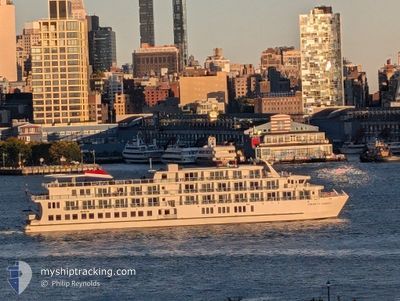
AMERICAN LIBERTY
Passenger
Current Trip
| Trip Time | 2 days |
|---|---|
| Trip Distance | 121.96 nm |
| AVG Speed | 9.2 Knots |
| MAX Speed | 13.6 Knots |
| Dybgang | 2.1 m |
| AVG Wind | 4.4 knots |
| MAX Wind | 7.9 knots |
| MIN Temp | 11.9°C / 53.42°F |
| MAX Temp | 19.4°C / 66.92°F |
| Position Modtaget | 10 h, 33 m siden |
Current Position
| Longitude | -79.97203° |
|---|---|
| Latitude | 32.76693° |
| Status | Under way using engine |
| Fart | 1.9 Knots |
| Kurs | 64° |
| Område | North Atlantic Ocean |
| Station | T-AIS |
| Position Modtaget | 10 h, 33 m siden |
Info
Information
The current position of AMERICAN LIBERTY is in North Atlantic Ocean with coordinates 32.76693° / -79.97203° as reported on 2025-02-07 14:24 by AIS to our vessel tracker app. The vessel's current speed is 1.9 Knots and is currently inside the port of CHARLESTON.
The vessel AMERICAN LIBERTY (MMSI: 368366750) is a Passenger It's sailing under the flag of [US] USA.
In this page you can find informations about the vessels current position, last detected port calls, and current voyage information. If the vessels is not in coverage by AIS you will find the latest position.
The current position of AMERICAN LIBERTY is detected by our AIS receivers and we are not responsible for the reliability of the data. The last position was recorded while the vessel was in Coverage by the Ais receivers of our vessel tracking app.
The current draught of AMERICAN LIBERTY as reported by AIS is 2.1 meters
Weather
| Temperature | 19°C / 66.2°F |
|---|---|
| Wind Speed | 7 knots |
| Direction | 267° W |
| Pressure | 1021 hPa |
| Humidity | 75.3 % |
| Cloud Coverage | --- |
Featured Company
Last Port Calls
| Port | Arrival | Departure | Time In Port |
|---|---|---|---|
| 2025-02-07 14:18 | |||
| 2025-02-03 21:36 | 2025-02-05 10:30 | 1 d | |
| 2025-02-02 02:24 | 2025-02-03 12:13 | 1 d | |
| 2025-01-05 08:52 | 2025-01-31 13:02 | 26 d | |
| 2025-01-03 16:25 | 2025-01-04 16:57 | 1 d | |
| 2024-12-31 02:26 | 2025-01-01 09:29 | 1 d | |
| 2024-12-28 23:48 | 2024-12-30 13:05 | 1 d | |
| 2024-12-25 18:47 | 2024-12-27 10:21 | 1 d | |
| 2024-12-24 03:48 | 2024-12-25 05:15 | 1 d | |
| 2024-12-20 17:05 | 2024-12-22 03:45 | 1 d |
Most Visited Ports (Last year)
| Port | Arrivals | |
|---|---|---|
| 11 | ||
| 9 | ||
| 6 | ||
| 6 | ||
| 6 | ||
| 6 |
Last Trips
| Origin | Departure | Destination | Arrival | Distance | |
|---|---|---|---|---|---|
| 2025-02-05 05:30 | 2025-02-07 09:18 | 121.96 nm | |||
| 2025-02-03 07:13 | 2025-02-03 16:36 | 60.03 nm | |||
| 2025-01-31 08:02 | 2025-02-01 21:24 | 34.19 nm | |||
| 2025-01-04 11:57 | 2025-01-05 03:52 | 127.34 nm | |||
| 2025-01-01 04:29 | 2025-01-03 11:25 | 117.81 nm | |||
| 2024-12-30 08:05 | 2024-12-30 21:26 | 93.01 nm | |||
| 2024-12-27 05:21 | 2024-12-28 18:48 | 65.10 nm | |||
| 2024-12-25 00:15 | 2024-12-25 13:47 | 85.65 nm | |||
| 2024-12-21 22:45 | 2024-12-23 22:48 | 68.92 nm | |||
| 2024-12-18 08:40 | 2024-12-20 12:05 | 77.73 nm |
Events
| Tid | Hændelsen | Detaljer | Position / Dest | Info |
|---|---|---|---|---|
| 2025-02-07 14:24 | Udenfor Dækning |
32.76693 / -79.97203
North Atlantic Ocean
[US] CHARLESTON
|
Fart: 1.9 kn Kurs: 45.7° |
|
| 2025-02-07 14:18 | Skibe i havn |
|
32.76658 / -79.97494
[US] CHARLESTON
|
Fart: 5.8 kn Kurs: 84.6° |
| 2025-02-07 14:08 | START Sejllads | 4.5 nm, West of CHARLESTON |
32.76921 / -79.99287
PORT ROYAL, SC
|
Fart: 8.7 kn Kurs: 61.1° |
| 2025-02-07 14:00 | STOP Sejllads | 5.18 nm, West of CHARLESTON |
32.76764 / -80.00616
PORT ROYAL, SC
|
Fart: 0.3 kn Kurs: 99° |
| 2025-02-07 09:59 | Indenfor Dækning |
32.61136 / -80.38709
North Atlantic Ocean
|
Fart: 8.3 kn Kurs: 7.6° |
|
| 2025-02-06 13:06 | Udenfor Dækning |
32.37177 / -80.69250
North Atlantic Ocean
|
Fart: Kurs: 139.9° |
|
| 2025-02-06 12:45 | Indenfor Dækning |
32.37177 / -80.69250
North Atlantic Ocean
|
Fart: Kurs: 139.6° |
|
| 2025-02-05 23:08 | Udenfor Dækning |
32.24774 / -80.75141
North Atlantic Ocean
|
Fart: 7.7 kn Kurs: 326.4° |
|
| 2025-02-05 22:06 | START Sejllads | 15.12 nm, East of SAVANNAH |
32.14214 / -80.81790
PORT ROYAL, SC
|
Fart: 3.9 kn Kurs: 354° |
| 2025-02-05 22:04 | Destination er ændret | PORT ROYAL, SC HILTON HEAD, SC |
32.14093 / -80.81681
PORT ROYAL, SC
|
Fart: 0.9 kn Kurs: 356° |