
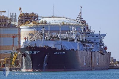
AMUR RIVER
Lng Tanker
Current Trip
MED SEA FOR ORDERS
| Time Travelled | --- |
|---|---|
| Remaining Time | --- |
| Distance Travelled | 7551.95 nm |
| Remaining Distance | --- |
| AVG Speed | 12.4 Knots |
| MAX Speed | 15.1 Knots |
| AVG Wind | 11.7 knots |
| MAX Wind | 29 knots |
| MIN Temp | 15.7°C / 60.26°F |
| MAX Temp | 31.4°C / 88.52°F |
| Dybgang | 9.1 m |
| Position Modtaget | 5 h, 59 m siden |
Current Position
| Longitude | 13.95788° |
|---|---|
| Latitude | 36.34142° |
| Status | Under way using engine |
| Fart | 9.7 Knots |
| Kurs | 292° |
| Område | Mediterranean Sea - Eastern Basin |
| Station | T-AIS |
| Position Modtaget | 5 h, 59 m siden |
Info
Information
The current position of AMUR RIVER is in Mediterranean Sea - Eastern Basin with coordinates 36.34142° / 13.95788° as reported on 2025-03-22 11:20 by AIS to our vessel tracker app. The vessel's current speed is 9.7 Knots
The vessel AMUR RIVER (IMO: 9317999, MMSI: 538003001) is a Lng Tanker that was built in 2008 ( 17 år gamle ). It's sailing under the flag of [MH] Marshall Is.
In this page you can find informations about the vessels current position, last detected port calls, and current voyage information. If the vessels is not in coverage by AIS you will find the latest position.
The current position of AMUR RIVER is detected by our AIS receivers and we are not responsible for the reliability of the data. The last position was recorded while the vessel was in Coverage by the Ais receivers of our vessel tracking app.
The current draught of AMUR RIVER as reported by AIS is 9.1 meters
Weather
| Temperature | 15.8°C / 60.44°F |
|---|---|
| Wind Speed | 23 knots |
| Direction | 118° ESE |
| Pressure | 1012.3 hPa |
| Humidity | 86.6 % |
| Cloud Coverage | 45 % |
Featured Company
Last Port Calls
Most Visited Ports (Last year)
| Port | Arrivals | |
|---|---|---|
| 1 | ||
| 1 | ||
| 1 | ||
| 1 | ||
| 1 |
Last Trips
| Origin | Departure | Destination | Arrival | Distance |
|---|
Events
| Tid | Hændelsen | Detaljer | Position / Dest | Info |
|---|---|---|---|---|
| 2025-03-22 11:30 | Status er ændret | Default Under way using engine |
36.35156 / 13.92872
MED SEA FOR ORDERS
|
Fart: 9.7 kn Kurs: 292° |
| 2025-03-22 11:20 | Udenfor Dækning |
36.34142 / 13.95788
Mediterranean Sea - Eastern Basin
MED SEA FOR ORDERS
|
Fart: 9.7 kn Kurs: 292° |
|
| 2025-03-22 06:05 | Status er ændret | Under way using engine Default |
35.96176 / 14.94153
MED SEA FOR ORDERS
|
Fart: 2.4 kn Kurs: 270° |
| 2025-03-22 05:58 | Status er ændret | Default Under way using engine |
35.95966 / 14.94665
MED SEA FOR ORDERS
|
Fart: 1.8 kn Kurs: 248° |
| 2025-03-22 05:50 | Status er ændret | Under way using engine Default |
35.95612 / 14.94787
MED SEA FOR ORDERS
|
Fart: 1.7 kn Kurs: 250° |
| 2025-03-22 05:45 | Status er ændret | Default Under way using engine |
35.95399 / 14.94832
MED SEA FOR ORDERS
|
Fart: 1.7 kn Kurs: 252° |
| 2025-03-22 05:40 | Status er ændret | Under way using engine Default |
35.95156 / 14.94882
MED SEA FOR ORDERS
|
Fart: 1.7 kn Kurs: 249° |
| 2025-03-22 05:10 | Status er ændret | Default Under way using engine |
35.93742 / 14.95213
MED SEA FOR ORDERS
|
Fart: 1.5 kn Kurs: 233° |
| 2025-03-22 05:02 | Status er ændret | Under way using engine Default |
35.93458 / 14.95400
MED SEA FOR ORDERS
|
Fart: 1.4 kn Kurs: 230° |
| 2025-03-22 04:58 | Indenfor Dækning |
35.93458 / 14.95400
Mediterranean Sea - Eastern Basin
MED SEA FOR ORDERS
|
Fart: 1.5 kn Kurs: 325.5° |