
ANDEAN
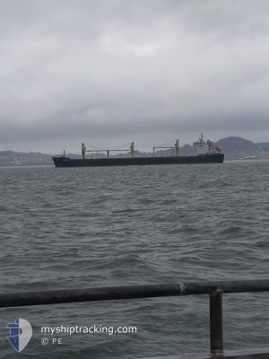
Bulk Carrier
Current Trip
| Time Travelled | 5 days |
|---|---|
| Remaining Time | 7 days |
| Distance Travelled | 1467.20 nm |
| Remaining Distance | 2981.03 nm |
| AVG Speed | 11.5 Knots |
| MAX Speed | 14.9 Knots |
| AVG Wind | 9.1 knots |
| MAX Wind | 22 knots |
| MIN Temp | 26.2°C / 79.16°F |
| MAX Temp | 29.8°C / 85.64°F |
| Dybgang | 6.8 m |
| Position Modtaget | 2 d siden |
Current Position
| Longitude | 104.06927° |
|---|---|
| Latitude | 1.24707° |
| Status | Under way using engine |
| Fart | 11.1 Knots |
| Kurs | 85.3° |
| Område | Singapore Strait |
| Station | T-AIS |
| Position Modtaget | 2 d siden |
Info
Information
The current position of ANDEAN is in Singapore Strait with coordinates 1.24707° / 104.06927° as reported on 2025-03-12 14:49 by AIS to our vessel tracker app. The vessel's current speed is 11.1 Knots and is heading at the port of TOWNSVILLE. The estimated time of arrival as calculated by MyShipTracking vessel tracking app is 2025-03-23 02:49 LT
The vessel ANDEAN (IMO: 9413925, MMSI: 212450000) is a Bulk Carrier that was built in 2009 ( 16 år gamle ). It's sailing under the flag of [CY] Cyprus.
In this page you can find informations about the vessels current position, last detected port calls, and current voyage information. If the vessels is not in coverage by AIS you will find the latest position.
The current position of ANDEAN is detected by our AIS receivers and we are not responsible for the reliability of the data. The last position was recorded while the vessel was in Coverage by the Ais receivers of our vessel tracking app.
The current draught of ANDEAN as reported by AIS is 6.8 meters
Weather
| Temperature | 28.3°C / 82.94°F |
|---|---|
| Wind Speed | 7 knots |
| Direction | 227° SW |
| Pressure | 1009 hPa |
| Humidity | 78 % |
| Cloud Coverage | 98 % |
Featured Company
Last Port Calls
| Port | Arrival | Departure | Time In Port |
|---|---|---|---|
| 2025-03-05 07:26 | 2025-03-09 18:37 | 4 d | |
| 2025-02-16 13:08 | 2025-02-19 18:10 | 3 d | |
| 2025-01-06 15:00 | 2025-01-20 11:34 | 13 d |
Most Visited Ports (Last year)
| Port | Arrivals | |
|---|---|---|
| 3 | ||
| 2 | ||
| 2 | ||
| 2 | ||
| 1 | ||
| 1 |
Last Trips
| Origin | Departure | Destination | Arrival | Distance | |
|---|---|---|---|---|---|
| 2025-02-19 18:10 | 2025-03-05 07:26 | 1685.37 nm | |||
| 2025-01-20 11:34 | 2025-02-16 13:08 | 6233.85 nm | |||
| 2024-11-21 07:12 | 2025-01-06 15:00 | 8427.75 nm |
Events
| Tid | Hændelsen | Detaljer | Position / Dest | Info |
|---|---|---|---|---|
| 2025-03-12 14:54 | Status er ændret | Default Under way using engine |
1.24820 / 104.08375
AU TSV
|
Fart: 11.1 kn Kurs: 85.3° |
| 2025-03-12 14:49 | Udenfor Dækning |
1.24707 / 104.06927
Singapore Strait
AU TSV
|
Fart: 11.1 kn Kurs: 85.3° |
|
| 2025-03-12 14:14 | Ændre havområde | Indonesian part of the Singapore Strait Singaporean part of the Singapore Strait |
1.24283 / 103.96833
Singapore Strait
AU TSV
|
Fart: 11.2 kn Kurs: 196.7° |
| 2025-03-12 13:47 | START Sejllads | 5.16 nm, East of SINGAPORE |
1.28557 / 103.93576
AU TSV
|
Fart: 5.6 kn Kurs: 123.2° |
| 2025-03-12 13:43 | Status er ændret | Under way using engine At anchor |
1.28672 / 103.93266
AU TSV
|
Fart: 0.9 kn Kurs: 64° |
| 2025-03-12 13:39 | Status er ændret | At anchor Default |
1.28624 / 103.93279
AU TSV
|
Fart: 0.1 kn Kurs: 53° |
| 2025-03-12 13:36 | Status er ændret | Default At anchor |
1.28623 / 103.93301
AU TSV
|
Fart: Kurs: 56° |
| 2025-03-12 12:27 | Status er ændret | At anchor Default |
1.28616 / 103.93330
AU TSV
|
Fart: Kurs: 64° |
| 2025-03-12 12:24 | Status er ændret | Default At anchor |
1.28621 / 103.93326
AU TSV
|
Fart: Kurs: 66° |
| 2025-03-12 11:51 | Status er ændret | At anchor Default |
1.28618 / 103.93328
AU TSV
|
Fart: Kurs: 56° |