

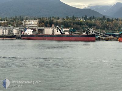
ANGLO CYNOSURE
Bulk Carrier

Current Trip
| Trip Time | 41 days |
|---|---|
| Trip Distance | 5929.29 nm |
| AVG Speed | 11.3 Knots |
| MAX Speed | 15.7 Knots |
| Dybgang | 13.3 m |
| AVG Wind | 12.5 knots |
| MAX Wind | 30 knots |
| MIN Temp | 22.3°C / 72.14°F |
| MAX Temp | 33.1°C / 91.58°F |
| Position Modtaget | 2025-04-21 14:44 |
Current Position
| Longitude | 76.12970° |
|---|---|
| Latitude | 8.59503° |
| Status | Under way using engine |
| Fart | 11.9 Knots |
| Kurs | 317.7° |
| Område | Laccadive Sea |
| Station | T-AIS |
| Position Modtaget | 2025-04-21 14:44 |
Information
The current position of ANGLO CYNOSURE is in Laccadive Sea with coordinates 8.59503° / 76.12970° as reported on 2025-04-21 14:44 by AIS to our vessel tracker app. The vessel's current speed is 11.9 Knots and is currently inside the port of KRISHNAPATNAM.
The vessel ANGLO CYNOSURE (IMO: 9599133, MMSI: 232025072) is a Bulk Carrier that was built in 2012 ( 13 år gamle ). It's sailing under the flag of [GB] United Kingdom.
In this page you can find informations about the vessels current position, last detected port calls, and current voyage information. If the vessels is not in coverage by AIS you will find the latest position.
The current position of ANGLO CYNOSURE is detected by our AIS receivers and we are not responsible for the reliability of the data. The last position was recorded while the vessel was in Coverage by the Ais receivers of our vessel tracking app.
The current draught of ANGLO CYNOSURE as reported by AIS is 13.3 meters
Weather
| Temperature | 32.6°C / 90.68°F |
|---|---|
| Wind Speed | 5 knots |
| Direction | 258° WSW |
| Pressure | 1002.1 hPa |
| Humidity | 50.1 % |
| Cloud Coverage | 100 % |


Featured Company
Last Port Calls
| Port | Arrival | Departure | Time In Port |
|---|---|---|---|
| 2025-06-09 18:21 | |||
| 2025-04-26 12:22 | 2025-04-29 11:10 | 2 d |
Last Trips
| Origin | Departure | Destination | Arrival | Distance | |
|---|---|---|---|---|---|
| 2025-04-29 11:10 | 2025-06-09 18:21 | 5929.29 nm | |||
| 2025-03-26 09:30 | 2025-04-26 12:22 | 5981.25 nm |
Events
| Tid | Hændelsen | Detaljer | Position / Dest | Info |
|---|---|---|---|---|
| 2025-06-12 03:35 | START Sejllads |
14.24772 / 80.14168
[IN] KRISHNAPATNAM
|
Fart: 7.2 kn Kurs: 83° |
|
| 2025-06-09 13:41 | STOP Sejllads |
14.25396 / 80.11400
[IN] KRISHNAPATNAM
|
Fart: Kurs: 289° |
|
| 2025-06-09 12:51 | Skibe i havn |
|
14.24852 / 80.14713
[IN] KRISHNAPATNAM
|
Fart: 6.7 kn Kurs: 264° |
| 2025-06-09 11:39 | START Sejllads | 5.4 nm, East of KRISHNAPATNAM |
14.23878 / 80.23425
IN IXY
|
Fart: 3.8 kn Kurs: 38° |
| 2025-06-06 06:38 | STOP Sejllads | 5.73 nm, East of KRISHNAPATNAM |
14.23459 / 80.23943
IN IXY
|
Fart: 0.2 kn Kurs: 281° |
| 2025-06-04 04:49 | START Sejllads | 3.97 nm, South of HAMBANTOTA |
6.05903 / 81.10297
IN IXY
|
Fart: 5.5 kn Kurs: 104° |
| 2025-06-03 18:27 | STOP Sejllads | 3.87 nm, South of HAMBANTOTA |
6.06125 / 81.09190
IN IXY
|
Fart: 0.3 kn Kurs: 339° |