
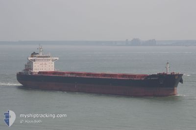
AP ARGOSY
Bulk Carrier
Current Trip
| Trip Time | --- |
|---|---|
| Trip Distance | --- |
| AVG Speed | --- |
| MAX Speed | --- |
| Dybgang | --- |
| AVG Wind | --- |
| MAX Wind | --- |
| MIN Temp | --- |
| MAX Temp | --- |
| Position Modtaget | 7 d siden |
Current Position
| Longitude | 119.49364° |
|---|---|
| Latitude | 16.01923° |
| Status | Under way using engine |
| Fart | 12 Knots |
| Kurs | 353° |
| Område | South China Sea |
| Station | T-AIS |
| Position Modtaget | 7 d siden |
Info
Information
The current position of AP ARGOSY is in South China Sea with coordinates 16.01923° / 119.49364° as reported on 2025-02-17 10:11 by AIS to our vessel tracker app. The vessel's current speed is 12 Knots and is currently inside the port of GWANGYANG.
The vessel AP ARGOSY (IMO: 9511258, MMSI: 215944000) is a Bulk Carrier that was built in 2012 ( 13 år gamle ). It's sailing under the flag of [MT] Malta.
In this page you can find informations about the vessels current position, last detected port calls, and current voyage information. If the vessels is not in coverage by AIS you will find the latest position.
The current position of AP ARGOSY is detected by our AIS receivers and we are not responsible for the reliability of the data. The last position was recorded while the vessel was in Coverage by the Ais receivers of our vessel tracking app.
The current draught of AP ARGOSY as reported by AIS is 8 meters
Weather
| Temperature | -1.5°C / 29.3°F |
|---|---|
| Wind Speed | 5 knots |
| Direction | 328° NNW |
| Pressure | 1029.4 hPa |
| Humidity | 64.7 % |
| Cloud Coverage | 31 % |
Featured Company
Most Visited Ports (Last year)
| Port | Arrivals | |
|---|---|---|
| 4 | ||
| 1 | ||
| 1 | ||
| 1 | ||
| 1 | ||
| 1 |
Last Trips
| Origin | Departure | Destination | Arrival | Distance |
|---|
Events
| Tid | Hændelsen | Detaljer | Position / Dest | Info |
|---|---|---|---|---|
| 2025-02-22 23:55 | STOP Sejllads |
34.86165 / 127.74054
[KR] GWANGYANG
|
Fart: Kurs: 89° |
|
| 2025-02-22 23:55 | Skibe i havn |
|
34.86165 / 127.74054
[KR] GWANGYANG
|
Fart: 0.8 kn Kurs: 77° |
| 2025-02-22 20:37 | START Sejllads | 16.56 nm, South of SINSUAN-GIL |
34.63550 / 127.98612
ID BUT
|
Fart: 3.1 kn Kurs: 340° |
| 2025-02-22 03:09 | STOP Sejllads | 16.67 nm, South of SINSUAN-GIL |
34.63348 / 127.98670
ID BUT
|
Fart: 0.1 kn Kurs: 24° |
| 2025-02-22 01:59 | START Sejllads | 21.11 nm, South East of YEOSU |
34.51222 / 127.99490
ID BUT
|
Fart: 4.1 kn Kurs: 353° |
| 2025-02-22 01:31 | STOP Sejllads | 21.31 nm, South East of YEOSU |
34.50788 / 127.99591
ID BUT
|
Fart: 0.1 kn Kurs: 284° |
| 2025-02-17 10:29 | Status er ændret | Default Under way using engine |
16.07846 / 119.49091
ID BUT
|
Fart: 12 kn Kurs: 353° |
| 2025-02-17 10:11 | Udenfor Dækning |
16.01923 / 119.49364
South China Sea
|
Fart: 12 kn Kurs: 353° |
|
| 2025-02-17 09:23 | Status er ændret | Under way using engine Default |
15.85765 / 119.51982
ID BUT
|
Fart: 12.2 kn Kurs: 348° |
| 2025-02-17 08:39 | Status er ændret | Default Under way using engine |
15.71320 / 119.54886
ID BUT
|
Fart: 12 kn Kurs: 347.7° |