
ARC INTEGRITY
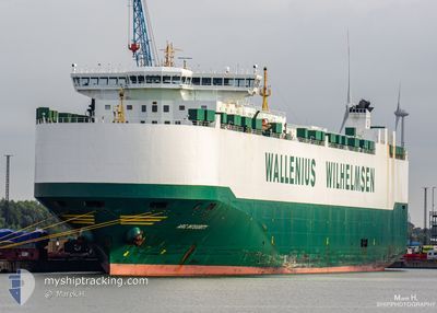
Vehicles Carrier
Current Trip
| Time Travelled | 4 days |
|---|---|
| Remaining Time | 7 days |
| Distance Travelled | 1374.83 nm |
| Remaining Distance | 3178.06 nm |
| AVG Speed | 13.1 Knots |
| MAX Speed | 16.8 Knots |
| AVG Wind | 10.7 knots |
| MAX Wind | 29 knots |
| MIN Temp | 4.9°C / 40.82°F |
| MAX Temp | 16.4°C / 61.52°F |
| Dybgang | 9.9 m |
| Position Modtaget | 3 d siden |
Current Position
| Longitude | -5.44378° |
|---|---|
| Latitude | 49.23419° |
| Status | Under way using engine |
| Fart | 12.8 Knots |
| Kurs | 258.5° |
| Område | Celtic Sea |
| Station | T-AIS |
| Position Modtaget | 3 d siden |
Info
Information
The current position of ARC INTEGRITY is in Celtic Sea with coordinates 49.23419° / -5.44378° as reported on 2025-02-03 11:56 by AIS to our vessel tracker app. The vessel's current speed is 12.8 Knots and is heading at the port of BALTIMORE. The estimated time of arrival as calculated by MyShipTracking vessel tracking app is 2025-02-13 16:01 LT
The vessel ARC INTEGRITY (IMO: 9332949, MMSI: 338058000) is a Vehicles Carrier that was built in 2008 ( 17 år gamle ). It's sailing under the flag of [US] USA.
In this page you can find informations about the vessels current position, last detected port calls, and current voyage information. If the vessels is not in coverage by AIS you will find the latest position.
The current position of ARC INTEGRITY is detected by our AIS receivers and we are not responsible for the reliability of the data. The last position was recorded while the vessel was in Coverage by the Ais receivers of our vessel tracking app.
The current draught of ARC INTEGRITY as reported by AIS is 9.9 meters
Weather
| Temperature | 16.1°C / 60.98°F |
|---|---|
| Wind Speed | 12 knots |
| Direction | 234° SW |
| Pressure | 1016.3 hPa |
| Humidity | 90.7 % |
| Cloud Coverage | 100 % |
Featured Company
Last Port Calls
| Port | Arrival | Departure | Time In Port |
|---|---|---|---|
| 2025-02-01 09:00 | 2025-02-02 19:09 | 1 d | |
| 2025-01-30 05:31 | 2025-01-31 04:31 | 22 h | |
| 2025-01-27 09:01 | 2025-01-29 02:56 | 1 d | |
| 2025-01-19 23:32 | 2025-01-24 16:42 | 4 d | |
| 2025-01-02 19:30 | 2025-01-03 18:22 | 22 h | |
| 2024-12-30 16:59 | 2024-12-31 10:37 | 17 h | |
| 2024-12-18 17:07 | 2024-12-20 10:04 | 1 d | |
| 2024-12-17 00:19 | 2024-12-18 02:31 | 1 d | |
| 2024-12-11 06:12 | 2024-12-11 13:34 | 7 h | |
| 2024-12-07 19:24 | 2024-12-09 00:24 | 1 d |
Most Visited Ports (Last year)
| Port | Arrivals | |
|---|---|---|
| 10 | ||
| 9 | ||
| 7 | ||
| 6 | ||
| 6 | ||
| 5 |
Last Trips
| Origin | Departure | Destination | Arrival | Distance | |
|---|---|---|---|---|---|
| 2025-01-31 04:31 | 2025-02-01 09:00 | 266.61 nm | |||
| 2025-01-29 02:56 | 2025-01-30 05:31 | 346.42 nm | |||
| 2025-01-24 16:42 | 2025-01-27 09:01 | 900.74 nm | |||
| 2025-01-03 18:22 | 2025-01-19 23:32 | 5823.14 nm | |||
| 2024-12-31 10:37 | 2025-01-02 19:30 | 681.99 nm | |||
| 2024-12-20 10:04 | 2024-12-30 16:59 | 1720.30 nm | |||
| 2024-12-18 02:31 | 2024-12-18 17:07 | 204.65 nm | |||
| 2024-12-11 13:34 | 2024-12-17 00:19 | 1480.98 nm | |||
| 2024-12-09 00:24 | 2024-12-11 06:12 | 682.73 nm | |||
| 2024-11-26 21:43 | 2024-12-07 19:24 | 3921.72 nm |
Events
| Tid | Hændelsen | Detaljer | Position / Dest | Info |
|---|---|---|---|---|
| 2025-02-03 12:03 | Status er ændret | Default Under way using engine |
49.22879 / -5.48309
US BAL
|
Fart: 12.8 kn Kurs: 258.5° |
| 2025-02-03 11:56 | Status er ændret | Under way using engine Default |
49.23419 / -5.44378
US BAL
|
Fart: 12.8 kn Kurs: 259° |
| 2025-02-03 11:56 | Udenfor Dækning |
49.23419 / -5.44378
Celtic Sea
|
Fart: 12.8 kn Kurs: 258.5° |
|
| 2025-02-03 11:55 | Status er ændret | Default Under way using engine |
49.23481 / -5.43934
US BAL
|
Fart: 12.7 kn Kurs: 258.4° |
| 2025-02-03 11:55 | Status er ændret | Under way using engine Default |
49.23494 / -5.43835
US BAL
|
Fart: 13.2 kn Kurs: 262° |
| 2025-02-03 11:55 | Ændre havområde | United Kingdom part of the Celtic Sea United Kingdom part of the English Channel |
49.23494 / -5.43835
Celtic Sea
|
Fart: 12.7 kn Kurs: 258.4° |
| 2025-02-03 11:43 | Indenfor Dækning |
49.23494 / -5.43835
Celtic Sea
|
Fart: 12.7 kn Kurs: 258.4° |
|
| 2025-02-03 10:47 | Status er ændret | Default Under way using engine |
49.31195 / -5.12341
US BAL
|
Fart: 10.7 kn Kurs: 248° |
| 2025-02-03 10:41 | Udenfor Dækning |
49.31877 / -5.09780
English Channel
|
Fart: 10.7 kn Kurs: 248° |
|
| 2025-02-03 10:41 | Status er ændret | Under way using engine Default |
49.31894 / -5.09717
US BAL
|
Fart: 10.6 kn Kurs: 249° |