
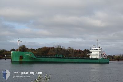
ARKLOW BAY
General Cargo
Current Trip
| Time Travelled | 4 days |
|---|---|
| Remaining Time | 4 h, 1 mins |
| Distance Travelled | 1210.73 nm |
| Remaining Distance | 125.38 nm |
| AVG Speed | 11.6 Knots |
| MAX Speed | 14.1 Knots |
| AVG Wind | 17.5 knots |
| MAX Wind | 34 knots |
| MIN Temp | 3.8°C / 38.84°F |
| MAX Temp | 16°C / 60.8°F |
| Dybgang | 4.4 m |
| Position Modtaget | 18 h, 2 m siden |
Current Position
| Longitude | -9.83410° |
|---|---|
| Latitude | 37.86517° |
| Status | Under way using engine |
| Fart | 12.5 Knots |
| Kurs | 165.9° |
| Område | North Atlantic Ocean |
| Station | T-AIS |
| Position Modtaget | 18 h, 2 m siden |
Info
Information
The current position of ARKLOW BAY is in North Atlantic Ocean with coordinates 37.86517° / -9.83410° as reported on 2025-02-02 00:54 by AIS to our vessel tracker app. The vessel's current speed is 12.5 Knots and is heading at the port of CEUTA. The estimated time of arrival as calculated by MyShipTracking vessel tracking app is 2025-02-02 22:57 LT
The vessel ARKLOW BAY (IMO: 9638771, MMSI: 244700336) is a General Cargo that was built in 2014 ( 11 år gamle ). It's sailing under the flag of [NL] Netherlands.
In this page you can find informations about the vessels current position, last detected port calls, and current voyage information. If the vessels is not in coverage by AIS you will find the latest position.
The current position of ARKLOW BAY is detected by our AIS receivers and we are not responsible for the reliability of the data. The last position was recorded while the vessel was in Coverage by the Ais receivers of our vessel tracking app.
The current draught of ARKLOW BAY as reported by AIS is 4.4 meters
Weather
| Temperature | 15°C / 59°F |
|---|---|
| Wind Speed | 6 knots |
| Direction | 292° WNW |
| Pressure | 1021.1 hPa |
| Humidity | 79.4 % |
| Cloud Coverage | 37 % |
Featured Company
Last Port Calls
| Port | Arrival | Departure | Time In Port |
|---|---|---|---|
| 2025-01-27 20:43 | 2025-01-29 00:42 | 1 d | |
| 2025-01-23 20:16 | 2025-01-24 21:05 | 1 d | |
| 2025-01-20 06:04 | 2025-01-21 15:16 | 1 d | |
| 2025-01-16 16:28 | 2025-01-17 20:54 | 1 d | |
| 2025-01-13 01:37 | 2025-01-14 14:38 | 1 d | |
| 2025-01-09 11:21 | 2025-01-10 15:23 | 1 d | |
| 2025-01-05 08:29 | 2025-01-07 02:10 | 1 d | |
| 2024-12-29 09:55 | 2024-12-31 01:07 | 1 d | |
| 2024-12-23 17:17 | 2024-12-24 15:14 | 21 h | |
| 2024-12-18 18:47 | 2024-12-20 21:15 | 2 d |
Last Trips
| Origin | Departure | Destination | Arrival | Distance | |
|---|---|---|---|---|---|
| 2025-01-24 22:05 | 2025-01-27 20:43 | 621.31 nm | |||
| 2025-01-21 15:16 | 2025-01-23 21:16 | 590.80 nm | |||
| 2025-01-17 21:54 | 2025-01-20 06:04 | 593.41 nm | |||
| 2025-01-14 14:38 | 2025-01-16 17:28 | 591.21 nm | |||
| 2025-01-10 16:23 | 2025-01-13 01:37 | 593.45 nm | |||
| 2025-01-07 02:10 | 2025-01-09 12:21 | 496.94 nm | |||
| 2024-12-31 02:07 | 2025-01-05 08:29 | 1004.86 nm | |||
| 2024-12-24 15:14 | 2024-12-29 10:55 | 405.71 nm | |||
| 2024-12-20 21:15 | 2024-12-23 17:17 | 641.90 nm | |||
| 2024-12-16 21:57 | 2024-12-18 18:47 | 307.75 nm |
Events
| Tid | Hændelsen | Detaljer | Position / Dest | Info |
|---|---|---|---|---|
| 2025-02-02 00:59 | Status er ændret | Default Under way using engine |
37.84667 / -9.82721
CEUTA
|
Fart: 12.5 kn Kurs: 165.9° |
| 2025-02-02 00:54 | Udenfor Dækning |
37.86517 / -9.83410
North Atlantic Ocean
CEUTA
|
Fart: 12.5 kn Kurs: 165.9° |
|
| 2025-02-01 21:18 | Status er ændret | Under way using engine Default |
38.62039 / -10.05668
CEUTA
|
Fart: 12.5 kn Kurs: 171° |
| 2025-02-01 21:15 | Status er ændret | Default Under way using engine |
38.62898 / -10.05884
CEUTA
|
Fart: 12.6 kn Kurs: 168.1° |
| 2025-02-01 21:07 | Status er ændret | Under way using engine Default |
38.65764 / -10.06590
CEUTA
|
Fart: 12.5 kn Kurs: 169° |
| 2025-02-01 21:03 | Status er ændret | Default Under way using engine |
38.67007 / -10.06889
CEUTA
|
Fart: 12.6 kn Kurs: 167.6° |
| 2025-02-01 15:38 | Destination er ændret | CEUTA ESMOT |
39.83057 / -10.08048
CEUTA
|
Fart: 12.7 kn Kurs: 181.8° |
| 2025-02-01 15:38 | ETA er ændret | 2025/02/03 00:30 2025/02/04 05:00 |
39.83057 / -10.08048
CEUTA
|
Fart: 12.7 kn Kurs: 181.8° |
| 2025-02-01 15:33 | Fundet i havområde | Portuguese part of the North Atlantic Ocean |
39.84719 / -10.08084
North Atlantic Ocean
ESMOT
|
Fart: 12.7 kn Kurs: 180.9° |
| 2025-02-01 15:33 | Status er ændret | Under way using engine Default |
39.84719 / -10.08084
ESMOT
|
Fart: 12.7 kn Kurs: 180° |