
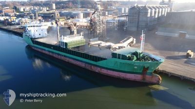
ARKLOW FERN
General Cargo
Current Trip
| Time Travelled | 3 days |
|---|---|
| Remaining Time | 2 mins |
| Distance Travelled | 690.56 nm |
| Remaining Distance | 460.45 nm |
| AVG Speed | 11.1 Knots |
| MAX Speed | 14.4 Knots |
| AVG Wind | 10.4 knots |
| MAX Wind | 24 knots |
| MIN Temp | 3.2°C / 37.76°F |
| MAX Temp | 14.4°C / 57.92°F |
| Dybgang | 6.4 m |
| Position Modtaget | 1 d siden |
Current Position
| Longitude | -5.88358° |
|---|---|
| Latitude | 48.75598° |
| Status | Under way using engine |
| Fart | 11.5 Knots |
| Kurs | 213° |
| Område | Celtic Sea |
| Station | T-AIS |
| Position Modtaget | 1 d siden |
Info
Information
The current position of ARKLOW FERN is in Celtic Sea with coordinates 48.75598° / -5.88358° as reported on 2025-02-13 11:37 by AIS to our vessel tracker app. The vessel's current speed is 11.5 Knots and is heading at the port of VILLAGARCIA. The estimated time of arrival as calculated by MyShipTracking vessel tracking app is 2025-02-15 03:41 LT
The vessel ARKLOW FERN (IMO: 9527661, MMSI: 250002173) is a General Cargo that was built in 2010 ( 15 år gamle ). It's sailing under the flag of [IE] Ireland.
In this page you can find informations about the vessels current position, last detected port calls, and current voyage information. If the vessels is not in coverage by AIS you will find the latest position.
The current position of ARKLOW FERN is detected by our AIS receivers and we are not responsible for the reliability of the data. The last position was recorded while the vessel was in Coverage by the Ais receivers of our vessel tracking app.
The current draught of ARKLOW FERN as reported by AIS is 6.4 meters
Weather
| Temperature | 14.1°C / 57.38°F |
|---|---|
| Wind Speed | 26 knots |
| Direction | 176° S |
| Pressure | 1009 hPa |
| Humidity | 82.8 % |
| Cloud Coverage | 100 % |
Featured Company
Last Port Calls
| Port | Arrival | Departure | Time In Port |
|---|---|---|---|
| 2025-02-11 06:22 | 2025-02-12 00:37 | 18 h | |
| 2025-02-09 22:08 | 2025-02-11 06:06 | 1 d | |
| 2025-02-07 23:13 | |||
| 2025-01-25 11:39 | 2025-01-29 21:35 | 4 d | |
| 2025-01-19 17:12 | 2025-01-21 19:05 | 2 d | |
| 2025-01-19 16:36 | 2025-01-19 16:51 | 15 m | |
| 2025-01-15 19:09 | 2025-01-16 22:56 | 1 d | |
| 2025-01-10 19:38 | 2025-01-14 14:46 | 3 d | |
| 2025-01-07 12:05 | 2025-01-09 15:27 | 2 d | |
| 2025-01-06 18:52 |
Last Trips
| Origin | Departure | Destination | Arrival | Distance | |
|---|---|---|---|---|---|
| 2025-02-11 06:06 | 2025-02-11 06:22 | 7.19 nm | |||
| 2025-02-07 23:13 | 2025-02-09 22:08 | 534.27 nm | |||
| 2025-01-21 20:05 | 2025-01-25 12:39 | 762.10 nm | |||
| 2025-01-19 17:51 | 2025-01-19 18:12 | 0.27 nm | |||
| 2025-01-16 22:56 | 2025-01-19 17:36 | 587.91 nm | |||
| 2025-01-14 14:46 | 2025-01-15 19:09 | 304.73 nm | |||
| 2025-01-09 15:27 | 2025-01-10 19:38 | 307.75 nm | |||
| 2025-01-06 18:52 | 2025-01-07 12:05 | 179.46 nm | |||
| 2024-12-15 17:22 | 2024-12-20 12:31 | 809.99 nm | |||
| 2024-12-15 17:22 | 2024-12-19 13:14 | 808.75 nm |
Events
| Tid | Hændelsen | Detaljer | Position / Dest | Info |
|---|---|---|---|---|
| 2025-02-13 11:40 | Status er ændret | Default Under way using engine |
48.74757 / -5.89198
VILAGARCIA
|
Fart: 11.5 kn Kurs: 213° |
| 2025-02-13 11:37 | Udenfor Dækning |
48.75598 / -5.88358
Celtic Sea
VILAGARCIA
|
Fart: 11.5 kn Kurs: 213° |
|
| 2025-02-13 11:36 | Status er ændret | Under way using engine Default |
48.75803 / -5.88158
VILAGARCIA
|
Fart: 11.7 kn Kurs: 214° |
| 2025-02-13 11:13 | Status er ændret | Default Under way using engine |
48.82084 / -5.81853
VILAGARCIA
|
Fart: 11.9 kn Kurs: 214° |
| 2025-02-13 11:04 | Ændre havområde | French part of the Celtic Sea United Kingdom part of the English Channel |
48.84467 / -5.79410
Celtic Sea
VILAGARCIA
|
Fart: 11.9 kn Kurs: 214° |
| 2025-02-13 11:02 | Status er ændret | Under way using engine Default |
48.84997 / -5.78877
VILAGARCIA
|
Fart: 12.5 kn Kurs: 235° |
| 2025-02-13 11:02 | Indenfor Dækning |
48.84467 / -5.79410
Celtic Sea
VILAGARCIA
|
Fart: 11.9 kn Kurs: 214° |
|
| 2025-02-13 02:35 | Status er ændret | Default Under way using engine |
49.61782 / -3.84143
VILAGARCIA
|
Fart: 11.5 kn Kurs: 235° |
| 2025-02-13 02:28 | Status er ændret | Under way using engine Default |
49.63050 / -3.81247
VILAGARCIA
|
Fart: 11.5 kn Kurs: 235° |
| 2025-02-13 02:28 | Udenfor Dækning |
49.63050 / -3.81247
English Channel
VILAGARCIA
|
Fart: 11.5 kn Kurs: 235° |