
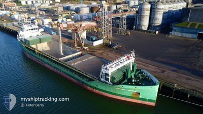
ARKLOW VENUS
Cargo
Current Trip
| Time Travelled | 3 days |
|---|---|
| Remaining Time | --- |
| Distance Travelled | 272.06 nm |
| Remaining Distance | --- |
| AVG Speed | 10.7 Knots |
| MAX Speed | 11.6 Knots |
| AVG Wind | 9.4 knots |
| MAX Wind | 20.4 knots |
| MIN Temp | 9.8°C / 49.64°F |
| MAX Temp | 14.9°C / 58.82°F |
| Dybgang | 4 m |
| Position Modtaget | 2 d siden |
Current Position
| Longitude | -7.68977° |
|---|---|
| Latitude | 43.85477° |
| Status | Under way using engine |
| Fart | 11.1 Knots |
| Kurs | 103.9° |
| Område | Bay of Biscay |
| Station | T-AIS |
| Position Modtaget | 2 d siden |
Info
Information
The current position of ARKLOW VENUS is in Bay of Biscay with coordinates 43.85477° / -7.68977° as reported on 2025-02-09 10:51 by AIS to our vessel tracker app. The vessel's current speed is 11.1 Knots
The vessel ARKLOW VENUS (IMO: 9772591, MMSI: 244140578) is a Cargo It's sailing under the flag of [NL] Netherlands.
In this page you can find informations about the vessels current position, last detected port calls, and current voyage information. If the vessels is not in coverage by AIS you will find the latest position.
The current position of ARKLOW VENUS is detected by our AIS receivers and we are not responsible for the reliability of the data. The last position was recorded while the vessel was in Coverage by the Ais receivers of our vessel tracking app.
The current draught of ARKLOW VENUS as reported by AIS is 4 meters
Weather
| Temperature | 14.1°C / 57.38°F |
|---|---|
| Wind Speed | 8 knots |
| Direction | 164° SSE |
| Pressure | 1010 hPa |
| Humidity | 70.1 % |
| Cloud Coverage | 100 % |
Featured Company
Last Port Calls
| Port | Arrival | Departure | Time In Port |
|---|---|---|---|
| 2025-02-07 11:35 | 2025-02-08 10:18 | 22 h | |
| 2025-02-06 07:35 | 2025-02-06 19:17 | 11 h | |
| 2025-01-25 07:31 | 2025-02-02 15:49 | 8 d | |
| 2025-01-22 07:13 | 2025-01-22 11:59 | 4 h | |
| 2025-01-18 06:18 | 2025-01-18 20:19 | 14 h | |
| 2025-01-13 12:26 | 2025-01-14 22:02 | 1 d | |
| 2025-01-08 07:31 | 2025-01-09 15:41 | 1 d | |
| 2025-01-02 20:07 | 2025-01-03 23:35 | 1 d | |
| 2024-12-29 20:27 | 2025-01-01 21:48 | 3 d | |
| 2024-12-19 09:00 | 2024-12-25 13:04 | 6 d |
Last Trips
| Origin | Departure | Destination | Arrival | Distance | |
|---|---|---|---|---|---|
| 2025-02-06 19:17 | 2025-02-07 11:35 | 186.78 nm | |||
| 2025-02-02 16:49 | 2025-02-06 07:35 | 997.01 nm | |||
| 2025-01-22 12:59 | 2025-01-25 08:31 | 700.17 nm | |||
| 2025-01-18 21:19 | 2025-01-22 08:13 | 807.67 nm | |||
| 2025-01-14 22:02 | 2025-01-18 07:18 | 747.22 nm | |||
| 2025-01-09 16:41 | 2025-01-13 12:26 | 975.87 nm | |||
| 2025-01-04 00:35 | 2025-01-08 08:31 | 594.72 nm | |||
| 2025-01-01 21:48 | 2025-01-02 21:07 | 132.51 nm | |||
| 2024-12-25 14:04 | 2024-12-29 20:27 | 163.10 nm | |||
| 2024-12-19 09:14 | 2024-12-19 10:00 | 4.30 nm |
Events
| Tid | Hændelsen | Detaljer | Position / Dest | Info |
|---|---|---|---|---|
| 2025-02-09 11:07 | Status er ændret | Default Under way using engine |
43.84343 / -7.62478
ESSCI
|
Fart: 11.1 kn Kurs: 103.9° |
| 2025-02-09 10:51 | Fundet i havområde | Spanish part of the Bay of Biscay |
43.85477 / -7.68977
Bay of Biscay
ESSCI
|
Fart: 11.1 kn Kurs: 103.9° |
| 2025-02-09 10:51 | Udenfor Dækning |
43.85477 / -7.68977
Bay of Biscay
ESSCI
|
Fart: 11.1 kn Kurs: 103.9° |
|
| 2025-02-09 10:08 | Status er ændret | Under way using engine Default |
43.88283 / -7.86903
ESSCI
|
Fart: 10.9 kn Kurs: 73° |
| 2025-02-09 10:08 | Indenfor Dækning |
43.88283 / -7.86903
North Atlantic Ocean
ESSCI
|
Fart: 11 kn Kurs: 99.9° |
|
| 2025-02-09 06:34 | Status er ændret | Default Under way using engine |
43.68877 / -8.69645
ESSCI
|
Fart: 10.7 kn Kurs: 71.7° |
| 2025-02-09 06:27 | Udenfor Dækning |
43.68193 / -8.72593
North Atlantic Ocean
ESSCI
|
Fart: 10.7 kn Kurs: 71.7° |
|
| 2025-02-09 06:21 | Status er ændret | Under way using engine Default |
43.67630 / -8.74800
ESSCI
|
Fart: 10.8 kn Kurs: 70° |
| 2025-02-09 06:06 | Status er ændret | Default Under way using engine |
43.66058 / -8.80546
ESSCI
|
Fart: 10.6 kn Kurs: 68.1° |
| 2025-02-09 05:51 | Status er ændret | Under way using engine Default |
43.64338 / -8.86367
ESSCI
|
Fart: 10.7 kn Kurs: 68° |