

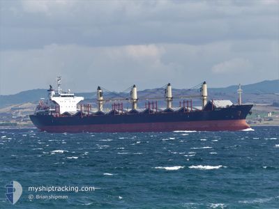
ASALET
Bulk Carrier

Current Trip
US MSY
| Time Travelled | 9 days |
|---|---|
| Remaining Time | --- |
| Distance Travelled | 31.48 nm |
| Remaining Distance | --- |
| AVG Speed | 7.1 Knots |
| MAX Speed | 8.2 Knots |
| AVG Wind | 6 knots |
| MAX Wind | 12 knots |
| MIN Temp | 20.2°C / 68.36°F |
| MAX Temp | 33.8°C / 92.84°F |
| Dybgang | 5.2 m |
| Position Modtaget | 16 h, 45 m siden |
Current Position
| Longitude | -90.57701° |
|---|---|
| Latitude | 30.05453° |
| Status | Moored |
| Fart | |
| Kurs | 264° |
| Område | Gulf of Mexico |
| Station | T-AIS |
| Position Modtaget | 16 h, 45 m siden |
Information
The current position of ASALET is in Gulf of Mexico with coordinates 30.05453° / -90.57701° as reported on 2025-05-27 14:31 by AIS to our vessel tracker app. The vessel's current speed is 0 Knots
The vessel ASALET (IMO: 9574169, MMSI: 271042325) is a Bulk Carrier that was built in 2010 ( 15 år gamle ). It's sailing under the flag of [TR] Turkey.
In this page you can find informations about the vessels current position, last detected port calls, and current voyage information. If the vessels is not in coverage by AIS you will find the latest position.
The current position of ASALET is detected by our AIS receivers and we are not responsible for the reliability of the data. The last position was recorded while the vessel was in Coverage by the Ais receivers of our vessel tracking app.
The current draught of ASALET as reported by AIS is 5.2 meters
Weather
| Temperature | 22.7°C / 72.86°F |
|---|---|
| Wind Speed | 2 knots |
| Direction | 264° W |
| Pressure | 1015.9 hPa |
| Humidity | 95.2 % |
| Cloud Coverage | --- |


Featured Company
Last Port Calls
| Port | Arrival | Departure | Time In Port |
|---|---|---|---|
| 2025-05-10 03:48 | 2025-05-18 16:04 | 8 d | |
| 2025-04-15 20:04 | 2025-04-24 07:20 | 8 d | |
| 2025-04-05 08:34 | 2025-04-07 20:01 | 2 d | |
| 2025-03-28 09:22 | 2025-04-02 14:36 | 5 d | |
| 2025-03-07 07:19 | 2025-03-07 10:49 | 3 h | |
| 2025-03-01 18:14 | 2025-03-03 15:23 | 1 d |
Most Visited Ports (Last year)
| Port | Arrivals | |
|---|---|---|
| 3 | ||
| 2 | ||
| 2 | ||
| 2 | ||
| 1 | ||
| 1 |
Last Trips
| Origin | Departure | Destination | Arrival | Distance | |
|---|---|---|---|---|---|
| 2025-04-24 07:20 | 2025-05-10 03:48 | 4478.46 nm | |||
| 2025-04-07 20:01 | 2025-04-15 20:04 | 1299.30 nm | |||
| 2025-04-02 14:36 | 2025-04-05 08:34 | 9.19 nm | |||
| 2025-03-07 10:49 | 2025-03-28 09:22 | 4578.91 nm | |||
| 2025-03-03 15:23 | 2025-03-07 07:19 | 70.93 nm | |||
| 2025-02-18 16:26 | 2025-03-01 18:14 | 1660.49 nm |
Events
| Tid | Hændelsen | Detaljer | Position / Dest | Info |
|---|---|---|---|---|
| 2025-05-27 14:34 | Status er ændret | Default Moored |
30.05452 / -90.57703
US MSY
|
Fart: Kurs: 264° |
| 2025-05-27 14:32 | Dybgangen er ændret | 5.2 5.5 |
30.05453 / -90.57701
US MSY
|
Fart: Kurs: 264° |
| 2025-05-27 14:31 | Status er ændret | Moored Default |
30.05453 / -90.57701
US MSY
|
Fart: Kurs: 264° |
| 2025-05-27 14:31 | Udenfor Dækning |
30.05453 / -90.57701
Gulf of Mexico
|
Fart: Kurs: 274.3° |
|
| 2025-05-27 14:28 | Indenfor Dækning |
30.05453 / -90.57701
Gulf of Mexico
|
Fart: Kurs: 274.3° |
|
| 2025-05-27 13:22 | STOP Sejllads | 6.26 nm, East of LUTCHER |
30.05454 / -90.57703
US MSY
|
Fart: Kurs: 264° |
| 2025-05-27 11:37 | START Sejllads | 2.36 nm, West of GOOD HOPE |
29.99710 / -90.44813
US MSY
|
Fart: 3.1 kn Kurs: 274° |
| 2025-05-20 03:46 | Dybgangen er ændret | 5.5 9.7 |
29.99827 / -90.44475
US MSY
|
Fart: 0.1 kn Kurs: 273° |
| 2025-05-19 12:54 | Status er ændret | Default At anchor |
29.99851 / -90.44480
US MSY
|
Fart: Kurs: 273° |
| 2025-05-19 12:48 | Udenfor Dækning |
29.99851 / -90.44484
Gulf of Mexico
|
Fart: Kurs: 178.9° |