

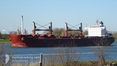
ASTORIA
Bulk Carrier

Current Trip
CA QUE > CA SJB
| Time Travelled | 8 days |
|---|---|
| Remaining Time | --- |
| Distance Travelled | 2422.60 nm |
| Remaining Distance | --- |
| AVG Speed | 12.2 Knots |
| MAX Speed | 15.2 Knots |
| AVG Wind | 15.5 knots |
| MAX Wind | 37.9 knots |
| MIN Temp | 7.4°C / 45.32°F |
| MAX Temp | 27.2°C / 80.96°F |
| Dybgang | 8.8 m |
| Position Modtaget | 4 d siden |
Current Position
| Longitude | -58.41027° |
|---|---|
| Latitude | 29.25831° |
| Status | Under way using engine |
| Fart | 13.3 Knots |
| Kurs | 157.4° |
| Område | North Atlantic Ocean |
| Station | T-AIS |
| Position Modtaget | 4 d siden |
Information
The current position of ASTORIA is in North Atlantic Ocean with coordinates 29.25831° / -58.41027° as reported on 2025-06-03 03:03 by AIS to our vessel tracker app. The vessel's current speed is 13.3 Knots
The vessel ASTORIA (IMO: 9663635, MMSI: 636015672) is a Bulk Carrier that was built in 2013 ( 12 år gamle ). It's sailing under the flag of [LR] Liberia.
In this page you can find informations about the vessels current position, last detected port calls, and current voyage information. If the vessels is not in coverage by AIS you will find the latest position.
The current position of ASTORIA is detected by our AIS receivers and we are not responsible for the reliability of the data. The last position was recorded while the vessel was in Coverage by the Ais receivers of our vessel tracking app.
The current draught of ASTORIA as reported by AIS is 8.8 meters
Weather
| Temperature | 27.1°C / 80.78°F |
|---|---|
| Wind Speed | 18 knots |
| Direction | 69° ENE |
| Pressure | 1014.4 hPa |
| Humidity | 73.3 % |
| Cloud Coverage | 100 % |


Featured Company
Last Port Calls
| Port | Arrival | Departure | Time In Port |
|---|---|---|---|
| 2025-05-27 00:12 | 2025-05-30 02:44 | 3 d | |
| 2025-05-16 23:41 | 2025-05-21 19:23 | 4 d | |
| 2025-04-21 22:14 | 2025-04-24 12:46 | 2 d | |
| 2025-04-08 02:56 | 2025-04-14 21:56 | 6 d |
Last Trips
| Origin | Departure | Destination | Arrival | Distance | |
|---|---|---|---|---|---|
| 2025-05-21 19:23 | 2025-05-27 00:12 | 1149.34 nm | |||
| 2025-04-24 12:46 | 2025-05-16 23:41 | 5328.53 nm | |||
| 2025-04-14 21:56 | 2025-04-21 22:14 | 816.18 nm | |||
| 2025-03-28 10:41 | 2025-04-08 02:56 | 3152.40 nm |
Events
| Tid | Hændelsen | Detaljer | Position / Dest | Info |
|---|---|---|---|---|
| 2025-06-03 03:04 | Status er ændret | Default Under way using engine |
29.25320 / -58.40789
CA QUE > CA SJB
|
Fart: 13.3 kn Kurs: 157.4° |
| 2025-06-03 03:03 | Udenfor Dækning |
29.25831 / -58.41027
North Atlantic Ocean
|
Fart: 13.3 kn Kurs: 157.4° |
|
| 2025-06-03 02:22 | Fundet i havområde | High seas of the North Atlantic Ocean |
29.39635 / -58.47762
North Atlantic Ocean
|
Fart: 13.1 kn Kurs: 156° |
| 2025-06-03 02:22 | Status er ændret | Under way using engine Default |
29.39635 / -58.47762
CA QUE > CA SJB
|
Fart: 13.4 kn Kurs: 155° |
| 2025-06-03 02:03 | Indenfor Dækning |
29.39635 / -58.47762
North Atlantic Ocean
|
Fart: 13.1 kn Kurs: 156° |
|
| 2025-05-30 05:44 | Afsejlet fra sidste havn |
|
45.23970 / -66.04517
CA QUE > CA SJB
|
Fart: 7.5 kn Kurs: 172° |
| 2025-05-30 05:33 | START Sejllads |
45.26196 / -66.04511
[CA] SAINT JOHN
|
Fart: 4.2 kn Kurs: 200° |