

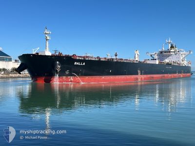
BALLA
Tanker

Current Trip
EG SKT
| Time Travelled | --- |
|---|---|
| Remaining Time | --- |
| Distance Travelled | 5166.35 nm |
| Remaining Distance | --- |
| AVG Speed | 8.8 Knots |
| MAX Speed | 8.8 Knots |
| AVG Wind | 13.2 knots |
| MAX Wind | 37.9 knots |
| MIN Temp | 10.6°C / 51.08°F |
| MAX Temp | 28.5°C / 83.3°F |
| Dybgang | 8.5 m |
| Position Modtaget | 1 d siden |
Current Position
| Longitude | 27.09961° |
|---|---|
| Latitude | 34.58543° |
| Status | Under way using engine |
| Fart | 11.9 Knots |
| Kurs | 149.2° |
| Område | Mediterranean Sea - Eastern Basin |
| Station | T-AIS |
| Position Modtaget | 1 d siden |
Information
The current position of BALLA is in Mediterranean Sea - Eastern Basin with coordinates 34.58543° / 27.09961° as reported on 2025-05-24 09:36 by AIS to our vessel tracker app. The vessel's current speed is 11.9 Knots
The vessel BALLA (IMO: 9749556, MMSI: 636021796) is a Tanker It's sailing under the flag of [LR] Liberia.
In this page you can find informations about the vessels current position, last detected port calls, and current voyage information. If the vessels is not in coverage by AIS you will find the latest position.
The current position of BALLA is detected by our AIS receivers and we are not responsible for the reliability of the data. The last position was recorded while the vessel was in Coverage by the Ais receivers of our vessel tracking app.
The current draught of BALLA as reported by AIS is 8.5 meters
Weather
| Temperature | 26.8°C / 80.24°F |
|---|---|
| Wind Speed | 12 knots |
| Direction | 126° SE |
| Pressure | 1008.2 hPa |
| Humidity | 34.4 % |
| Cloud Coverage | 36 % |


Featured Company
Most Visited Ports (Last year)
| Port | Arrivals | |
|---|---|---|
| 1 | ||
| 1 | ||
| 1 | ||
| 1 | ||
| 1 | ||
| 1 |
Events
| Tid | Hændelsen | Detaljer | Position / Dest | Info |
|---|---|---|---|---|
| 2025-05-25 19:05 | STOP Sejllads | 11.44 nm, West of EL DEKHEILA |
31.09192 / 29.59314
EG SKT
|
Fart: 0.1 kn Kurs: 70° |
| 2025-05-25 17:19 | START Sejllads | 12.1 nm, West of EL DEKHEILA |
31.13607 / 29.57141
EG SKT
|
Fart: 3.7 kn Kurs: 108° |
| 2025-05-25 07:58 | STOP Sejllads | 12.49 nm, West of EL DEKHEILA |
31.13607 / 29.56389
EG SKT
|
Fart: 0.3 kn Kurs: 178° |
| 2025-05-24 09:41 | Status er ændret | Default Under way using engine |
34.57039 / 27.11027
EG SKT
|
Fart: 11.9 kn Kurs: 149.2° |
| 2025-05-24 09:36 | Udenfor Dækning |
34.58543 / 27.09961
Mediterranean Sea - Eastern Basin
EG SKT
|
Fart: 11.9 kn Kurs: 149.2° |
|
| 2025-05-24 05:07 | Ændre havområde | Greek part of the Mediterranean Sea - Eastern Basin Greek part of the Aegean Sea |
35.31486 / 26.55421
Mediterranean Sea - Eastern Basin
EG SKT
|
Fart: 11.4 kn Kurs: 148.7° |
| 2025-05-23 13:29 | Dybgangen er ændret | 8.5 8 |
37.23549 / 23.98119
EG SKT
|
Fart: 11.4 kn Kurs: 170.1° |
| 2025-05-23 13:29 | ETA er ændret | 2025/05/25 08:00 |
37.23549 / 23.98119
EG SKT
|
Fart: 11.4 kn Kurs: 170.1° |
| 2025-05-23 13:23 | Dybgangen er ændret | 8 8.5 |
37.25346 / 23.97747
EG SKT
|
Fart: 10.3 kn Kurs: 170° |
| 2025-05-23 13:05 | Dybgangen er ændret | 8.5 8 |
37.29972 / 23.96542
EG SKT
|
Fart: 11.3 kn Kurs: 162.8° |