

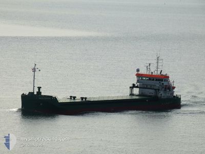
BALTIC CRYSTAL
Cargo

Current Trip
| Trip Time | 20 h, 14 mins |
|---|---|
| Trip Distance | 230.33 nm |
| AVG Speed | 12.4 Knots |
| MAX Speed | 14.2 Knots |
| Dybgang | 4.2 m |
| AVG Wind | 2.9 knots |
| MAX Wind | 8 knots |
| MIN Temp | 2.7°C / 36.86°F |
| MAX Temp | 8.3°C / 46.94°F |
| Position Modtaget | Nu |
Current Position
| Longitude | 14.60689° |
|---|---|
| Latitude | 53.40146° |
| Status | Moored |
| Fart | |
| Kurs | 10° |
| Område | Baltic Sea |
| Station | T-AIS |
| Position Modtaget | Nu |
Information
The current position of BALTIC CRYSTAL is in Baltic Sea with coordinates 53.40146° / 14.60689° as reported on 2025-02-27 14:11 by AIS to our vessel tracker app. The vessel's current speed is 0 Knots and is currently inside the port of SZCZECIN.
The vessel BALTIC CRYSTAL (IMO: 9963487, MMSI: 231873000) is a Cargo It's sailing under the flag of [FO] Faroe Is.
In this page you can find informations about the vessels current position, last detected port calls, and current voyage information. If the vessels is not in coverage by AIS you will find the latest position.
The current position of BALTIC CRYSTAL is detected by our AIS receivers and we are not responsible for the reliability of the data. The last position was recorded while the vessel was in Coverage by the Ais receivers of our vessel tracking app.
The current draught of BALTIC CRYSTAL as reported by AIS is 4.2 meters
Weather
| Temperature | 9.6°C / 49.28°F |
|---|---|
| Wind Speed | 4 knots |
| Direction | 211° SSW |
| Pressure | 1015.7 hPa |
| Humidity | 57.4 % |
| Cloud Coverage | 99 % |

Featured Company
Last Port Calls
| Port | Arrival | Departure | Time In Port |
|---|---|---|---|
| 2025-02-27 10:06 | |||
| 2025-02-25 04:51 | 2025-02-26 13:52 | 1 d | |
| 2025-02-22 03:01 | 2025-02-22 18:09 | 15 h | |
| 2025-02-20 03:07 | 2025-02-20 19:01 | 15 h | |
| 2025-02-15 20:34 | 2025-02-17 19:46 | 1 d | |
| 2025-02-14 13:29 | 2025-02-15 10:33 | 21 h | |
| 2025-02-12 15:36 | 2025-02-13 12:45 | 21 h | |
| 2025-01-24 17:53 | 2025-01-31 06:40 | 6 d | |
| 2025-01-19 19:15 | 2025-01-23 19:50 | 4 d | |
| 2025-01-09 08:59 | 2025-01-10 22:17 | 1 d |
Last Trips
| Origin | Departure | Destination | Arrival | Distance | |
|---|---|---|---|---|---|
| 2025-02-26 14:52 | 2025-02-27 11:06 | 230.33 nm | |||
| 2025-02-22 20:09 | 2025-02-25 05:51 | 641.52 nm | |||
| 2025-02-20 20:01 | 2025-02-22 05:01 | 296.58 nm | |||
| 2025-02-17 20:46 | 2025-02-20 04:07 | 531.57 nm | |||
| 2025-02-15 11:33 | 2025-02-15 21:34 | 89.98 nm | |||
| 2025-02-13 13:45 | 2025-02-14 14:29 | 285.26 nm | |||
| 2025-01-31 07:40 | 2025-02-12 16:36 | 2192.66 nm | |||
| 2025-01-23 20:50 | 2025-01-24 18:53 | 58.52 nm | |||
| 2025-01-10 23:17 | 2025-01-19 20:15 | 1985.29 nm | |||
| 2025-01-09 00:38 | 2025-01-09 09:59 | 110.88 nm |
Events
| Tid | Hændelsen | Detaljer | Position / Dest | Info |
|---|---|---|---|---|
| 2025-02-27 13:35 | Status er ændret | Moored Default |
53.40149 / 14.60692
[PL] SZCZECIN
|
Fart: Kurs: 10° |
| 2025-02-27 13:17 | Status er ændret | Default Moored |
53.40148 / 14.60689
[PL] SZCZECIN
|
Fart: Kurs: 10° |
| 2025-02-27 12:53 | Status er ændret | Moored Under way using engine |
53.40146 / 14.60691
[PL] SZCZECIN
|
Fart: Kurs: 10° |
| 2025-02-27 10:46 | STOP Sejllads |
53.40143 / 14.60678
[PL] SZCZECIN
|
Fart: 0.3 kn Kurs: 10° |
|
| 2025-02-27 10:06 | Skibe i havn |
|
53.45755 / 14.59822
[PL] SZCZECIN
|
Fart: 8.7 kn Kurs: 193.8° |
| 2025-02-27 10:05 | Status er ændret | Under way using engine Default |
53.45995 / 14.59914
SEHAD>PLSZZ
|
Fart: 9 kn Kurs: 199° |
| 2025-02-27 10:05 | Indenfor Dækning |
53.45438 / 14.59713
Baltic Sea
[PL] SZCZECIN
|
Fart: 8.7 kn Kurs: 190.4° |
|
| 2025-02-27 02:26 | Status er ændret | Default Under way using engine |
54.43586 / 13.85736
SEHAD>PLSZZ
|
Fart: 13.1 kn Kurs: 151.8° |
| 2025-02-27 02:21 | Udenfor Dækning |
54.45022 / 13.84377
Baltic Sea
SEHAD>PLSZZ
|
Fart: 13.1 kn Kurs: 151.8° |
|
| 2025-02-27 02:02 | Status er ændret | Under way using engine Default |
54.50958 / 13.78786
SEHAD>PLSZZ
|
Fart: 12.9 kn Kurs: 151° |