

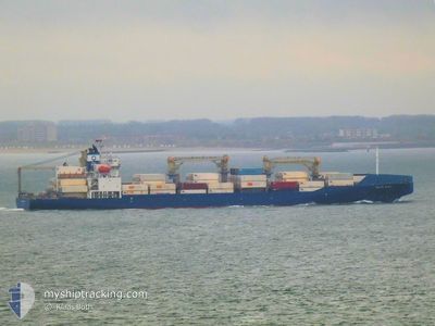
BALTIC SPIRIT
Cargo

Current Trip
| Time Travelled | 3 days |
|---|---|
| Remaining Time | --- |
| Distance Travelled | 984.64 nm |
| Remaining Distance | --- |
| AVG Speed | 14.8 Knots |
| MAX Speed | 19.5 Knots |
| AVG Wind | 8.8 knots |
| MAX Wind | 18 knots |
| MIN Temp | 20.7°C / 69.26°F |
| MAX Temp | 30.9°C / 87.62°F |
| Dybgang | 10.1 m |
| Position Modtaget | 3 h, 52 m siden |
Current Position
| Longitude | -79.50173° |
|---|---|
| Latitude | 8.89499° |
| Status | At anchor |
| Fart | 0.1 Knots |
| Kurs | 61° |
| Område | North Pacific Ocean |
| Station | T-AIS |
| Position Modtaget | 3 h, 52 m siden |
Information
The current position of BALTIC SPIRIT is in North Pacific Ocean with coordinates 8.89499° / -79.50173° as reported on 2025-06-11 15:45 by AIS to our vessel tracker app. The vessel's current speed is 0.1 Knots
The vessel BALTIC SPIRIT (IMO: 9765873, MMSI: 311000851) is a Cargo It's sailing under the flag of [BS] Bahamas.
In this page you can find informations about the vessels current position, last detected port calls, and current voyage information. If the vessels is not in coverage by AIS you will find the latest position.
The current position of BALTIC SPIRIT is detected by our AIS receivers and we are not responsible for the reliability of the data. The last position was recorded while the vessel was in Coverage by the Ais receivers of our vessel tracking app.
The current draught of BALTIC SPIRIT as reported by AIS is 10.1 meters
Weather
| Temperature | 26.4°C / 79.52°F |
|---|---|
| Wind Speed | 3 knots |
| Direction | 175° S |
| Pressure | 1011.2 hPa |
| Humidity | 85.5 % |
| Cloud Coverage | 100 % |


Featured Company
Last Port Calls
| Port | Arrival | Departure | Time In Port |
|---|---|---|---|
| 2025-05-28 14:54 | 2025-06-07 19:47 | 10 d | |
| 2025-05-03 08:26 | 2025-05-09 12:20 | 6 d |
Most Visited Ports (Last year)
| Port | Arrivals | |
|---|---|---|
| 6 | ||
| 2 | ||
| 2 | ||
| 2 | ||
| 1 |
Last Trips
| Origin | Departure | Destination | Arrival | Distance | |
|---|---|---|---|---|---|
| 2025-05-09 12:20 | 2025-05-28 14:54 | 7248.25 nm | |||
| 2025-03-22 14:55 | 2025-05-03 08:26 | 9925.95 nm |
Events
| Tid | Hændelsen | Detaljer | Position / Dest | Info |
|---|---|---|---|---|
| 2025-06-11 15:54 | Status er ændret | Default At anchor |
8.89530 / -79.50185
PABLB
|
Fart: 0.1 kn Kurs: 61° |
| 2025-06-11 15:45 | Udenfor Dækning |
8.89499 / -79.50173
North Pacific Ocean
|
Fart: 0.1 kn Kurs: 147.3° |
|
| 2025-06-11 15:06 | Status er ændret | At anchor Default |
8.89460 / -79.50136
PABLB
|
Fart: 0.4 kn Kurs: 38° |
| 2025-06-11 14:48 | Indenfor Dækning |
8.89460 / -79.50136
North Pacific Ocean
|
Fart: 0.4 kn Kurs: 305.7° |
|
| 2025-06-11 11:39 | Status er ændret | Default At anchor |
8.89435 / -79.50085
PABLB
|
Fart: 0.1 kn Kurs: 20° |
| 2025-06-11 11:30 | Status er ændret | At anchor Default |
8.89436 / -79.50089
PABLB
|
Fart: Kurs: 23° |
| 2025-06-11 11:30 | Udenfor Dækning |
8.89436 / -79.50089
North Pacific Ocean
|
Fart: 0.1 kn Kurs: 179.6° |
|
| 2025-06-11 11:03 | Status er ændret | Default At anchor |
8.89438 / -79.50092
PABLB
|
Fart: 0.1 kn Kurs: 18° |
| 2025-06-11 10:57 | Status er ændret | At anchor Default |
8.89438 / -79.50085
PABLB
|
Fart: Kurs: 21° |
| 2025-06-11 10:57 | Indenfor Dækning |
8.89438 / -79.50085
North Pacific Ocean
|
Fart: 0.1 kn Kurs: 1.3° |