

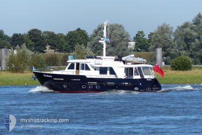
BARBARA
Pleasure Craft

Current Trip
BARBARA is out of coverage. Learn how you can join the community and extend the coverage to your area by clicking here!
Unknown
Destination Port
ETA*
---
| Time Travelled | 4 days |
|---|---|
| Remaining Time | --- |
| Distance Travelled | 8.79 nm |
| Remaining Distance | --- |
| AVG Speed | 7.2 Knots |
| MAX Speed | 8.7 Knots |
| AVG Wind | 14.2 knots |
| MAX Wind | 15 knots |
| MIN Temp | 12.5°C / 54.5°F |
| MAX Temp | 13.3°C / 55.94°F |
| Dybgang | --- |
| Position Modtaget | 4 d siden |
Current Position
| Longitude | 4.81965° |
|---|---|
| Latitude | 51.71169° |
| Status | Default |
| Fart | 5 Knots |
| Kurs | 268.8° |
| Område | North Sea |
| Station | T-AIS |
| Position Modtaget | 4 d siden |
Information
The current position of BARBARA is in North Sea with coordinates 51.71169° / 4.81965° as reported on 2025-04-01 13:10 by AIS to our vessel tracker app. The vessel's current speed is 5 Knots
The vessel BARBARA (MMSI: 232049895) is a Pleasure Craft It's sailing under the flag of [GB] United Kingdom.
In this page you can find informations about the vessels current position, last detected port calls, and current voyage information. If the vessels is not in coverage by AIS you will find the latest position.
The current position of BARBARA is detected by our AIS receivers and we are not responsible for the reliability of the data. The last position was recorded while the vessel was in Coverage by the Ais receivers of our vessel tracking app.
Weather
| Temperature | 13.3°C / 55.94°F |
|---|---|
| Wind Speed | 15 knots |
| Direction | 80° E |
| Pressure | 1026.6 hPa |
| Humidity | 46.5 % |
| Cloud Coverage | 6 % |


Featured Company
Limited time offer - Install a base station receiver to your area and list your company on MyShipTracking Free forever!
Most Visited Ports (Last year)
| Port | Arrivals | |
|---|---|---|
| 1 |
Last Trips
| Origin | Departure | Destination | Arrival | Distance |
|---|
Events
| Tid | Hændelsen | Detaljer | Position / Dest | Info |
|---|---|---|---|---|
| 2025-04-01 13:10 | Udenfor Dækning |
51.71169 / 4.81965
North Sea
|
Fart: 5 kn Kurs: 268.8° |
|
| 2025-04-01 12:03 | START Sejllads | 0.99 nm, North of WAALWIJK |
51.71199 / 5.05114
|
Fart: 5.2 kn Kurs: 259.1° |
| 2025-04-01 12:03 | Afsejlet fra sidste havn |
|
51.71199 / 5.05114
|
Fart: Kurs: 511° |
| 2025-04-01 11:51 | STOP Sejllads |
51.70713 / 5.05697
[NL] WAALWIJK
|
Fart: 0.1 kn Kurs: 511° |
|
| 2025-04-01 11:46 | START Sejllads |
51.70184 / 5.05665
[NL] WAALWIJK
|
Fart: 5.4 kn Kurs: 355.9° |
|
| 2025-04-01 08:21 | Indenfor Dækning |
51.69923 / 5.05752
North Sea
[NL] WAALWIJK
|
Fart: Kurs: 511° |
|
| 2025-03-31 13:07 | Udenfor Dækning |
51.69926 / 5.05753
North Sea
[NL] WAALWIJK
|
Fart: Kurs: 511° |
|
| 2025-03-31 13:07 | Indenfor Dækning |
51.69926 / 5.05753
North Sea
[NL] WAALWIJK
|
Fart: Kurs: 511° |
|
| 2025-03-31 10:17 | Udenfor Dækning |
51.69924 / 5.05756
North Sea
[NL] WAALWIJK
|
Fart: Kurs: 511° |
|
| 2025-03-31 05:12 | Indenfor Dækning |
51.69925 / 5.05752
North Sea
[NL] WAALWIJK
|
Fart: 0.1 kn Kurs: 511° |