
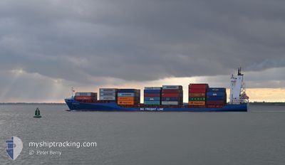
BG IRELAND
Container Ship
Current Trip
| Time Travelled | 22 h, 18 mins |
|---|---|
| Remaining Time | 16 h, 47 mins |
| Distance Travelled | 323.95 nm |
| Remaining Distance | 231.11 nm |
| AVG Speed | 14.6 Knots |
| MAX Speed | 18.3 Knots |
| AVG Wind | 15.7 knots |
| MAX Wind | 24 knots |
| MIN Temp | 5.1°C / 41.18°F |
| MAX Temp | 9.8°C / 49.64°F |
| Dybgang | 7.2 m |
| Position Modtaget | 2 m siden |
Current Position
| Longitude | -3.15292° |
|---|---|
| Latitude | 50.18216° |
| Status | Under way using engine |
| Fart | 12.9 Knots |
| Kurs | 258.2° |
| Område | English Channel |
| Station | T-AIS |
| Position Modtaget | 2 m siden |
Info
Information
The current position of BG IRELAND is in English Channel with coordinates 50.18216° / -3.15292° as reported on 2025-02-05 09:35 by AIS to our vessel tracker app. The vessel's current speed is 12.9 Knots and is heading at the port of CORK. The estimated time of arrival as calculated by MyShipTracking vessel tracking app is 2025-02-06 02:25 LT
The vessel BG IRELAND (IMO: 9355446, MMSI: 209719000) is a Container Ship that was built in 2007 ( 18 år gamle ). It's sailing under the flag of [CY] Cyprus.
In this page you can find informations about the vessels current position, last detected port calls, and current voyage information. If the vessels is not in coverage by AIS you will find the latest position.
The current position of BG IRELAND is detected by our AIS receivers and we are not responsible for the reliability of the data. The last position was recorded while the vessel was in Coverage by the Ais receivers of our vessel tracking app.
The current draught of BG IRELAND as reported by AIS is 7.2 meters
Weather
| Temperature | 8.9°C / 48.02°F |
|---|---|
| Wind Speed | 8 knots |
| Direction | 282° WNW |
| Pressure | 1037.6 hPa |
| Humidity | 75.2 % |
| Cloud Coverage | 100 % |
Featured Company
Last Port Calls
| Port | Arrival | Departure | Time In Port |
|---|---|---|---|
| 2025-02-03 14:25 | 2025-02-04 12:20 | 21 h | |
| 2025-02-03 11:52 | 2025-02-03 12:26 | 33 m | |
| 2025-02-03 06:26 | 2025-02-03 11:43 | 5 h | |
| 2025-02-03 05:30 | 2025-02-03 06:11 | 41 m | |
| 2025-01-30 18:48 | 2025-02-01 11:39 | 1 d | |
| 2025-01-30 18:31 | 2025-01-30 18:42 | 11 m | |
| 2025-01-25 07:29 | 2025-01-26 08:29 | 1 d | |
| 2025-01-25 05:26 | 2025-01-25 06:00 | 34 m | |
| 2025-01-24 19:54 | 2025-01-25 05:25 | 9 h | |
| 2025-01-24 18:42 | 2025-01-24 19:49 | 1 h |
Most Visited Ports (Last year)
| Port | Arrivals | |
|---|---|---|
| 69 | ||
| 52 | ||
| 45 | ||
| 15 | ||
| 10 | ||
| 8 |
Last Trips
| Origin | Departure | Destination | Arrival | Distance | |
|---|---|---|---|---|---|
| 2025-02-03 12:26 | 2025-02-03 14:25 | 16.42 nm | |||
| 2025-02-03 06:11 | 2025-02-03 11:52 | 3.05 nm | |||
| 2025-02-03 06:11 | 2025-02-03 06:26 | 0.58 nm | |||
| 2025-02-01 11:39 | 2025-02-03 05:30 | 582.22 nm | |||
| 2025-01-30 18:42 | 2025-01-30 18:48 | 0.97 nm | |||
| 2025-01-26 08:29 | 2025-01-30 18:31 | 639.38 nm | |||
| 2025-01-25 06:00 | 2025-01-25 07:29 | 16.27 nm | |||
| 2025-01-25 05:25 | 2025-01-25 05:26 | 0.30 nm | |||
| 2025-01-24 19:49 | 2025-01-24 19:54 | 0.08 nm | |||
| 2025-01-24 17:17 | 2025-01-24 18:42 | 15.92 nm |
Events
| Tid | Hændelsen | Detaljer | Position / Dest | Info |
|---|---|---|---|---|
| 2025-02-05 05:41 | Status er ændret | Under way using engine Default |
50.36566 / -1.57462
CORK
|
Fart: 18 kn Kurs: 258° |
| 2025-02-05 05:39 | Status er ændret | Default Under way using engine |
50.36781 / -1.55924
CORK
|
Fart: 17.8 kn Kurs: 257.8° |
| 2025-02-04 21:19 | Ændre havområde | United Kingdom part of the English Channel United Kingdom part of the North Sea |
51.06983 / 1.45946
English Channel
CORK
|
Fart: 15.4 kn Kurs: 229.4° |
| 2025-02-04 19:26 | ETA er ændret | 2025/02/06 06:15 2025/02/06 05:00 |
51.39040 / 1.91121
CORK
|
Fart: 12.6 kn Kurs: 213.8° |
| 2025-02-04 17:30 | Ændre havområde | United Kingdom part of the North Sea Belgian part of the North Sea |
51.69693 / 2.34621
North Sea
CORK
|
Fart: 12.5 kn Kurs: 223.2° |
| 2025-02-04 17:30 | Status er ændret | Under way using engine Default |
51.69693 / 2.34621
CORK
|
Fart: 12.5 kn Kurs: 223° |
| 2025-02-04 17:29 | Status er ændret | Default Under way using engine |
51.69931 / 2.34994
CORK
|
Fart: 12.6 kn Kurs: 224.5° |
| 2025-02-04 17:29 | Status er ændret | Under way using engine Default |
51.70014 / 2.35127
CORK
|
Fart: 12.4 kn Kurs: 223° |
| 2025-02-04 17:09 | Status er ændret | Default Under way using engine |
51.74980 / 2.42676
CORK
|
Fart: 12.4 kn Kurs: 225.2° |
| 2025-02-04 16:31 | Ændre havområde | Belgian part of the North Sea Dutch part of the North Sea |
51.84493 / 2.57987
North Sea
CORK
|
Fart: 12.8 kn Kurs: 225.1° |