
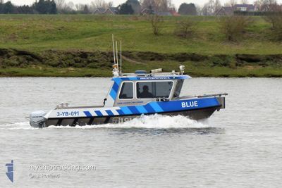
BLUE
Dredging or underwater ops
Current Trip
| Trip Time | 7 h, 32 mins |
|---|---|
| Trip Distance | 72.29 nm |
| AVG Speed | 12.3 Knots |
| MAX Speed | 12.3 Knots |
| Dybgang | 0.6 m |
| AVG Wind | 10.6 knots |
| MAX Wind | 11.3 knots |
| MIN Temp | 7.9°C / 46.22°F |
| MAX Temp | 8.2°C / 46.76°F |
| Position Modtaget | 1 d siden |
Current Position
| Longitude | 3.58610° |
|---|---|
| Latitude | 51.44853° |
| Status | Under way using engine |
| Fart | |
| Kurs | --- |
| Område | North Sea |
| Station | T-AIS |
| Position Modtaget | 1 d siden |
Information
The current position of BLUE is in North Sea with coordinates 51.44853° / 3.58610° as reported on 2025-04-10 15:29 by AIS to our vessel tracker app. The vessel's current speed is 0 Knots and is currently inside the port of VLISSINGEN STATION.
The vessel BLUE (MMSI: 244013024) is a Dredging or underwater ops It's sailing under the flag of [NL] Netherlands.
In this page you can find informations about the vessels current position, last detected port calls, and current voyage information. If the vessels is not in coverage by AIS you will find the latest position.
The current position of BLUE is detected by our AIS receivers and we are not responsible for the reliability of the data. The last position was recorded while the vessel was in Coverage by the Ais receivers of our vessel tracking app.
The current draught of BLUE as reported by AIS is 0.6 meters
Weather
| Temperature | 8.2°C / 46.76°F |
|---|---|
| Wind Speed | 11 knots |
| Direction | 356° N |
| Pressure | 1028.5 hPa |
| Humidity | 86 % |
| Cloud Coverage | 14 % |
Featured Company
Last Port Calls
| Port | Arrival | Departure | Time In Port |
|---|---|---|---|
| 2025-04-10 15:03 | |||
| 2025-04-10 07:31 | |||
| 2025-04-09 16:38 | |||
| 2025-04-09 16:38 | |||
| 2025-04-09 15:14 | |||
| 2025-04-09 15:07 | 2025-04-09 15:11 | 3 m | |
| 2025-04-09 15:04 | 2025-04-09 15:05 | 1 m | |
| 2025-04-09 14:57 | 2025-04-09 15:00 | 2 m | |
| 2025-04-09 14:50 | 2025-04-09 14:53 | 2 m | |
| 2025-04-09 14:43 | 2025-04-09 14:46 | 3 m |
Most Visited Ports (Last year)
| Port | Arrivals | |
|---|---|---|
| 45 | ||
| 30 | ||
| 27 | ||
| 25 | ||
| 23 | ||
| 9 |
Last Trips
| Origin | Departure | Destination | Arrival | Distance | |
|---|---|---|---|---|---|
| 2025-04-10 09:31 | 2025-04-10 17:03 | 72.29 nm | |||
| 2025-04-09 18:38 | 2025-04-09 18:38 | --- | |||
| 2025-04-09 17:11 | 2025-04-09 17:14 | 0.90 nm | |||
| 2025-04-09 17:05 | 2025-04-09 17:07 | 1.58 nm | |||
| 2025-04-09 17:00 | 2025-04-09 17:04 | 1.06 nm | |||
| 2025-04-09 16:53 | 2025-04-09 16:57 | 0.80 nm | |||
| 2025-04-09 16:46 | 2025-04-09 16:50 | 0.82 nm | |||
| 2025-04-09 16:37 | 2025-04-09 16:43 | 0.79 nm | |||
| 2025-04-09 16:28 | 2025-04-09 16:36 | 1.60 nm | |||
| 2025-04-09 15:39 | 2025-04-09 16:16 | 6.09 nm |
Events
| Tid | Hændelsen | Detaljer | Position / Dest | Info |
|---|---|---|---|---|
| 2025-04-10 15:29 | Udenfor Dækning |
51.44853 / 3.58610
North Sea
[NL] VLISSINGEN STATION
|
Fart: Kurs: 511° |
|
| 2025-04-10 15:03 | STOP Sejllads |
51.44854 / 3.58609
[NL] VLISSINGEN STATION
|
Fart: 0.1 kn Kurs: 511° |
|
| 2025-04-10 15:03 | Skibe i havn |
|
51.44854 / 3.58609
[NL] VLISSINGEN STATION
|
Fart: 0.7 kn Kurs: 511° |
| 2025-04-10 14:55 | START Sejllads | 0.23 nm, South of VLISSINGEN STATION |
51.44369 / 3.59212
PEILEN
|
Fart: 7.8 kn Kurs: 288° |
| 2025-04-10 14:43 | STOP Sejllads | 0.31 nm, South East of VLISSINGEN STATION |
51.44303 / 3.59489
PEILEN
|
Fart: 0.1 kn Kurs: 511° |
| 2025-04-10 07:38 | START Sejllads | 0.64 nm, South East of VLISSINGEN STATION |
51.43832 / 3.59959
PEILEN
|
Fart: 8.7 kn Kurs: 14.9° |
| 2025-04-10 07:37 | STOP Sejllads | 0.72 nm, South East of VLISSINGEN STATION |
51.43658 / 3.59863
PEILEN
|
Fart: 0.3 kn Kurs: 511° |
| 2025-04-10 07:31 | Afsejlet fra sidste havn |
|
51.44127 / 3.59978
PEILEN
|
Fart: 5.9 kn Kurs: 127.3° |
| 2025-04-10 07:30 | START Sejllads |
51.44210 / 3.59802
[NL] VLISSINGEN STATION
|
Fart: 6.3 kn Kurs: 127° |
|
| 2025-04-10 07:22 | STOP Sejllads |
51.44293 / 3.59517
[NL] VLISSINGEN STATION
|
Fart: Kurs: 511° |