

BOB
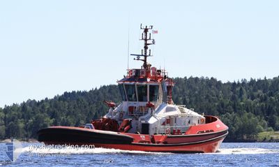
Tug

Current Trip
| Trip Time | 11 h, 56 mins |
|---|---|
| Trip Distance | 70.48 nm |
| AVG Speed | 8.6 Knots |
| MAX Speed | 10.7 Knots |
| Dybgang | 6.2 m |
| AVG Wind | 14.1 knots |
| MAX Wind | 30.8 knots |
| MIN Temp | 9.7°C / 49.46°F |
| MAX Temp | 20.1°C / 68.18°F |
| Position Modtaget | Nu |
Current Position
| Longitude | 5.26398° |
|---|---|
| Latitude | 59.40779° |
| Status | Under way using engine |
| Fart | 0.2 Knots |
| Kurs | 163° |
| Område | North Sea |
| Station | T-AIS |
| Position Modtaget | Nu |
Information
The current position of BOB is in North Sea with coordinates 59.40779° / 5.26398° as reported on 2025-05-22 03:16 by AIS to our vessel tracker app. The vessel's current speed is 0.2 Knots and is currently inside the port of HAUGESUND.
The vessel BOB (IMO: 9875915, MMSI: 257878000) is a Tug It's sailing under the flag of [NO] Norway.
In this page you can find informations about the vessels current position, last detected port calls, and current voyage information. If the vessels is not in coverage by AIS you will find the latest position.
The current position of BOB is detected by our AIS receivers and we are not responsible for the reliability of the data. The last position was recorded while the vessel was in Coverage by the Ais receivers of our vessel tracking app.
The current draught of BOB as reported by AIS is 6.2 meters
Weather
| Temperature | 6°C / 42.8°F |
|---|---|
| Wind Speed | 12 knots |
| Direction | 13° NNE |
| Pressure | 1009.6 hPa |
| Humidity | 64.5 % |
| Cloud Coverage | 1 % |


Featured Company
Last Port Calls
| Port | Arrival | Departure | Time In Port |
|---|---|---|---|
| 2025-05-20 17:25 | |||
| 2025-05-19 19:45 | 2025-05-20 05:29 | 9 h | |
| 2025-05-19 12:59 | 2025-05-19 13:16 | 17 m | |
| 2025-05-17 23:33 | 2025-05-19 07:20 | 1 d | |
| 2025-05-16 16:55 | 2025-05-17 13:53 | 20 h | |
| 2025-05-15 11:42 | 2025-05-16 07:33 | 19 h | |
| 2025-05-15 09:43 | 2025-05-15 11:30 | 1 h | |
| 2025-05-14 22:31 | 2025-05-15 09:25 | 10 h | |
| 2025-05-14 07:28 | 2025-05-14 18:11 | 10 h | |
| 2025-05-12 16:10 | 2025-05-13 18:48 | 1 d |
Last Trips
| Origin | Departure | Destination | Arrival | Distance | |
|---|---|---|---|---|---|
| 2025-05-20 07:29 | 2025-05-20 19:25 | 70.48 nm | |||
| 2025-05-19 15:16 | 2025-05-19 21:45 | 48.92 nm | |||
| 2025-05-19 09:20 | 2025-05-19 14:59 | 56.71 nm | |||
| 2025-05-17 15:53 | 2025-05-18 01:33 | 80.26 nm | |||
| 2025-05-16 09:33 | 2025-05-16 18:55 | 76.81 nm | |||
| 2025-05-15 13:30 | 2025-05-15 13:42 | 1.83 nm | |||
| 2025-05-15 11:25 | 2025-05-15 11:43 | 2.04 nm | |||
| 2025-05-14 20:11 | 2025-05-15 00:31 | 45.96 nm | |||
| 2025-05-13 20:48 | 2025-05-14 09:28 | 113.13 nm | |||
| 2025-05-12 02:05 | 2025-05-12 18:10 | 111.27 nm |
Events
| Tid | Hændelsen | Detaljer | Position / Dest | Info |
|---|---|---|---|---|
| 2025-05-22 02:56 | STOP Sejllads |
59.40756 / 5.26409
[NO] HAUGESUND
|
Fart: 0.3 kn Kurs: 168° |
|
| 2025-05-22 02:43 | START Sejllads |
59.41402 / 5.26418
[NO] HAUGESUND
|
Fart: 5.3 kn Kurs: 314° |
|
| 2025-05-20 17:49 | STOP Sejllads |
59.41264 / 5.26671
[NO] HAUGESUND
|
Fart: 0.3 kn Kurs: 136° |
|
| 2025-05-20 17:38 | START Sejllads |
59.40751 / 5.26039
[NO] HAUGESUND
|
Fart: 7.5 kn Kurs: 321° |
|
| 2025-05-20 17:25 | STOP Sejllads |
59.40695 / 5.26394
[NO] HAUGESUND
|
Fart: 0.2 kn Kurs: 339° |
|
| 2025-05-20 17:25 | Skibe i havn |
|
59.40693 / 5.26398
[NO] HAUGESUND
|
Fart: 0.6 kn Kurs: 345° |
| 2025-05-20 12:26 | Destination er ændret | HAUGESUND FORSAND |
58.86311 / 6.12380
HAUGESUND
|
Fart: 7.3 kn Kurs: 294.5° |
| 2025-05-20 12:21 | START Sejllads | 0.27 nm, South West of HELLE |
58.85918 / 6.14014
FORSAND
|
Fart: 6.6 kn Kurs: 286.5° |
| 2025-05-20 11:28 | Status er ændret | Under way using engine Default |
58.85849 / 6.15026
FORSAND
|
Fart: 0.3 kn Kurs: 310° |
| 2025-05-20 11:25 | Status er ændret | Default Under way using engine |
58.85847 / 6.15024
FORSAND
|
Fart: Kurs: 323° |