

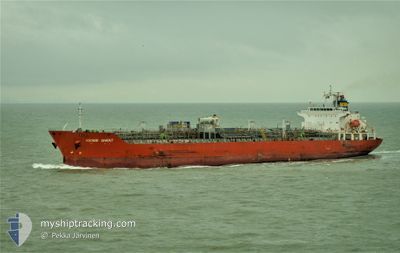
BOCHEM GHENT
Oil/Chemical Tanker

Current Trip
| Time Travelled | 23 days |
|---|---|
| Remaining Time | --- |
| Distance Travelled | 7015.25 nm |
| Remaining Distance | --- |
| AVG Speed | 13.2 Knots |
| MAX Speed | 16.6 Knots |
| AVG Wind | 13.4 knots |
| MAX Wind | 28.1 knots |
| MIN Temp | 14.5°C / 58.1°F |
| MAX Temp | 31.5°C / 88.7°F |
| Dybgang | 9.9 m |
| Position Modtaget | 4 d siden |
Current Position
| Longitude | 18.27211° |
|---|---|
| Latitude | -34.59798° |
| Status | Under way using engine |
| Fart | 14.8 Knots |
| Kurs | 326.9° |
| Område | South Atlantic Ocean |
| Station | T-AIS |
| Position Modtaget | 4 d siden |
Information
The current position of BOCHEM GHENT is in South Atlantic Ocean with coordinates -34.59798° / 18.27211° as reported on 2025-06-04 14:25 by AIS to our vessel tracker app. The vessel's current speed is 14.8 Knots and is heading at the port of LE HAVRE. The estimated time of arrival as calculated by MyShipTracking vessel tracking app is 2025-06-20 05:30 LT
The vessel BOCHEM GHENT (IMO: 9565649, MMSI: 477351300) is a Oil/Chemical Tanker that was built in 2011 ( 14 år gamle ). It's sailing under the flag of [HK] Hong Kong.
In this page you can find informations about the vessels current position, last detected port calls, and current voyage information. If the vessels is not in coverage by AIS you will find the latest position.
The current position of BOCHEM GHENT is detected by our AIS receivers and we are not responsible for the reliability of the data. The last position was recorded while the vessel was in Coverage by the Ais receivers of our vessel tracking app.
The current draught of BOCHEM GHENT as reported by AIS is 9.9 meters
Weather
| Temperature | 21.8°C / 71.24°F |
|---|---|
| Wind Speed | 17 knots |
| Direction | 119° ESE |
| Pressure | 1016.5 hPa |
| Humidity | 70.3 % |
| Cloud Coverage | 61 % |


Featured Company
Most Visited Ports (Last year)
| Port | Arrivals | |
|---|---|---|
| 2 | ||
| 2 | ||
| 1 | ||
| 1 | ||
| 1 | ||
| 1 |
Events
| Tid | Hændelsen | Detaljer | Position / Dest | Info |
|---|---|---|---|---|
| 2025-06-04 14:34 | Status er ændret | Default Under way using engine |
-34.56821 / 18.24473
FRLEH
|
Fart: 14.8 kn Kurs: 326.9° |
| 2025-06-04 14:25 | Ændre havområde | South African part of the South Atlantic Ocean Omani part of the Gulf of Oman |
-34.59798 / 18.27211
South Atlantic Ocean
FRLEH
|
Fart: 14.8 kn Kurs: 326.9° |
| 2025-06-04 14:25 | Status er ændret | Under way using engine Default |
-34.59798 / 18.27211
FRLEH
|
Fart: 14.9 kn Kurs: 292° |
| 2025-06-04 14:25 | Indenfor Dækning |
-34.59798 / 18.27211
South Atlantic Ocean
FRLEH
|
Fart: 14.8 kn Kurs: 326.9° |
|
| 2025-06-04 14:25 | Udenfor Dækning |
-34.59798 / 18.27211
South Atlantic Ocean
FRLEH
|
Fart: 14.8 kn Kurs: 326.9° |