

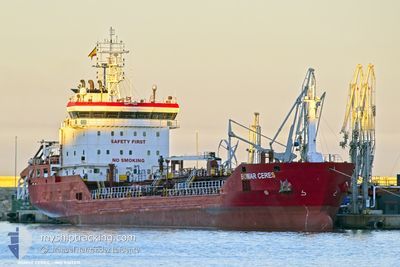
BOMAR CERES
Oil/Chemical Tanker

Current Trip
| Time Travelled | 20 h, 32 mins |
|---|---|
| Remaining Time | 3 days |
| Distance Travelled | 205.80 nm |
| Remaining Distance | 944.27 nm |
| AVG Speed | 10 Knots |
| MAX Speed | 10.8 Knots |
| AVG Wind | 14.2 knots |
| MAX Wind | 21.3 knots |
| MIN Temp | 10.3°C / 50.54°F |
| MAX Temp | 13.6°C / 56.48°F |
| Dybgang | 5.9 m |
| Position Modtaget | Nu |
Current Position
| Longitude | 16.71428° |
|---|---|
| Latitude | 55.84598° |
| Status | Under way using engine |
| Fart | 10.2 Knots |
| Kurs | 256° |
| Område | Baltic Sea |
| Station | T-AIS |
| Position Modtaget | Nu |
Information
The current position of BOMAR CERES is in Baltic Sea with coordinates 55.84598° / 16.71428° as reported on 2025-06-04 18:54 by AIS to our vessel tracker app. The vessel's current speed is 10.2 Knots and is heading at the port of ROTTERDAM. The estimated time of arrival as calculated by MyShipTracking vessel tracking app is 2025-06-08 16:55 LT
The vessel BOMAR CERES (IMO: 9367231, MMSI: 256815000) is a Oil/Chemical Tanker that was built in 2007 ( 18 år gamle ). It's sailing under the flag of [MT] Malta.
In this page you can find informations about the vessels current position, last detected port calls, and current voyage information. If the vessels is not in coverage by AIS you will find the latest position.
The current position of BOMAR CERES is detected by our AIS receivers and we are not responsible for the reliability of the data. The last position was recorded while the vessel was in Coverage by the Ais receivers of our vessel tracking app.
The current draught of BOMAR CERES as reported by AIS is 5.9 meters
Weather
| Temperature | 13.5°C / 56.3°F |
|---|---|
| Wind Speed | 9 knots |
| Direction | 157° SSE |
| Pressure | 1004.9 hPa |
| Humidity | 86 % |
| Cloud Coverage | 61 % |


Featured Company
Last Port Calls
| Port | Arrival | Departure | Time In Port |
|---|---|---|---|
| 2025-06-03 02:26 | 2025-06-04 01:23 | 22 h | |
| 2025-05-29 07:19 | 2025-05-30 11:22 | 1 d | |
| 2025-05-22 11:03 | 2025-05-23 13:58 | 1 d | |
| 2025-05-18 16:12 | 2025-05-20 10:11 | 1 d | |
| 2025-05-07 17:40 | 2025-05-08 21:07 | 1 d | |
| 2025-04-28 22:56 | 2025-04-30 02:07 | 1 d | |
| 2025-04-27 13:47 | 2025-04-28 22:34 | 1 d | |
| 2025-04-16 18:26 | 2025-04-17 21:16 | 1 d | |
| 2025-04-16 10:58 | 2025-04-16 18:19 | 7 h | |
| 2025-04-12 16:56 | 2025-04-13 14:08 | 21 h |
Last Trips
| Origin | Departure | Destination | Arrival | Distance | |
|---|---|---|---|---|---|
| 2025-05-30 11:22 | 2025-06-03 02:26 | 866.51 nm | |||
| 2025-05-23 13:58 | 2025-05-29 07:19 | 1006.62 nm | |||
| 2025-05-20 10:11 | 2025-05-22 11:03 | 138.75 nm | |||
| 2025-05-08 21:07 | 2025-05-18 16:12 | 1161.76 nm | |||
| 2025-04-30 02:07 | 2025-05-07 17:40 | 8.08 nm | |||
| 2025-04-28 22:34 | 2025-04-28 22:56 | 1.70 nm | |||
| 2025-04-17 21:16 | 2025-04-27 13:47 | 2155.46 nm | |||
| 2025-04-16 18:19 | 2025-04-16 18:26 | 0.28 nm | |||
| 2025-04-13 14:08 | 2025-04-16 10:58 | 716.22 nm | |||
| 2025-04-10 05:55 | 2025-04-12 16:56 | 566.05 nm |
Events
| Tid | Hændelsen | Detaljer | Position / Dest | Info |
|---|---|---|---|---|
| 2025-06-04 17:00 | Status er ændret | Under way using engine Default |
55.92790 / 17.28270
NLRTM
|
Fart: 10.2 kn Kurs: 253° |
| 2025-06-04 17:00 | Indenfor Dækning |
55.92660 / 17.27465
Baltic Sea
NLRTM
|
Fart: 10.2 kn Kurs: 253° |
|
| 2025-06-04 14:11 | Status er ændret | Default Under way using engine |
56.11427 / 18.05473
NLRTM
|
Fart: 9.9 kn Kurs: 238° |
| 2025-06-04 14:04 | Status er ændret | Under way using engine Default |
56.12342 / 18.08145
NLRTM
|
Fart: 9.9 kn Kurs: 238° |
| 2025-06-04 14:04 | Udenfor Dækning |
56.12342 / 18.08145
Baltic Sea
NLRTM
|
Fart: 9.9 kn Kurs: 238° |
|
| 2025-06-04 14:03 | Status er ændret | Default Under way using engine |
56.12582 / 18.08860
NLRTM
|
Fart: 9.9 kn Kurs: 239° |
| 2025-06-04 13:56 | Status er ændret | Under way using engine Default |
56.13518 / 18.11598
NLRTM
|
Fart: 9.9 kn Kurs: 239° |
| 2025-06-04 13:56 | Indenfor Dækning |
56.13518 / 18.11598
Baltic Sea
NLRTM
|
Fart: 9.9 kn Kurs: 239° |
|
| 2025-06-04 08:59 | Status er ændret | Default Under way using engine |
56.70270 / 19.08967
NLRTM
|
Fart: 9.7 kn Kurs: 208° |
| 2025-06-04 08:52 | Udenfor Dækning |
56.71900 / 19.10585
Baltic Sea
NLRTM
|
Fart: 9.7 kn Kurs: 208° |