
BROOKLYN BRIDGE
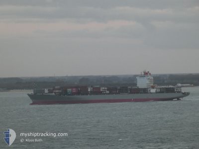
Container Ship
Current Trip
BRRIO
| Time Travelled | 8 days |
|---|---|
| Remaining Time | --- |
| Distance Travelled | 2948.76 nm |
| Remaining Distance | --- |
| AVG Speed | 15.7 Knots |
| MAX Speed | 19.5 Knots |
| AVG Wind | 13.3 knots |
| MAX Wind | 20 knots |
| MIN Temp | 18.6°C / 65.48°F |
| MAX Temp | 36.1°C / 96.98°F |
| Dybgang | 12.9 m |
| Position Modtaget | 9 d siden |
Current Position
| Longitude | -46.32876° |
|---|---|
| Latitude | -23.99505° |
| Status | Under way using engine |
| Fart | 9.5 Knots |
| Kurs | 231° |
| Område | South Atlantic Ocean |
| Station | T-AIS |
| Position Modtaget | 9 d siden |
Info
Information
The current position of BROOKLYN BRIDGE is in South Atlantic Ocean with coordinates -23.99505° / -46.32876° as reported on 2025-02-01 20:08 by AIS to our vessel tracker app. The vessel's current speed is 9.5 Knots
The vessel BROOKLYN BRIDGE (IMO: 9458999, MMSI: 431187000) is a Container Ship that was built in 2010 ( 15 år gamle ). It's sailing under the flag of [JP] Japan.
In this page you can find informations about the vessels current position, last detected port calls, and current voyage information. If the vessels is not in coverage by AIS you will find the latest position.
The current position of BROOKLYN BRIDGE is detected by our AIS receivers and we are not responsible for the reliability of the data. The last position was recorded while the vessel was in Coverage by the Ais receivers of our vessel tracking app.
The current draught of BROOKLYN BRIDGE as reported by AIS is 12.9 meters
Weather
| Temperature | 18.6°C / 65.48°F |
|---|---|
| Wind Speed | 19 knots |
| Direction | 13° NNE |
| Pressure | 1013.9 hPa |
| Humidity | 81.2 % |
| Cloud Coverage | 100 % |
Featured Company
Last Port Calls
| Port | Arrival | Departure | Time In Port |
|---|---|---|---|
| 2025-02-03 09:50 | 2025-02-03 09:54 | 4 m | |
| 2025-01-31 19:59 | 2025-02-01 20:12 | 1 d | |
| 2025-01-30 16:13 | 2025-01-31 04:00 | 11 h | |
| 2025-01-29 05:32 | 2025-01-29 23:38 | 18 h | |
| 2025-01-23 18:22 | 2025-01-24 17:06 | 22 h | |
| 2025-01-22 18:10 | 2025-01-23 04:26 | 10 h | |
| 2025-01-18 14:32 | 2025-01-19 00:34 | 10 h | |
| 2025-01-17 04:13 | 2025-01-17 19:30 | 15 h | |
| 2025-01-04 12:46 | 2025-01-05 05:10 | 16 h | |
| 2025-01-01 08:33 | 2025-01-03 02:24 | 1 d |
Most Visited Ports (Last year)
| Port | Arrivals | |
|---|---|---|
| 12 | ||
| 11 | ||
| 9 | ||
| 7 | ||
| 6 | ||
| 6 |
Last Trips
| Origin | Departure | Destination | Arrival | Distance | |
|---|---|---|---|---|---|
| 2025-02-01 17:12 | 2025-02-03 06:50 | 234.30 nm | |||
| 2025-01-31 01:00 | 2025-01-31 16:59 | 181.17 nm | |||
| 2025-01-29 20:38 | 2025-01-30 13:13 | 69.55 nm | |||
| 2025-01-24 14:06 | 2025-01-29 02:32 | 873.19 nm | |||
| 2025-01-23 01:26 | 2025-01-23 15:22 | 152.14 nm | |||
| 2025-01-18 21:34 | 2025-01-22 15:10 | 823.73 nm | |||
| 2025-01-17 16:30 | 2025-01-18 11:32 | 170.97 nm | |||
| 2025-01-05 06:10 | 2025-01-17 01:13 | 4428.44 nm | |||
| 2025-01-03 02:24 | 2025-01-04 13:46 | 406.08 nm | |||
| 2024-12-29 11:00 | 2025-01-01 08:33 | 1110.21 nm |
Events
| Tid | Hændelsen | Detaljer | Position / Dest | Info |
|---|---|---|---|---|
| 2025-02-03 18:30 | START Sejllads | 2.3 nm, North West of RIO DE JANEIRO |
-22.87805 / -43.19546
BRRIO
|
Fart: 6.3 kn Kurs: 128° |
| 2025-02-03 10:14 | STOP Sejllads | 2.77 nm, North West of RIO DE JANEIRO |
-22.87512 / -43.20370
BRRIO
|
Fart: 0.3 kn Kurs: 225° |
| 2025-02-03 09:54 | Afsejlet fra sidste havn |
|
-22.88290 / -43.18832
BRRIO
|
Fart: 8 kn Kurs: 298° |
| 2025-02-03 09:50 | Skibe i havn |
|
-22.88754 / -43.18070
[BR] RIO DE JANEIRO
|
Fart: 9 kn Kurs: 273° |
| 2025-02-03 08:07 | START Sejllads | 17.08 nm, South West of RIO DE JANEIRO |
-23.15596 / -43.30394
BRRIO
|
Fart: 6.3 kn Kurs: 18° |
| 2025-02-02 13:15 | STOP Sejllads | 14.42 nm, South of RIO DE JANEIRO |
-23.13800 / -43.21632
BRRIO
|
Fart: 0.3 kn Kurs: 215° |
| 2025-02-01 20:12 | Status er ændret | Default Under way using engine |
-24.00326 / -46.33585
BRRIO
|
Fart: 9.5 kn Kurs: 231° |
| 2025-02-01 20:12 | Afsejlet fra sidste havn |
|
-24.00326 / -46.33585
BRRIO
|
Fart: 9.5 kn Kurs: 231° |
| 2025-02-01 20:08 | Udenfor Dækning |
-23.99505 / -46.32876
South Atlantic Ocean
BRRIO
|
Fart: 9.5 kn Kurs: 236.2° |
|
| 2025-02-01 20:06 | Status er ændret | Under way using engine Default |
-23.99234 / -46.32229
[BR] SANTOS
|
Fart: 10 kn Kurs: 275° |