
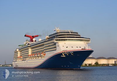
CARNIVAL PRIDE
Passengers Ship
Current Trip
| Time Travelled | 1 day |
|---|---|
| Remaining Time | --- |
| Distance Travelled | 479.67 nm |
| Remaining Distance | --- |
| AVG Speed | 21.9 Knots |
| MAX Speed | 23.8 Knots |
| AVG Wind | 5.6 knots |
| MAX Wind | 14 knots |
| MIN Temp | 21.6°C / 70.88°F |
| MAX Temp | 24.2°C / 75.56°F |
| Dybgang | 8.2 m |
| Position Modtaget | 1 d siden |
Current Position
| Longitude | -78.78406° |
|---|---|
| Latitude | 26.50098° |
| Status | Under way using engine |
| Fart | 10.2 Knots |
| Kurs | 21.9° |
| Område | North Atlantic Ocean |
| Station | T-AIS |
| Position Modtaget | 1 d siden |
Info
Information
The current position of CARNIVAL PRIDE is in North Atlantic Ocean with coordinates 26.50098° / -78.78406° as reported on 2025-02-07 11:09 by AIS to our vessel tracker app. The vessel's current speed is 10.2 Knots
The vessel CARNIVAL PRIDE (IMO: 9223954, MMSI: 354215000) is a Passengers Ship that was built in 2001 ( 24 år gamle ). It's sailing under the flag of [PA] Panama.
In this page you can find informations about the vessels current position, last detected port calls, and current voyage information. If the vessels is not in coverage by AIS you will find the latest position.
The current position of CARNIVAL PRIDE is detected by our AIS receivers and we are not responsible for the reliability of the data. The last position was recorded while the vessel was in Coverage by the Ais receivers of our vessel tracking app.
The current draught of CARNIVAL PRIDE as reported by AIS is 8.2 meters
Weather
| Temperature | 18.5°C / 65.3°F |
|---|---|
| Wind Speed | 7 knots |
| Direction | 204° SSW |
| Pressure | 1017.1 hPa |
| Humidity | 84.7 % |
| Cloud Coverage | 100 % |
Featured Company
Last Port Calls
| Port | Arrival | Departure | Time In Port |
|---|---|---|---|
| 2025-02-07 06:19 | 2025-02-07 13:35 | 7 h | |
| 2025-02-06 10:12 | 2025-02-06 17:33 | 7 h | |
| 2025-02-06 07:14 | 2025-02-06 09:14 | 2 h | |
| 2025-02-05 07:25 | 2025-02-05 17:18 | 9 h | |
| 2025-02-02 08:24 | 2025-02-02 17:17 | 8 h | |
| 2025-01-31 06:39 | 2025-01-31 13:47 | 7 h | |
| 2025-01-30 07:30 | 2025-01-30 17:52 | 10 h | |
| 2025-01-29 07:31 | 2025-01-29 17:01 | 9 h | |
| 2025-01-26 08:04 | 2025-01-26 17:29 | 9 h | |
| 2025-01-23 07:12 | 2025-01-23 16:08 | 8 h |
Most Visited Ports (Last year)
| Port | Arrivals | |
|---|---|---|
| 33 | ||
| 27 | ||
| 21 | ||
| 16 | ||
| 12 | ||
| 9 |
Last Trips
| Origin | Departure | Destination | Arrival | Distance | |
|---|---|---|---|---|---|
| 2025-02-06 17:33 | 2025-02-07 06:19 | 218.83 nm | |||
| 2025-02-06 09:14 | 2025-02-06 10:12 | 12.73 nm | |||
| 2025-02-05 17:18 | 2025-02-06 07:14 | 148.30 nm | |||
| 2025-02-02 17:17 | 2025-02-05 07:25 | 886.72 nm | |||
| 2025-01-31 13:47 | 2025-02-02 08:24 | 848.22 nm | |||
| 2025-01-30 17:52 | 2025-01-31 06:39 | 125.43 nm | |||
| 2025-01-29 17:01 | 2025-01-30 07:30 | 153.75 nm | |||
| 2025-01-26 17:29 | 2025-01-29 07:31 | 917.84 nm | |||
| 2025-01-23 16:08 | 2025-01-26 08:04 | 1113.76 nm | |||
| 2025-01-20 18:29 | 2025-01-23 07:12 | 910.71 nm |
Events
| Tid | Hændelsen | Detaljer | Position / Dest | Info |
|---|---|---|---|---|
| 2025-02-07 18:35 | START Sejllads | 0.58 nm, South West of FREEPORT (BS) |
26.51416 / -78.77853
USBAL-BSNAS
|
Fart: 8.3 kn Kurs: 202° |
| 2025-02-07 18:35 | Afsejlet fra sidste havn |
|
26.51416 / -78.77853
USBAL-BSNAS
|
Fart: 3.7 kn Kurs: 224° |
| 2025-02-07 11:39 | STOP Sejllads |
26.52091 / -78.77356
[BS] FREEPORT (BS)
|
Fart: 0.1 kn Kurs: 248° |
|
| 2025-02-07 11:19 | Skibe i havn |
|
26.52250 / -78.77441
[BS] FREEPORT (BS)
|
Fart: 8.3 kn Kurs: 21° |
| 2025-02-07 11:15 | Status er ændret | Default Under way using engine |
26.51577 / -78.77756
USBAL-BSNAS
|
Fart: 10.2 kn Kurs: 21.9° |
| 2025-02-07 11:09 | Udenfor Dækning |
26.50098 / -78.78406
North Atlantic Ocean
[BS] FREEPORT (BS)
|
Fart: 10.2 kn Kurs: 21.9° |
|
| 2025-02-07 10:49 | Status er ændret | Under way using engine Default |
26.45303 / -78.79663
USBAL-BSNAS
|
Fart: 10.2 kn Kurs: 11° |
| 2025-02-07 10:47 | Status er ændret | Default Under way using engine |
26.44745 / -78.79826
USBAL-BSNAS
|
Fart: 11.8 kn Kurs: 329.9° |
| 2025-02-07 10:16 | Status er ændret | Under way using engine Default |
26.36604 / -78.71453
USBAL-BSNAS
|
Fart: 14.1 kn Kurs: 290° |
| 2025-02-07 10:15 | Status er ændret | Default Under way using engine |
26.36532 / -78.71249
USBAL-BSNAS
|
Fart: 14.1 kn Kurs: 290.2° |