

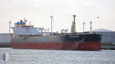
CATALAN SEA
Crude Oil Tanker

Current Trip
| Time Travelled | 8 days |
|---|---|
| Remaining Time | 3 days |
| Distance Travelled | 2315.93 nm |
| Remaining Distance | 876.66 nm |
| AVG Speed | 11.3 Knots |
| MAX Speed | 11.3 Knots |
| AVG Wind | 7.8 knots |
| MAX Wind | 24 knots |
| MIN Temp | 17.8°C / 64.04°F |
| MAX Temp | 22.8°C / 73.04°F |
| Dybgang | 12.8 m |
| Position Modtaget | 1 m siden |
Current Position
| Longitude | -9.54713° |
|---|---|
| Latitude | 37.35700° |
| Status | Under way using engine |
| Fart | 11.4 Knots |
| Kurs | 346.7° |
| Område | North Atlantic Ocean |
| Station | T-AIS |
| Position Modtaget | 1 m siden |
Information
The current position of CATALAN SEA is in North Atlantic Ocean with coordinates 37.35700° / -9.54713° as reported on 2025-06-07 22:53 by AIS to our vessel tracker app. The vessel's current speed is 11.4 Knots and is heading at the port of CORK. The estimated time of arrival as calculated by MyShipTracking vessel tracking app is 2025-06-11 06:50 LT
The vessel CATALAN SEA (IMO: 9577044, MMSI: 636016699) is a Crude Oil Tanker that was built in 2012 ( 13 år gamle ). It's sailing under the flag of [LR] Liberia.
In this page you can find informations about the vessels current position, last detected port calls, and current voyage information. If the vessels is not in coverage by AIS you will find the latest position.
The current position of CATALAN SEA is detected by our AIS receivers and we are not responsible for the reliability of the data. The last position was recorded while the vessel was in Coverage by the Ais receivers of our vessel tracking app.
The current draught of CATALAN SEA as reported by AIS is 12.8 meters
Weather
| Temperature | 18°C / 64.4°F |
|---|---|
| Wind Speed | 24 knots |
| Direction | 358° N |
| Pressure | 1017.9 hPa |
| Humidity | 85.2 % |
| Cloud Coverage | --- |


Featured Company
Most Visited Ports (Last year)
| Port | Arrivals | |
|---|---|---|
| 4 | ||
| 3 | ||
| 3 | ||
| 3 | ||
| 2 | ||
| 2 |
Events
| Tid | Hændelsen | Detaljer | Position / Dest | Info |
|---|---|---|---|---|
| 2025-06-07 12:28 | Ændre havområde | Portuguese part of the North Atlantic Ocean Spanish part of the North Atlantic Ocean |
36.30284 / -7.45155
North Atlantic Ocean
IEORK
|
Fart: 14 kn Kurs: 286.6° |
| 2025-06-07 07:00 | Ændre havområde | Spanish part of the North Atlantic Ocean Spanish part of the Strait of Gibraltar |
35.96270 / -5.97633
North Atlantic Ocean
IEORK
|
Fart: 13.8 kn Kurs: 271.4° |
| 2025-06-07 03:38 | Ændre havområde | Spanish part of the Strait of Gibraltar Gibraltarian part of the Strait of Gibraltar |
36.07442 / -5.37783
Strait of Gibraltar
IEORK
|
Fart: 9.8 kn Kurs: 196.6° |
| 2025-06-07 03:19 | START Sejllads | 2.39 nm, South of GIBRALTAR |
36.10760 / -5.36234
IEORK
|
Fart: 3.1 kn Kurs: 269° |
| 2025-06-07 03:00 | Status er ændret | Under way using engine At anchor |
36.10593 / -5.36013
IEORK
|
Fart: Kurs: 336° |
| 2025-06-07 01:25 | Destination er ændret | IEORK GIGIB |
36.10545 / -5.36130
IEORK
|
Fart: 0.1 kn Kurs: 351° |
| 2025-06-07 01:25 | ETA er ændret | 2025/06/10 17:00 2025/06/06 06:00 |
36.10545 / -5.36130
IEORK
|
Fart: 0.1 kn Kurs: 351° |
| 2025-06-06 16:46 | Status er ændret | At anchor Default |
36.10647 / -5.36198
GIGIB
|
Fart: 0.4 kn Kurs: 42° |
| 2025-06-06 16:40 | Status er ændret | Default At anchor |
36.10575 / -5.36225
GIGIB
|
Fart: 0.4 kn Kurs: 42° |
| 2025-06-06 14:31 | Status er ændret | At anchor Under way using engine |
36.10478 / -5.36225
GIGIB
|
Fart: 0.3 kn Kurs: 8° |