
CELEBRITY REFLECTION
Passengers Ship
Current Trip
| Time Travelled | 8 h, 47 mins |
|---|---|
| Remaining Time | 6 h, 23 mins |
| Distance Travelled | 25.43 nm |
| Remaining Distance | 65.55 nm |
| AVG Speed | 5.4 Knots |
| MAX Speed | 6.9 Knots |
| AVG Wind | 11.2 knots |
| MAX Wind | 13.9 knots |
| MIN Temp | 23.9°C / 75.02°F |
| MAX Temp | 24.6°C / 76.28°F |
| Dybgang | 8.9 m |
| Position Modtaget | 5 h, 46 m siden |
Current Position
| Longitude | -78.94063° |
|---|---|
| Latitude | 26.33321° |
| Status | Under way using engine |
| Fart | 4.2 Knots |
| Kurs | 239° |
| Område | North Atlantic Ocean |
| Station | T-AIS |
| Position Modtaget | 5 h, 46 m siden |
Info
Information
The current position of CELEBRITY REFLECTION is in North Atlantic Ocean with coordinates 26.33321° / -78.94063° as reported on 2026-01-09 01:07 by AIS to our vessel tracker app. The vessel's current speed is 4.2 Knots and is heading at the port of PORT EVERGLADES. The estimated time of arrival as calculated by MyShipTracking vessel tracking app is 2026-01-09 08:16 LT
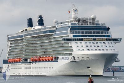
The vessel CELEBRITY REFLECTION (IMO: 9506459, MMSI: 229074000) is a Passengers Ship that was built in 2012 ( 14 år gamle ). It's sailing under the flag of [MT] Malta.
In this page you can find informations about the vessels current position, last detected port calls, and current voyage information. If the vessels is not in coverage by AIS you will find the latest position.
The current position of CELEBRITY REFLECTION is detected by our AIS receivers and we are not responsible for the reliability of the data. The last position was recorded while the vessel was in Coverage by the Ais receivers of our vessel tracking app.
The current draught of CELEBRITY REFLECTION as reported by AIS is 8.9 meters
Weather
| Temperature | 24.4°C / 75.92°F |
|---|---|
| Wind Speed | 14 knots |
| Direction | 127° SE |
| Pressure | 1020.2 hPa |
| Humidity | 73 % |
| Cloud Coverage | 75 % |
Featured Company
Last Port Calls
| Port | Arrival | Departure | Time In Port |
|---|---|---|---|
| 2026-01-08 07:20 | 2026-01-08 17:06 | 9 h | |
| 2026-01-06 06:14 | 2026-01-06 17:46 | 11 h | |
| 2026-01-05 06:33 | 2026-01-05 16:14 | 9 h | |
| 2026-01-03 06:39 | 2026-01-03 16:16 | 9 h | |
| 2026-01-02 05:20 | 2026-01-02 16:52 | 11 h | |
| 2026-01-02 04:51 | 2026-01-02 05:14 | 22 m | |
| 2025-12-30 06:35 | 2025-12-31 08:19 | 1 d | |
| 2025-12-29 06:22 | 2025-12-29 16:03 | 9 h | |
| 2025-12-27 06:40 | 2025-12-27 16:02 | 9 h | |
| 2025-12-26 06:36 | 2025-12-26 16:19 | 9 h |
Most Visited Ports (Last year)
| Port | Arrivals | |
|---|---|---|
| 89 | ||
| 35 | ||
| 14 | ||
| 13 | ||
| 11 | ||
| 10 |
Last Trips
| Origin | Departure | Destination | Arrival | Distance | |
|---|---|---|---|---|---|
| 2026-01-06 17:46 | 2026-01-08 07:20 | 291.64 nm | |||
| 2026-01-05 16:14 | 2026-01-06 06:14 | 184.39 nm | |||
| 2026-01-03 16:16 | 2026-01-05 06:33 | 260.65 nm | |||
| 2026-01-02 16:52 | 2026-01-03 06:39 | 187.84 nm | |||
| 2026-01-02 05:14 | 2026-01-02 05:20 | 0.17 nm | |||
| 2025-12-31 08:19 | 2026-01-02 04:51 | 306.25 nm | |||
| 2025-12-29 16:03 | 2025-12-30 06:35 | 185.89 nm | |||
| 2025-12-27 16:02 | 2025-12-29 06:22 | 272.28 nm | |||
| 2025-12-26 16:19 | 2025-12-27 06:40 | 185.71 nm | |||
| 2025-12-23 16:05 | 2025-12-26 06:36 | 397.65 nm |
Events
| Tid | Hændelsen | Detaljer | Position / Dest | Info |
|---|---|---|---|---|
| 2026-01-09 01:12 | Status er ændret | Default Under way using engine |
26.33058 / -78.94743
US PEF
|
Fart: 4.2 kn Kurs: 239° |
| 2026-01-09 01:07 | Status er ændret | Under way using engine Default |
26.33321 / -78.94063
US PEF
|
Fart: 4.2 kn Kurs: 238° |
| 2026-01-09 01:07 | Udenfor Dækning |
26.33321 / -78.94063
North Atlantic Ocean
US PEF
|
Fart: 4.2 kn Kurs: 245.7° |
|
| 2026-01-09 01:02 | Status er ændret | Default Under way using engine |
26.33532 / -78.93554
US PEF
|
Fart: 4.2 kn Kurs: 240° |
| 2026-01-09 00:53 | Status er ændret | Under way using engine Default |
26.33996 / -78.92415
US PEF
|
Fart: 4.2 kn Kurs: 240° |
| 2026-01-09 00:42 | Status er ændret | Default Under way using engine |
26.34510 / -78.91189
US PEF
|
Fart: 4 kn Kurs: 240° |
| 2026-01-09 00:24 | Status er ændret | Under way using engine Default |
26.35388 / -78.89189
US PEF
|
Fart: 4.1 kn Kurs: 240° |
| 2026-01-09 00:22 | Status er ændret | Default Under way using engine |
26.35481 / -78.88984
US PEF
|
Fart: 4 kn Kurs: 239° |
| 2026-01-09 00:17 | Status er ændret | Under way using engine Default |
26.35771 / -78.88349
US PEF
|
Fart: 4.1 kn Kurs: 239° |
| 2026-01-09 00:10 | Status er ændret | Default Under way using engine |
26.36098 / -78.87643
US PEF
|
Fart: 4.1 kn Kurs: 239° |