
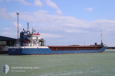
CELTIC RAIDER
General Cargo
Current Trip
GB WPT
| Time Travelled | 14 mins |
|---|---|
| Remaining Time | --- |
| Distance Travelled | --- |
| Remaining Distance | --- |
| AVG Speed | --- |
| MAX Speed | --- |
| AVG Wind | --- |
| MAX Wind | --- |
| MIN Temp | --- |
| MAX Temp | --- |
| Dybgang | 3.7 m |
| Position Modtaget | 16 h, 46 m siden |
Current Position
| Longitude | -6.13467° |
|---|---|
| Latitude | 54.04035° |
| Status | Under way using engine |
| Fart | 10.1 Knots |
| Kurs | 335.5° |
| Område | Irish Sea and St. George's Channel |
| Station | T-AIS |
| Position Modtaget | 16 h, 46 m siden |
Info
Information
The current position of CELTIC RAIDER is in Irish Sea and St. George's Channel with coordinates 54.04035° / -6.13467° as reported on 2025-02-04 19:07 by AIS to our vessel tracker app. The vessel's current speed is 10.1 Knots
The vessel CELTIC RAIDER (IMO: 9361330, MMSI: 232031869) is a General Cargo that was built in 2007 ( 18 år gamle ). It's sailing under the flag of [GB] United Kingdom.
In this page you can find informations about the vessels current position, last detected port calls, and current voyage information. If the vessels is not in coverage by AIS you will find the latest position.
The current position of CELTIC RAIDER is detected by our AIS receivers and we are not responsible for the reliability of the data. The last position was recorded while the vessel was in Coverage by the Ais receivers of our vessel tracking app.
The current draught of CELTIC RAIDER as reported by AIS is 3.7 meters
Weather
| Temperature | 5.2°C / 41.36°F |
|---|---|
| Wind Speed | 7 knots |
| Direction | 253° WSW |
| Pressure | 1036.3 hPa |
| Humidity | 76 % |
| Cloud Coverage | 96 % |
Featured Company
Last Port Calls
| Port | Arrival | Departure | Time In Port |
|---|---|---|---|
| 2025-02-04 19:43 | 2025-02-05 11:39 | 15 h | |
| 2025-02-01 19:49 | 2025-02-03 21:24 | 2 d | |
| 2025-01-23 14:17 | 2025-01-24 22:41 | 1 d | |
| 2025-01-08 09:38 | 2025-01-11 17:49 | 3 d | |
| 2025-01-07 07:47 | 2025-01-07 17:53 | 10 h | |
| 2024-12-28 18:25 | 2025-01-02 06:17 | 4 d | |
| 2024-12-24 17:11 | 2024-12-27 20:53 | 3 d | |
| 2024-12-20 05:18 | 2024-12-23 21:59 | 3 d | |
| 2024-12-13 19:59 | 2024-12-16 23:39 | 3 d | |
| 2024-12-11 15:58 | 2024-12-13 16:24 | 2 d |
Most Visited Ports (Last year)
| Port | Arrivals | |
|---|---|---|
| 9 | ||
| 7 | ||
| 4 | ||
| 3 | ||
| 3 | ||
| 3 |
Last Trips
| Origin | Departure | Destination | Arrival | Distance | |
|---|---|---|---|---|---|
| 2025-02-03 21:24 | 2025-02-04 19:43 | 247.78 nm | |||
| 2025-01-24 22:41 | 2025-02-01 19:49 | 1601.26 nm | |||
| 2025-01-11 17:49 | 2025-01-23 14:17 | 2453.17 nm | |||
| 2025-01-07 17:53 | 2025-01-08 09:38 | 81.33 nm | |||
| 2025-01-02 06:17 | 2025-01-07 07:47 | 1053.44 nm | |||
| 2024-12-27 20:53 | 2024-12-28 18:25 | 224.28 nm | |||
| 2024-12-23 21:59 | 2024-12-24 17:11 | 190.94 nm | |||
| 2024-12-16 23:39 | 2024-12-20 05:18 | 661.08 nm | |||
| 2024-12-13 16:24 | 2024-12-13 19:59 | 31.92 nm | |||
| 2024-12-02 13:08 | 2024-12-11 15:58 | 1729.69 nm |
Events
| Tid | Hændelsen | Detaljer | Position / Dest | Info |
|---|---|---|---|---|
| 2025-02-05 11:39 | START Sejllads | 0.37 nm, South East of WARRENPOINT |
54.09469 / -6.25230
GB WPT
|
Fart: 6.3 kn Kurs: 128° |
| 2025-02-05 11:39 | Afsejlet fra sidste havn |
|
54.09469 / -6.25230
GB WPT
|
Fart: 3 kn Kurs: 151° |
| 2025-02-04 19:51 | STOP Sejllads |
54.09953 / -6.25967
[GB] WARRENPOINT
|
Fart: Kurs: 133° |
|
| 2025-02-04 19:43 | Skibe i havn |
|
54.09767 / -6.25833
[GB] WARRENPOINT
|
Fart: 4.2 kn Kurs: 304° |
| 2025-02-04 19:11 | Status er ændret | Default Under way using engine |
54.05038 / -6.14994
GB WPT
|
Fart: 10.1 kn Kurs: 335.5° |
| 2025-02-04 19:07 | Udenfor Dækning |
54.04035 / -6.13467
Irish Sea and St. George's Channel
[GB] WARRENPOINT
|
Fart: 10.1 kn Kurs: 335.5° |
|
| 2025-02-04 18:40 | Status er ændret | Under way using engine Default |
54.00046 / -6.03299
GB WPT
|
Fart: 10.7 kn Kurs: 340° |
| 2025-02-04 18:39 | Status er ændret | Default Under way using engine |
53.99842 / -6.03093
GB WPT
|
Fart: 9.7 kn Kurs: 340.9° |
| 2025-02-04 18:29 | Ændre havområde | United Kingdom part of the Irish Sea and St. George's Channel Irish part of the Irish Sea and St. George's Channel |
53.97288 / -6.01908
Irish Sea and St. George's Channel
GB WPT
|
Fart: 12.4 kn Kurs: 345.6° |
| 2025-02-04 18:29 | Status er ændret | Under way using engine Default |
53.97288 / -6.01908
GB WPT
|
Fart: 12.4 kn Kurs: 346° |