
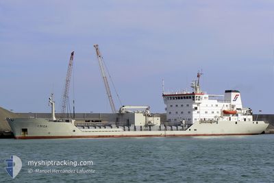
CEMENT FERRY
Cement Carrier
Current Trip
| Time Travelled | 3 days |
|---|---|
| Remaining Time | --- |
| Distance Travelled | 641.60 nm |
| Remaining Distance | --- |
| AVG Speed | 8.8 Knots |
| MAX Speed | 10.5 Knots |
| AVG Wind | 22.6 knots |
| MAX Wind | 34.8 knots |
| MIN Temp | 5.8°C / 42.44°F |
| MAX Temp | 12.4°C / 54.32°F |
| Dybgang | 7.3 m |
| Position Modtaget | 4 h, 0 m siden |
Current Position
| Longitude | 19.40436° |
|---|---|
| Latitude | 41.37057° |
| Status | Under way using engine |
| Fart | 3.9 Knots |
| Kurs | 68° |
| Område | Adriatic Sea |
| Station | T-AIS |
| Position Modtaget | 4 h, 0 m siden |
Info
Information
The current position of CEMENT FERRY is in Adriatic Sea with coordinates 41.37057° / 19.40436° as reported on 2025-02-11 06:12 by AIS to our vessel tracker app. The vessel's current speed is 3.9 Knots
The vessel CEMENT FERRY (IMO: 8404264, MMSI: 305963000) is a Cement Carrier that was built in 1985 ( 40 år gamle ). It's sailing under the flag of [AG] Antigua Barbuda.
In this page you can find informations about the vessels current position, last detected port calls, and current voyage information. If the vessels is not in coverage by AIS you will find the latest position.
The current position of CEMENT FERRY is detected by our AIS receivers and we are not responsible for the reliability of the data. The last position was recorded while the vessel was in Coverage by the Ais receivers of our vessel tracking app.
The current draught of CEMENT FERRY as reported by AIS is 7.3 meters
Weather
| Temperature | 8.3°C / 46.94°F |
|---|---|
| Wind Speed | 6 knots |
| Direction | 144° SE |
| Pressure | 1026 hPa |
| Humidity | 58.1 % |
| Cloud Coverage | 100 % |
Featured Company
Events
| Tid | Hændelsen | Detaljer | Position / Dest | Info |
|---|---|---|---|---|
| 2025-02-11 06:12 | Udenfor Dækning |
41.37057 / 19.40436
Adriatic Sea
AL ROM
|
Fart: 3.9 kn Kurs: 58.6° |
|
| 2025-02-11 03:25 | Indenfor Dækning |
41.21642 / 19.29396
Adriatic Sea
AL ROM
|
Fart: 6.4 kn Kurs: 16.7° |
|
| 2025-02-10 15:13 | Status er ændret | Default Under way using engine |
39.93231 / 19.79592
AL ROM
|
Fart: 9.6 kn Kurs: 314.8° |
| 2025-02-10 14:59 | Udenfor Dækning |
39.90754 / 19.82863
Adriatic Sea
AL ROM
|
Fart: 9.6 kn Kurs: 314.8° |
|
| 2025-02-10 14:34 | Ændre havområde | Albanian part of the Adriatic Sea Greek part of the Adriatic Sea |
39.86056 / 19.88950
Adriatic Sea
AL ROM
|
Fart: 9.5 kn Kurs: 314.3° |
| 2025-02-10 14:04 | Ændre havområde | Greek part of the Adriatic Sea Albanian part of the Adriatic Sea |
39.80851 / 19.96830
Adriatic Sea
AL ROM
|
Fart: 9.4 kn Kurs: 312.6° |
| 2025-02-10 13:58 | Ændre havområde | Albanian part of the Adriatic Sea Greek part of the Adriatic Sea |
39.79768 / 19.98077
Adriatic Sea
AL ROM
|
Fart: 10.2 kn Kurs: 8.7° |
| 2025-02-10 13:55 | Ændre havområde | Greek part of the Adriatic Sea Albanian part of the Adriatic Sea |
39.78923 / 19.97780
Adriatic Sea
AL ROM
|
Fart: 10.3 kn Kurs: 15.9° |
| 2025-02-10 13:49 | Ændre havområde | Albanian part of the Adriatic Sea Greek part of the Ionian Sea |
39.77252 / 19.97173
Adriatic Sea
AL ROM
|
Fart: 10.3 kn Kurs: 16.2° |
| 2025-02-10 13:47 | Indenfor Dækning |
39.77252 / 19.97173
Adriatic Sea
AL ROM
|
Fart: 10.3 kn Kurs: 16.2° |