
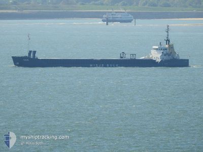
CEMILE
General Cargo
Current Trip
| Time Travelled | 1 day |
|---|---|
| Remaining Time | --- |
| Distance Travelled | 27.96 nm |
| Remaining Distance | --- |
| AVG Speed | 10 Knots |
| MAX Speed | 10.3 Knots |
| AVG Wind | 5.7 knots |
| MAX Wind | 6.8 knots |
| MIN Temp | 10.8°C / 51.44°F |
| MAX Temp | 16.4°C / 61.52°F |
| Dybgang | 3.9 m |
| Position Modtaget | 1 d siden |
Current Position
| Longitude | 35.60041° |
|---|---|
| Latitude | 36.41871° |
| Status | Under way using engine |
| Fart | 9.9 Knots |
| Kurs | 256.2° |
| Område | Mediterranean Sea - Eastern Basin |
| Station | T-AIS |
| Position Modtaget | 1 d siden |
Info
Information
The current position of CEMILE is in Mediterranean Sea - Eastern Basin with coordinates 36.41871° / 35.60041° as reported on 2025-02-03 18:24 by AIS to our vessel tracker app. The vessel's current speed is 9.9 Knots and is heading at the port of CONSTANTA. The estimated time of arrival as calculated by MyShipTracking vessel tracking app is 2025-02-08 00:00 LT
The vessel CEMILE (IMO: 8822612, MMSI: 577439000) is a General Cargo that was built in 1991 ( 34 år gamle ). It's sailing under the flag of [VU] Vanuatu.
In this page you can find informations about the vessels current position, last detected port calls, and current voyage information. If the vessels is not in coverage by AIS you will find the latest position.
The current position of CEMILE is detected by our AIS receivers and we are not responsible for the reliability of the data. The last position was recorded while the vessel was in Coverage by the Ais receivers of our vessel tracking app.
The current draught of CEMILE as reported by AIS is 3.9 meters
Weather
| Temperature | 10.1°C / 50.18°F |
|---|---|
| Wind Speed | 3 knots |
| Direction | 320° NW |
| Pressure | 1011.8 hPa |
| Humidity | 75.4 % |
| Cloud Coverage | 15 % |
Featured Company
Last Port Calls
| Port | Arrival | Departure | Time In Port |
|---|---|---|---|
| 2025-01-30 16:49 | 2025-02-03 15:09 | 3 d | |
| 2025-01-25 06:16 | 2025-01-27 16:12 | 2 d | |
| 2024-12-08 20:48 | 2024-12-21 09:53 | 12 d |
Last Trips
| Origin | Departure | Destination | Arrival | Distance | |
|---|---|---|---|---|---|
| 2025-01-27 18:12 | 2025-01-30 19:49 | 693.62 nm | |||
| 2024-12-21 13:53 | 2025-01-25 08:16 | 1516.08 nm | |||
| 2024-11-29 02:24 | 2024-12-09 00:48 | 703.39 nm |
Events
| Tid | Hændelsen | Detaljer | Position / Dest | Info |
|---|---|---|---|---|
| 2025-02-03 18:41 | Status er ændret | Default Under way using engine |
36.41029 / 35.54553
ROCND
|
Fart: 9.9 kn Kurs: 256.2° |
| 2025-02-03 18:24 | Udenfor Dækning |
36.41871 / 35.60041
Mediterranean Sea - Eastern Basin
ROCND
|
Fart: 9.9 kn Kurs: 256.2° |
|
| 2025-02-03 16:59 | Dybgangen er ændret | 3.9 5.3 |
36.55188 / 35.84336
ROCND
|
Fart: 10.2 kn Kurs: 228° |
| 2025-02-03 16:59 | Destination er ændret | ROCND TR ISK |
36.55188 / 35.84336
ROCND
|
Fart: 10.2 kn Kurs: 228° |
| 2025-02-03 16:59 | ETA er ændret | 2025/02/08 00:00 2025/01/30 08:00 |
36.55188 / 35.84336
ROCND
|
Fart: 10.2 kn Kurs: 228° |
| 2025-02-03 16:55 | Status er ændret | Under way using engine Default |
36.55786 / 35.85162
TR ISK
|
Fart: 10.1 kn Kurs: 229° |
| 2025-02-03 16:37 | Indenfor Dækning |
36.55786 / 35.85162
Mediterranean Sea - Eastern Basin
|
Fart: 10.1 kn Kurs: 228.8° |
|
| 2025-02-03 15:09 | Afsejlet fra sidste havn |
|
36.70034 / 36.16187
TR ISK
|
Fart: 8 kn Kurs: 267° |
| 2025-02-03 15:01 | START Sejllads |
36.70153 / 36.18561
[TR] ISKENDERUN
|
Fart: 5.9 kn Kurs: 265° |
|
| 2025-01-30 17:13 | STOP Sejllads |
36.70129 / 36.19093
[TR] ISKENDERUN
|
Fart: 0.3 kn Kurs: 249° |