

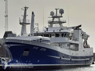
CETUS
Fishing

Current Trip
UNDERWAY
| Time Travelled | 2 days |
|---|---|
| Remaining Time | --- |
| Distance Travelled | 228.07 nm |
| Remaining Distance | --- |
| AVG Speed | 5.8 Knots |
| MAX Speed | 11.3 Knots |
| AVG Wind | 18.7 knots |
| MAX Wind | 29.3 knots |
| MIN Temp | 7.6°C / 45.68°F |
| MAX Temp | 10.3°C / 50.54°F |
| Dybgang | 7 m |
| Position Modtaget | 2 m siden |
Current Position
| Longitude | 3.09338° |
|---|---|
| Latitude | 60.58917° |
| Status | Moored |
| Fart | 0.5 Knots |
| Kurs | 68° |
| Område | North Sea |
| Station | T-AIS |
| Position Modtaget | 2 m siden |
Information
The current position of CETUS is in North Sea with coordinates 60.58917° / 3.09338° as reported on 2025-05-24 23:20 by AIS to our vessel tracker app. The vessel's current speed is 0.5 Knots
The vessel CETUS (IMO: 9836024, MMSI: 257076300) is a Fishing It's sailing under the flag of [NO] Norway.
In this page you can find informations about the vessels current position, last detected port calls, and current voyage information. If the vessels is not in coverage by AIS you will find the latest position.
The current position of CETUS is detected by our AIS receivers and we are not responsible for the reliability of the data. The last position was recorded while the vessel was in Coverage by the Ais receivers of our vessel tracking app.
The current draught of CETUS as reported by AIS is 7 meters
Weather
| Temperature | 9.2°C / 48.56°F |
|---|---|
| Wind Speed | 28 knots |
| Direction | 156° SSE |
| Pressure | 996.8 hPa |
| Humidity | 95.3 % |
| Cloud Coverage | 100 % |


Featured Company
Events
| Tid | Hændelsen | Detaljer | Position / Dest | Info |
|---|---|---|---|---|
| 2025-05-24 20:56 | START Sejllads |
60.56063 / 3.14626
UNDERWAY
|
Fart: 3.4 kn Kurs: 316° |
|
| 2025-05-24 20:30 | STOP Sejllads |
60.54916 / 3.14869
UNDERWAY
|
Fart: 0.2 kn Kurs: 353° |
|
| 2025-05-24 08:24 | Status er ændret | Moored Engaged in Fishing |
60.11162 / 3.18647
UNDERWAY
|
Fart: 2.8 kn Kurs: 5° |
| 2025-05-22 17:08 | Afsejlet fra sidste havn |
|
59.33141 / 5.30642
UNDERWAY
|
Fart: 9 kn Kurs: 116° |
| 2025-05-22 17:05 | START Sejllads |
59.33657 / 5.29900
[NO] HUSOYA
|
Fart: 3.7 kn Kurs: 208° |
|
| 2025-05-21 14:57 | STOP Sejllads |
59.34007 / 5.29950
[NO] HUSOYA
|
Fart: 0.3 kn Kurs: 4° |
|
| 2025-05-21 14:51 | START Sejllads |
59.33818 / 5.29841
[NO] HUSOYA
|
Fart: 6.2 kn Kurs: 208° |