
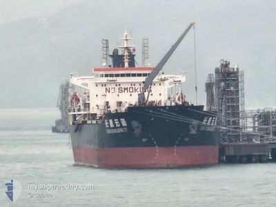
CHANG HANG HONG TU
Oil Products Tanker
Current Trip
| Time Travelled | 8 days |
|---|---|
| Remaining Time | --- |
| Distance Travelled | 2144.90 nm |
| Remaining Distance | --- |
| AVG Speed | 11 Knots |
| MAX Speed | 12.7 Knots |
| AVG Wind | 7.1 knots |
| MAX Wind | 19 knots |
| MIN Temp | 16.9°C / 62.42°F |
| MAX Temp | 27.6°C / 81.68°F |
| Dybgang | 11.6 m |
| Position Modtaget | 6 d siden |
Current Position
| Longitude | 57.14847° |
|---|---|
| Latitude | 25.65286° |
| Status | Under way using engine |
| Fart | 11.5 Knots |
| Kurs | 138.6° |
| Område | Gulf of Oman |
| Station | T-AIS |
| Position Modtaget | 6 d siden |
Info
Information
The current position of CHANG HANG HONG TU is in Gulf of Oman with coordinates 25.65286° / 57.14847° as reported on 2025-02-06 10:27 by AIS to our vessel tracker app. The vessel's current speed is 11.5 Knots and is heading at the port of BEIRA. The estimated time of arrival as calculated by MyShipTracking vessel tracking app is 2025-02-18 12:00 LT
The vessel CHANG HANG HONG TU (IMO: 9379777, MMSI: 413372000) is a Oil Products Tanker that was built in 2008 ( 17 år gamle ). It's sailing under the flag of [CN] China.
In this page you can find informations about the vessels current position, last detected port calls, and current voyage information. If the vessels is not in coverage by AIS you will find the latest position.
The current position of CHANG HANG HONG TU is detected by our AIS receivers and we are not responsible for the reliability of the data. The last position was recorded while the vessel was in Coverage by the Ais receivers of our vessel tracking app.
The current draught of CHANG HANG HONG TU as reported by AIS is 11.6 meters
Weather
| Temperature | 27.5°C / 81.5°F |
|---|---|
| Wind Speed | 16 knots |
| Direction | 48° NE |
| Pressure | 1011.1 hPa |
| Humidity | 76.6 % |
| Cloud Coverage | 71 % |
Featured Company
Last Port Calls
| Port | Arrival | Departure | Time In Port |
|---|---|---|---|
| 2025-02-02 21:41 | 2025-02-04 09:48 | 1 d | |
| 2025-01-22 22:12 | 2025-01-24 04:09 | 1 d | |
| 2025-01-12 07:48 | 2025-01-13 18:22 | 1 d | |
| 2024-12-27 21:53 | 2024-12-30 23:45 | 3 d | |
| 2024-12-22 00:39 | 2024-12-23 10:36 | 1 d | |
| 2024-12-12 08:05 | 2024-12-15 16:00 | 3 d | |
| 2024-12-01 23:33 | 2024-12-03 05:08 | 1 d |
Last Trips
| Origin | Departure | Destination | Arrival | Distance | |
|---|---|---|---|---|---|
| 2025-01-24 08:09 | 2025-02-03 00:41 | 615.42 nm | |||
| 2025-01-13 22:22 | 2025-01-23 02:12 | 1563.53 nm | |||
| 2024-12-31 05:15 | 2025-01-12 11:48 | 2063.16 nm | |||
| 2024-12-23 16:06 | 2024-12-28 03:23 | 1252.93 nm | |||
| 2024-12-15 21:30 | 2024-12-22 06:09 | 1274.67 nm | |||
| 2024-12-03 08:08 | 2024-12-12 13:35 | 2242.47 nm | |||
| 2024-11-11 09:34 | 2024-12-02 02:33 | 3694.69 nm |
Events
| Tid | Hændelsen | Detaljer | Position / Dest | Info |
|---|---|---|---|---|
| 2025-02-06 10:38 | Status er ændret | Default Under way using engine |
25.62610 / 57.17326
MZBEW
|
Fart: 11.5 kn Kurs: 138.6° |
| 2025-02-06 10:27 | Udenfor Dækning |
25.65286 / 57.14847
Gulf of Oman
MZBEW
|
Fart: 11.5 kn Kurs: 138.6° |
|
| 2025-02-06 09:25 | Status er ændret | Under way using engine Default |
25.82562 / 57.02869
MZBEW
|
Fart: 12 kn Kurs: 151° |
| 2025-02-06 09:16 | Status er ændret | Default Under way using engine |
25.85211 / 57.01259
MZBEW
|
Fart: 12 kn Kurs: 151.1° |
| 2025-02-06 09:15 | Status er ændret | Under way using engine Default |
25.85599 / 57.01021
MZBEW
|
Fart: 12 kn Kurs: 150° |
| 2025-02-06 09:15 | Ændre havområde | Iranian part of the Gulf of Oman Omani part of the Persian Gulf |
25.85599 / 57.01021
Gulf of Oman
MZBEW
|
Fart: 12 kn Kurs: 151.1° |
| 2025-02-06 09:07 | Indenfor Dækning |
25.85599 / 57.01021
Gulf of Oman
MZBEW
|
Fart: 12 kn Kurs: 151.1° |
|
| 2025-02-06 01:25 | Status er ændret | Default Under way using engine |
26.29783 / 55.85232
MZBEW
|
Fart: 10.6 kn Kurs: 59.7° |
| 2025-02-06 01:20 | Udenfor Dækning |
26.29022 / 55.83545
Persian Gulf
MZBEW
|
Fart: 10.6 kn Kurs: 59.7° |
|
| 2025-02-06 01:15 | Status er ændret | Under way using engine Default |
26.28329 / 55.82225
MZBEW
|
Fart: 10.5 kn Kurs: 45° |