
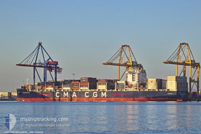
CMA CGM BOLDNESS
Cargo D
Current Trip
| Time Travelled | 3 days |
|---|---|
| Remaining Time | 4 days |
| Distance Travelled | 1475.51 nm |
| Remaining Distance | 1829.67 nm |
| AVG Speed | 16.4 Knots |
| MAX Speed | 18.5 Knots |
| AVG Wind | 12.2 knots |
| MAX Wind | 25 knots |
| MIN Temp | 14.6°C / 58.28°F |
| MAX Temp | 19.9°C / 67.82°F |
| Dybgang | 13.8 m |
| Position Modtaget | 3 d siden |
Current Position
| Longitude | -6.23993° |
|---|---|
| Latitude | 35.97008° |
| Status | Under way using engine |
| Fart | 16.4 Knots |
| Kurs | 272.7° |
| Område | North Atlantic Ocean |
| Station | T-AIS |
| Position Modtaget | 3 d siden |
Info
Information
The current position of CMA CGM BOLDNESS is in North Atlantic Ocean with coordinates 35.97008° / -6.23993° as reported on 2025-02-05 13:31 by AIS to our vessel tracker app. The vessel's current speed is 16.4 Knots and is heading at the port of FORT DE FRANCE. The estimated time of arrival as calculated by MyShipTracking vessel tracking app is 2025-02-13 00:50 LT
The vessel CMA CGM BOLDNESS (IMO: 9948243, MMSI: 256744000) is a Cargo D It's sailing under the flag of [MT] Malta.
In this page you can find informations about the vessels current position, last detected port calls, and current voyage information. If the vessels is not in coverage by AIS you will find the latest position.
The current position of CMA CGM BOLDNESS is detected by our AIS receivers and we are not responsible for the reliability of the data. The last position was recorded while the vessel was in Coverage by the Ais receivers of our vessel tracking app.
The current draught of CMA CGM BOLDNESS as reported by AIS is 13.8 meters
Weather
| Temperature | 19.3°C / 66.74°F |
|---|---|
| Wind Speed | 11 knots |
| Direction | 45° NE |
| Pressure | 1025.8 hPa |
| Humidity | 57.8 % |
| Cloud Coverage | 4 % |
Featured Company
Last Port Calls
| Port | Arrival | Departure | Time In Port |
|---|---|---|---|
| 2025-02-04 09:41 | 2025-02-05 11:37 | 1 d | |
| 2025-01-30 12:26 | 2025-01-31 09:32 | 21 h | |
| 2025-01-27 18:36 | 2025-01-28 16:59 | 22 h | |
| 2025-01-25 04:49 | 2025-01-25 20:49 | 15 h | |
| 2025-01-23 08:20 | 2025-01-24 08:34 | 1 d | |
| 2025-01-21 10:51 | 2025-01-22 08:40 | 21 h | |
| 2025-01-18 16:39 | 2025-01-20 03:58 | 1 d | |
| 2025-01-14 16:05 | 2025-01-15 12:04 | 19 h | |
| 2025-01-04 03:50 | 2025-01-04 21:39 | 17 h | |
| 2024-12-27 02:45 | 2024-12-29 05:55 | 2 d |
Last Trips
| Origin | Departure | Destination | Arrival | Distance | |
|---|---|---|---|---|---|
| 2025-01-31 09:32 | 2025-02-04 09:41 | 578.76 nm | |||
| 2025-01-28 16:59 | 2025-01-30 12:26 | 252.20 nm | |||
| 2025-01-25 20:49 | 2025-01-27 18:36 | 284.37 nm | |||
| 2025-01-24 08:34 | 2025-01-25 04:49 | 228.69 nm | |||
| 2025-01-22 08:40 | 2025-01-23 08:20 | 115.61 nm | |||
| 2025-01-20 03:58 | 2025-01-21 10:51 | 548.80 nm | |||
| 2025-01-15 12:04 | 2025-01-18 16:39 | 1052.48 nm | |||
| 2025-01-04 21:39 | 2025-01-14 16:05 | 4224.33 nm | |||
| 2024-12-29 05:55 | 2025-01-04 03:50 | 1500.14 nm | |||
| 2024-12-26 17:47 | 2024-12-27 02:45 | 39.56 nm |
Events
| Tid | Hændelsen | Detaljer | Position / Dest | Info |
|---|---|---|---|---|
| 2025-02-05 13:40 | Status er ændret | Default Under way using engine |
35.97270 / -6.29095
MQFDF
|
Fart: 16.4 kn Kurs: 272.7° |
| 2025-02-05 13:31 | Udenfor Dækning |
35.97008 / -6.23993
North Atlantic Ocean
MQFDF
|
Fart: 16.4 kn Kurs: 272.7° |
|
| 2025-02-05 13:21 | Fundet i havområde | Spanish part of the North Atlantic Ocean |
35.96801 / -6.18407
North Atlantic Ocean
MQFDF
|
Fart: 16.3 kn Kurs: 273.1° |
| 2025-02-05 13:21 | Status er ændret | Under way using engine Default |
35.96801 / -6.18407
MQFDF
|
Fart: 15.7 kn Kurs: 280° |
| 2025-02-05 12:57 | Status er ændret | Default Under way using engine |
35.95852 / -6.05872
MQFDF
|
Fart: 15.1 kn Kurs: 270° |
| 2025-02-05 12:52 | ETA er ændret | 2025/02/13 09:00 2025/02/12 09:00 |
35.95681 / -6.03066
MQFDF
|
Fart: 15.1 kn Kurs: 269.8° |
| 2025-02-05 12:48 | Fundet i havområde | Moroccan part of the North Atlantic Ocean |
35.95677 / -6.01092
North Atlantic Ocean
MQFDF
|
Fart: 14.9 kn Kurs: 268.9° |
| 2025-02-05 12:47 | Status er ændret | Under way using engine Default |
35.95684 / -6.00483
MQFDF
|
Fart: 13.9 kn Kurs: 268° |
| 2025-02-05 12:25 | Status er ændret | Default Under way using engine |
35.95757 / -5.89639
MQFDF
|
Fart: 14 kn Kurs: 266.2° |
| 2025-02-05 12:22 | Status er ændret | Under way using engine Default |
35.95806 / -5.88645
MQFDF
|
Fart: 14 kn Kurs: 269° |