
COLD STREAM
Reefer
Current Trip
EC PBO
| Time Travelled | 3 days |
|---|---|
| Remaining Time | --- |
| Distance Travelled | 1466.82 nm |
| Remaining Distance | --- |
| AVG Speed | 17.7 Knots |
| MAX Speed | 18.7 Knots |
| AVG Wind | 10.9 knots |
| MAX Wind | 15 knots |
| MIN Temp | 18.9°C / 66.02°F |
| MAX Temp | 25.1°C / 77.18°F |
| Dybgang | 7.1 m |
| Position Modtaget | 5 d siden |
Current Position
| Longitude | -79.45761° |
|---|---|
| Latitude | 8.50147° |
| Status | Under way using engine |
| Fart | 18 Knots |
| Kurs | 178° |
| Område | North Pacific Ocean |
| Station | T-AIS |
| Position Modtaget | 5 d siden |
Info
Information
The current position of COLD STREAM is in North Pacific Ocean with coordinates 8.50147° / -79.45761° as reported on 2025-01-27 05:43 by AIS to our vessel tracker app. The vessel's current speed is 18 Knots
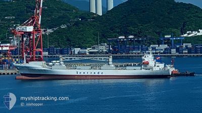
The vessel COLD STREAM (IMO: 9051791, MMSI: 636020388) is a Reefer that was built in 1994 ( 31 år gamle ). It's sailing under the flag of [LR] Liberia.
In this page you can find informations about the vessels current position, last detected port calls, and current voyage information. If the vessels is not in coverage by AIS you will find the latest position.
The current position of COLD STREAM is detected by our AIS receivers and we are not responsible for the reliability of the data. The last position was recorded while the vessel was in Coverage by the Ais receivers of our vessel tracking app.
The current draught of COLD STREAM as reported by AIS is 7.1 meters
Weather
| Temperature | 19.7°C / 67.46°F |
|---|---|
| Wind Speed | 13 knots |
| Direction | 178° S |
| Pressure | 1012.7 hPa |
| Humidity | 84.4 % |
| Cloud Coverage | 100 % |
Featured Company
Last Port Calls
| Port | Arrival | Departure | Time In Port |
|---|---|---|---|
| 2025-01-28 22:31 | 2025-01-29 09:04 | 10 h | |
| 2024-12-01 13:48 | 2024-12-01 21:24 | 7 h |
Last Trips
| Origin | Departure | Destination | Arrival | Distance | |
|---|---|---|---|---|---|
| 2024-12-01 21:24 | 2025-01-28 17:31 | 13101.11 nm | |||
| 2024-11-30 16:46 | 2024-12-01 13:48 | 345.75 nm |
Events
| Tid | Hændelsen | Detaljer | Position / Dest | Info |
|---|---|---|---|---|
| 2025-01-29 09:04 | Afsejlet fra sidste havn |
|
-3.24713 / -80.00537
EC PBO
|
Fart: 5.1 kn Kurs: 335° |
| 2025-01-28 22:44 | STOP Sejllads |
-3.25432 / -80.00143
[EC] PUERTO BOLIVAR
|
Fart: 0.1 kn Kurs: 358° |
|
| 2025-01-28 22:31 | Skibe i havn |
|
-3.25473 / -80.00423
[EC] PUERTO BOLIVAR
|
Fart: 6.6 kn Kurs: 164° |
| 2025-01-27 05:50 | Status er ændret | Default Under way using engine |
8.46845 / -79.45679
EC PBO
|
Fart: 18 kn Kurs: 178° |
| 2025-01-27 05:43 | Udenfor Dækning |
8.50147 / -79.45761
North Pacific Ocean
EC PBO
|
Fart: 18 kn Kurs: 178° |
|
| 2025-01-27 05:38 | Status er ændret | Under way using engine Default |
8.52748 / -79.45913
EC PBO
|
Fart: 18.5 kn Kurs: 178° |
| 2025-01-27 05:27 | Status er ændret | Default Under way using engine |
8.58403 / -79.46173
EC PBO
|
Fart: 18 kn Kurs: 178° |
| 2025-01-27 05:23 | Status er ændret | Under way using engine Default |
8.60637 / -79.46197
EC PBO
|
Fart: 18.6 kn Kurs: 179° |
| 2025-01-27 05:19 | Status er ændret | Default At anchor |
8.62899 / -79.46234
EC PBO
|
Fart: 18 kn Kurs: 178° |
| 2025-01-27 05:13 | Status er ændret | At anchor Default |
8.65731 / -79.46366
EC PBO
|
Fart: 18.5 kn Kurs: 184° |