
CONTAINERSHIPSAURORA
Cargo A
Current Trip
GBTEE VIA NOK
| Time Travelled | 2 days |
|---|---|
| Remaining Time | --- |
| Distance Travelled | 824.78 nm |
| Remaining Distance | --- |
| AVG Speed | 16.5 Knots |
| MAX Speed | 18.4 Knots |
| AVG Wind | 17 knots |
| MAX Wind | 24.7 knots |
| MIN Temp | -3.9°C / 24.98°F |
| MAX Temp | 4.1°C / 39.38°F |
| Dybgang | 9.2 m |
| Position Modtaget | 1 m siden |
Current Position
| Longitude | 10.74756° |
|---|---|
| Latitude | 54.61111° |
| Status | Under way using engine |
| Fart | 1.5 Knots |
| Kurs | 358° |
| Område | Baltic Sea |
| Station | T-AIS |
| Position Modtaget | 1 m siden |
Info
Information
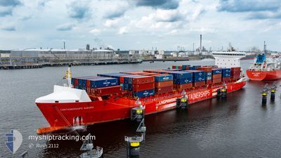
The current position of CONTAINERSHIPSAURORA is in Baltic Sea with coordinates 54.61111° / 10.74756° as reported on 2025-02-07 17:33 by AIS to our vessel tracker app. The vessel's current speed is 1.5 Knots
The vessel CONTAINERSHIPSAURORA (IMO: 9814014, MMSI: 209659000) is a Cargo A It's sailing under the flag of [CY] Cyprus.
In this page you can find informations about the vessels current position, last detected port calls, and current voyage information. If the vessels is not in coverage by AIS you will find the latest position.
The current position of CONTAINERSHIPSAURORA is detected by our AIS receivers and we are not responsible for the reliability of the data. The last position was recorded while the vessel was in Coverage by the Ais receivers of our vessel tracking app.
The current draught of CONTAINERSHIPSAURORA as reported by AIS is 9.2 meters
Weather
| Temperature | 4°C / 39.2°F |
|---|---|
| Wind Speed | 19 knots |
| Direction | 97° E |
| Pressure | 1034 hPa |
| Humidity | 83.2 % |
| Cloud Coverage | 100 % |
Featured Company
Last Port Calls
| Port | Arrival | Departure | Time In Port |
|---|---|---|---|
| 2025-02-04 10:07 | 2025-02-04 22:55 | 12 h | |
| 2025-02-03 05:01 | 2025-02-04 01:24 | 20 h | |
| 2025-01-29 08:53 | 2025-01-30 18:04 | 1 d | |
| 2025-01-28 09:54 | 2025-01-28 23:30 | 13 h | |
| 2025-01-26 20:50 | 2025-01-27 14:49 | 17 h | |
| 2025-01-25 20:34 | 2025-01-25 21:54 | 1 h | |
| 2025-01-21 17:44 | 2025-01-22 07:22 | 13 h | |
| 2025-01-20 09:03 | 2025-01-21 14:24 | 1 d | |
| 2025-01-18 17:20 | 2025-01-18 17:24 | 3 m | |
| 2025-01-15 03:52 | 2025-01-16 21:39 | 1 d |
Last Trips
| Origin | Departure | Destination | Arrival | Distance | |
|---|---|---|---|---|---|
| 2025-02-04 03:24 | 2025-02-04 12:07 | 48.48 nm | |||
| 2025-01-30 19:04 | 2025-02-03 07:01 | 979.55 nm | |||
| 2025-01-29 00:30 | 2025-01-29 09:53 | 111.65 nm | |||
| 2025-01-27 14:49 | 2025-01-28 10:54 | 291.61 nm | |||
| 2025-01-25 22:54 | 2025-01-26 20:50 | 376.46 nm | |||
| 2025-01-22 09:22 | 2025-01-25 21:34 | 903.11 nm | |||
| 2025-01-21 16:24 | 2025-01-21 19:44 | 46.09 nm | |||
| 2025-01-18 18:24 | 2025-01-20 11:03 | 648.81 nm | |||
| 2025-01-16 22:39 | 2025-01-18 18:20 | 331.36 nm | |||
| 2025-01-14 20:15 | 2025-01-15 04:52 | 111.49 nm |
Events
| Tid | Hændelsen | Detaljer | Position / Dest | Info |
|---|---|---|---|---|
| 2025-02-07 16:49 | Ændre havområde | Danish part of the Baltic Sea German part of the Baltic Sea |
54.59414 / 10.82088
Baltic Sea
GBTEE VIA NOK
|
Fart: 16.8 kn Kurs: 285.1° |
| 2025-02-07 15:49 | Ændre havområde | German part of the Baltic Sea Danish part of the Baltic Sea |
54.56750 / 11.31969
Baltic Sea
GBTEE VIA NOK
|
Fart: 18.1 kn Kurs: 298.2° |
| 2025-02-07 14:04 | Ændre havområde | Danish part of the Baltic Sea German part of the Baltic Sea |
54.43492 / 12.12995
Baltic Sea
GBTEE VIA NOK
|
Fart: 16.5 kn Kurs: 272.8° |
| 2025-02-07 13:49 | Ændre havområde | German part of the Baltic Sea Danish part of the Baltic Sea |
54.48378 / 12.20063
Baltic Sea
GBTEE VIA NOK
|
Fart: 17.3 kn Kurs: 193.7° |
| 2025-02-07 13:01 | Ændre havområde | Danish part of the Baltic Sea German part of the Baltic Sea |
54.66688 / 12.40977
Baltic Sea
GBTEE VIA NOK
|
Fart: 16.9 kn Kurs: 237.8° |
| 2025-02-07 12:49 | Ændre havområde | German part of the Baltic Sea Danish part of the Baltic Sea |
54.69737 / 12.49118
Baltic Sea
GBTEE VIA NOK
|
Fart: 16.9 kn Kurs: 235.5° |
| 2025-02-07 11:49 | Ændre havområde | Danish part of the Baltic Sea German part of the Baltic Sea |
54.83070 / 12.91906
Baltic Sea
GBTEE VIA NOK
|
Fart: 17.3 kn Kurs: 247.4° |
| 2025-02-07 10:07 | Ændre havområde | German part of the Baltic Sea Swedish part of the Baltic Sea |
55.01609 / 13.70620
Baltic Sea
GBTEE VIA NOK
|
Fart: 17.4 kn Kurs: 250.8° |
| 2025-02-07 07:29 | Ændre havområde | Swedish part of the Baltic Sea Danish part of the Kattegat |
55.47951 / 14.70285
Baltic Sea
GBTEE VIA NOK
|
Fart: 17.2 kn Kurs: 240.9° |
| 2025-02-07 06:19 | Ændre havområde | Danish part of the Kattegat Swedish part of the Baltic Sea |
55.64449 / 15.22076
Kattegat
GBTEE VIA NOK
|
Fart: 17.6 kn Kurs: 240.6° |