
COPIAPO
Cargo A
Current Trip
| Time Travelled | 4 days |
|---|---|
| Remaining Time | 4 days |
| Distance Travelled | 1748.32 nm |
| Remaining Distance | 1806.30 nm |
| AVG Speed | 15.3 Knots |
| MAX Speed | 20.7 Knots |
| AVG Wind | 10.1 knots |
| MAX Wind | 19.7 knots |
| MIN Temp | 17.9°C / 64.22°F |
| MAX Temp | 21.7°C / 71.06°F |
| Dybgang | 10.4 m |
| Position Modtaget | 38 m siden |
Current Position
| Longitude | -20.29107° |
|---|---|
| Latitude | 18.07603° |
| Status | Under way using engine |
| Fart | 14.6 Knots |
| Kurs | 207.5° |
| Område | North Atlantic Ocean |
| Station | T-AIS |
| Position Modtaget | 38 m siden |
Information
The current position of COPIAPO is in North Atlantic Ocean with coordinates 18.07603° / -20.29107° as reported on 2025-05-31 15:20 by AIS to our vessel tracker app. The vessel's current speed is 14.6 Knots and is heading at the port of SUAPE. The estimated time of arrival as calculated by MyShipTracking vessel tracking app is 2025-06-05 13:11 LT
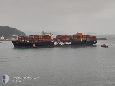
The vessel COPIAPO (IMO: 9687526, MMSI: 636092775) is a Cargo A It's sailing under the flag of [LR] Liberia.
In this page you can find informations about the vessels current position, last detected port calls, and current voyage information. If the vessels is not in coverage by AIS you will find the latest position.
The current position of COPIAPO is detected by our AIS receivers and we are not responsible for the reliability of the data. The last position was recorded while the vessel was in Coverage by the Ais receivers of our vessel tracking app.
The current draught of COPIAPO as reported by AIS is 10.4 meters
Weather
| Temperature | 20.3°C / 68.54°F |
|---|---|
| Wind Speed | 14 knots |
| Direction | 344° NNW |
| Pressure | 1015.6 hPa |
| Humidity | 92.5 % |
| Cloud Coverage | --- |
Featured Company
Last Port Calls
| Port | Arrival | Departure | Time In Port |
|---|---|---|---|
| 2025-05-26 04:31 | 2025-05-26 21:54 | 17 h | |
| 2025-05-25 00:07 | 2025-05-25 23:15 | 23 h | |
| 2025-05-21 04:00 | 2025-05-23 15:49 | 2 d | |
| 2025-05-18 14:20 | 2025-05-20 16:53 | 2 d | |
| 2025-05-16 12:36 | 2025-05-17 14:45 | 1 d | |
| 2025-05-13 23:26 | 2025-05-15 04:20 | 1 d | |
| 2025-05-06 06:17 | 2025-05-07 09:35 | 1 d | |
| 2025-04-23 21:11 | 2025-04-23 21:27 | 16 m | |
| 2025-04-23 07:28 | 2025-04-23 08:12 | 43 m | |
| 2025-04-22 08:31 | 2025-04-22 09:29 | 58 m |
Most Visited Ports (Last year)
| Port | Arrivals | |
|---|---|---|
| 3 | ||
| 3 | ||
| 3 | ||
| 2 | ||
| 2 | ||
| 2 |
Last Trips
| Origin | Departure | Destination | Arrival | Distance | |
|---|---|---|---|---|---|
| 2025-05-26 01:15 | 2025-05-26 06:31 | 12.08 nm | |||
| 2025-05-23 17:49 | 2025-05-25 02:07 | 520.15 nm | |||
| 2025-05-20 18:53 | 2025-05-21 06:00 | 90.43 nm | |||
| 2025-05-17 16:45 | 2025-05-18 16:20 | 389.70 nm | |||
| 2025-05-15 06:20 | 2025-05-16 14:36 | 210.18 nm | |||
| 2025-05-07 10:35 | 2025-05-14 01:26 | 1166.87 nm | |||
| 2025-04-23 18:27 | 2025-05-06 07:17 | 3545.83 nm | |||
| 2025-04-23 05:12 | 2025-04-23 18:11 | 224.09 nm | |||
| 2025-04-22 06:29 | 2025-04-23 04:28 | 5.20 nm | |||
| 2025-04-16 11:47 | 2025-04-22 05:31 | 902.88 nm |
Events
| Tid | Hændelsen | Detaljer | Position / Dest | Info |
|---|---|---|---|---|
| 2025-05-31 15:26 | Status er ændret | Default Under way using engine |
18.05570 / -20.30076
BRSUA
|
Fart: 14.6 kn Kurs: 207.5° |
| 2025-05-31 15:19 | Status er ændret | Under way using engine Default |
18.08330 / -20.28711
BRSUA
|
Fart: 14.5 kn Kurs: 207° |
| 2025-05-31 15:12 | Indenfor Dækning |
18.08330 / -20.28711
North Atlantic Ocean
BRSUA
|
Fart: 14.6 kn Kurs: 207.6° |
|
| 2025-05-31 13:38 | Status er ændret | Default Under way using engine |
18.46061 / -20.06879
BRSUA
|
Fart: 15.6 kn Kurs: 211.3° |
| 2025-05-31 13:33 | Udenfor Dækning |
18.47986 / -20.05674
North Atlantic Ocean
BRSUA
|
Fart: 15.6 kn Kurs: 211.3° |
|
| 2025-05-31 13:32 | Status er ændret | Under way using engine Default |
18.48310 / -20.05469
BRSUA
|
Fart: 15.7 kn Kurs: 211° |
| 2025-05-31 13:14 | Status er ændret | Default Under way using engine |
18.55299 / -20.01114
BRSUA
|
Fart: 15.7 kn Kurs: 210.5° |
| 2025-05-31 13:13 | Status er ændret | Under way using engine Default |
18.55731 / -20.00849
BRSUA
|
Fart: 15.6 kn Kurs: 210° |
| 2025-05-31 13:13 | Fundet i havområde | Cape Verdean part of the North Atlantic Ocean |
18.55731 / -20.00849
North Atlantic Ocean
BRSUA
|
Fart: 15.7 kn Kurs: 210.5° |
| 2025-05-31 12:46 | Ændre havområde | Mauritanian part of the North Atlantic Ocean Western Saharan part of the North Atlantic Ocean |
18.65643 / -19.94836
North Atlantic Ocean
BRSUA
|
Fart: 15.6 kn Kurs: 209.9° |