

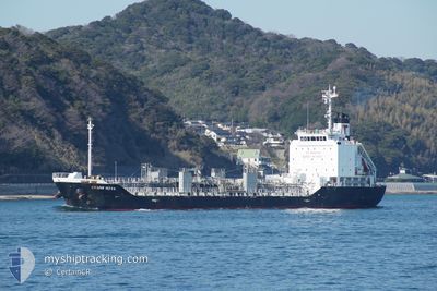
CRANE NOVA
Tanker B

Current Trip
| Time Travelled | 11 days |
|---|---|
| Remaining Time | --- |
| Distance Travelled | 2948.76 nm |
| Remaining Distance | --- |
| AVG Speed | 12.1 Knots |
| MAX Speed | 14.8 Knots |
| AVG Wind | 9.3 knots |
| MAX Wind | 21.9 knots |
| MIN Temp | 17.1°C / 62.78°F |
| MAX Temp | 30°C / 86°F |
| Dybgang | 6.7 m |
| Position Modtaget | 1 d siden |
Current Position
| Longitude | 136.77349° |
|---|---|
| Latitude | 34.80289° |
| Status | Under way using engine |
| Fart | 12.5 Knots |
| Kurs | 0.2° |
| Område | Philippine Sea |
| Station | T-AIS |
| Position Modtaget | 1 d siden |
Information
The current position of CRANE NOVA is in Philippine Sea with coordinates 34.80289° / 136.77349° as reported on 2025-06-03 01:13 by AIS to our vessel tracker app. The vessel's current speed is 12.5 Knots
The vessel CRANE NOVA (IMO: 9840855, MMSI: 371958000) is a Tanker B It's sailing under the flag of [PA] Panama.
In this page you can find informations about the vessels current position, last detected port calls, and current voyage information. If the vessels is not in coverage by AIS you will find the latest position.
The current position of CRANE NOVA is detected by our AIS receivers and we are not responsible for the reliability of the data. The last position was recorded while the vessel was in Coverage by the Ais receivers of our vessel tracking app.
The current draught of CRANE NOVA as reported by AIS is 6.7 meters
Weather
| Temperature | 23.3°C / 73.94°F |
|---|---|
| Wind Speed | 12 knots |
| Direction | 326° NW |
| Pressure | 1003.2 hPa |
| Humidity | 47.8 % |
| Cloud Coverage | 44 % |


Featured Company
Last Port Calls
| Port | Arrival | Departure | Time In Port |
|---|---|---|---|
| 2025-05-22 19:27 | 2025-05-24 05:22 | 1 d | |
| 2025-05-19 06:36 | 2025-05-19 19:28 | 12 h | |
| 2025-05-18 02:14 | 2025-05-18 22:54 | 20 h | |
| 2025-05-10 14:20 | 2025-05-11 13:47 | 23 h | |
| 2025-05-06 23:08 | 2025-05-08 23:06 | 1 d | |
| 2025-05-02 08:58 | 2025-05-03 08:15 | 23 h | |
| 2025-04-27 11:38 | 2025-04-29 07:58 | 1 d | |
| 2025-04-24 15:42 | 2025-04-25 05:30 | 13 h | |
| 2025-04-18 12:30 | 2025-04-19 05:14 | 16 h | |
| 2025-04-15 16:14 | 2025-04-16 04:22 | 12 h |
Last Trips
| Origin | Departure | Destination | Arrival | Distance | |
|---|---|---|---|---|---|
| 2025-05-19 19:28 | 2025-05-22 19:27 | 889.10 nm | |||
| 2025-05-18 22:54 | 2025-05-19 06:36 | 44.75 nm | |||
| 2025-05-11 13:47 | 2025-05-18 02:14 | 1626.53 nm | |||
| 2025-05-08 23:06 | 2025-05-10 14:20 | 152.44 nm | |||
| 2025-05-03 08:15 | 2025-05-06 23:08 | 994.61 nm | |||
| 2025-04-29 07:58 | 2025-05-02 08:58 | 790.84 nm | |||
| 2025-04-25 05:30 | 2025-04-27 11:38 | 475.02 nm | |||
| 2025-04-19 05:14 | 2025-04-24 15:42 | 1189.78 nm | |||
| 2025-04-16 04:22 | 2025-04-18 12:30 | 6.94 nm | |||
| 2025-04-05 18:33 | 2025-04-15 16:14 | 2757.62 nm |
Events
| Tid | Hændelsen | Detaljer | Position / Dest | Info |
|---|---|---|---|---|
| 2025-06-03 02:23 | STOP Sejllads | 3.55 nm, East of YOKKAICHI |
34.95675 / 136.74379
JP NGO
|
Fart: 0.3 kn Kurs: 169° |
| 2025-06-03 01:19 | Status er ændret | Default Under way using engine |
34.82124 / 136.77210
JP NGO
|
Fart: 12.5 kn Kurs: 0.2° |
| 2025-06-03 01:13 | Status er ændret | Under way using engine Default |
34.80289 / 136.77349
JP NGO
|
Fart: 12.8 kn Kurs: 332° |
| 2025-06-03 01:13 | Udenfor Dækning |
34.80289 / 136.77349
Philippine Sea
JP NGO
|
Fart: 12.5 kn Kurs: 0.2° |
|
| 2025-06-03 01:07 | Status er ændret | Default Under way using engine |
34.78019 / 136.78267
JP NGO
|
Fart: 12.7 kn Kurs: 337.6° |
| 2025-06-03 01:00 | Status er ændret | Under way using engine Default |
34.75703 / 136.79453
JP NGO
|
Fart: 12.8 kn Kurs: 337° |
| 2025-06-03 00:42 | Status er ændret | Default Under way using engine |
34.70171 / 136.82606
JP NGO
|
Fart: 12.7 kn Kurs: 326.6° |
| 2025-06-03 00:30 | Dybgangen er ændret | 6.7 6.8 |
34.66490 / 136.85367
JP NGO
|
Fart: 12.8 kn Kurs: 309.7° |
| 2025-06-03 00:30 | ETA er ændret | 2025/06/03 02:30 2025/06/02 22:00 |
34.66490 / 136.85367
JP NGO
|
Fart: 12.8 kn Kurs: 309.7° |
| 2025-06-03 00:19 | Status er ændret | Under way using engine Default |
34.64172 / 136.89158
JP NGO
|
Fart: 13 kn Kurs: 307° |