
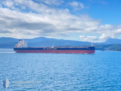
DARYA DEVI
Bulk Carrier
Current Trip
| Trip Time | 58 days |
|---|---|
| Trip Distance | 9749.72 nm |
| AVG Speed | 9.8 Knots |
| MAX Speed | 15.1 Knots |
| Dybgang | 13.6 m |
| AVG Wind | 13.6 knots |
| MAX Wind | 34.8 knots |
| MIN Temp | -5.3°C / 22.46°F |
| MAX Temp | 28.7°C / 83.66°F |
| Position Modtaget | 8 d siden |
Current Position
| Longitude | 121.30817° |
|---|---|
| Latitude | 22.11070° |
| Status | Under way using engine |
| Fart | 11 Knots |
| Kurs | 20.5° |
| Område | Philippine Sea |
| Station | T-AIS |
| Position Modtaget | 8 d siden |
Info
Information
The current position of DARYA DEVI is in Philippine Sea with coordinates 22.11070° / 121.30817° as reported on 2025-12-06 00:57 by AIS to our vessel tracker app. The vessel's current speed is 11 Knots and is currently inside the port of BAYUQUAN.
The vessel DARYA DEVI (IMO: 9627760, MMSI: 477182600) is a Bulk Carrier that was built in 2013 ( 12 år gamle ). It's sailing under the flag of [HK] Hong Kong.
In this page you can find informations about the vessels current position, last detected port calls, and current voyage information. If the vessels is not in coverage by AIS you will find the latest position.
The current position of DARYA DEVI is detected by our AIS receivers and we are not responsible for the reliability of the data. The last position was recorded while the vessel was in Coverage by the Ais receivers of our vessel tracking app.
The current draught of DARYA DEVI as reported by AIS is 13.6 meters
Weather
| Temperature | -0.5°C / 31.1°F |
|---|---|
| Wind Speed | 6 knots |
| Direction | 168° SSE |
| Pressure | 1022.2 hPa |
| Humidity | 60.5 % |
| Cloud Coverage | --- |
Featured Company
Last Port Calls
| Port | Arrival | Departure | Time In Port |
|---|---|---|---|
| 2025-12-13 09:41 | |||
| 2025-10-11 12:44 | 2025-10-15 18:40 | 4 d |
Most Visited Ports (Last year)
| Port | Arrivals | |
|---|---|---|
| 2 | ||
| 2 | ||
| 1 | ||
| 1 | ||
| 1 | ||
| 1 |
Last Trips
| Origin | Departure | Destination | Arrival | Distance | |
|---|---|---|---|---|---|
| 2025-10-15 18:40 | 2025-12-13 09:41 | 9749.72 nm | |||
| 2025-09-10 04:46 | 2025-10-11 12:44 | 9146.44 nm |
Events
| Tid | Hændelsen | Detaljer | Position / Dest | Info |
|---|---|---|---|---|
| 2025-12-13 02:35 | STOP Sejllads |
40.28902 / 122.08881
[CN] BAYUQUAN
|
Fart: Kurs: 62° |
|
| 2025-12-13 01:41 | Skibe i havn |
|
40.29202 / 122.04043
[CN] BAYUQUAN
|
Fart: 8.3 kn Kurs: 96° |
| 2025-12-12 19:37 | START Sejllads |
40.16994 / 121.53676
BYCUQUAN
|
Fart: 3.9 kn Kurs: 35° |
|
| 2025-12-10 18:13 | STOP Sejllads |
40.16540 / 121.53447
BYCUQUAN
|
Fart: 0.2 kn Kurs: 31° |
|
| 2025-12-06 00:59 | Status er ændret | Default Under way using engine |
22.11508 / 121.30997
BYCUQUAN
|
Fart: 11 kn Kurs: 20.5° |
| 2025-12-06 00:57 | Status er ændret | Under way using engine Default |
22.11070 / 121.30817
BYCUQUAN
|
Fart: 11 kn Kurs: 19° |
| 2025-12-06 00:57 | Indenfor Dækning |
22.11070 / 121.30817
Philippine Sea
BYCUQUAN
|
Fart: 11 kn Kurs: 20.5° |
|
| 2025-12-06 00:57 | Udenfor Dækning |
22.11070 / 121.30817
Philippine Sea
BYCUQUAN
|
Fart: 11 kn Kurs: 20.5° |
|
| 2025-12-06 00:57 | Ændre havområde | Taiwanese part of the Philippine Sea Malaysian part of the Singapore Strait |
22.11070 / 121.30817
Philippine Sea
BYCUQUAN
|
Fart: 11 kn Kurs: 20.5° |