
DECATHLON
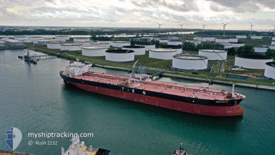
Crude Oil Tanker
Current Trip
| Time Travelled | 1 day |
|---|---|
| Remaining Time | 1 day |
| Distance Travelled | 500.52 nm |
| Remaining Distance | 785.33 nm |
| AVG Speed | 13.9 Knots |
| MAX Speed | 15.1 Knots |
| AVG Wind | 18.7 knots |
| MAX Wind | 26 knots |
| MIN Temp | 12.3°C / 54.14°F |
| MAX Temp | 14.6°C / 58.28°F |
| Dybgang | 9.3 m |
| Position Modtaget | 12 m siden |
Current Position
| Longitude | -10.10350° |
|---|---|
| Latitude | 40.65282° |
| Status | Under way using engine |
| Fart | 14.5 Knots |
| Kurs | 180° |
| Område | North Atlantic Ocean |
| Station | T-AIS |
| Position Modtaget | 12 m siden |
Info
Information
The current position of DECATHLON is in North Atlantic Ocean with coordinates 40.65282° / -10.10350° as reported on 2025-02-14 02:05 by AIS to our vessel tracker app. The vessel's current speed is 14.5 Knots and is heading at the port of ALGECIRAS. The estimated time of arrival as calculated by MyShipTracking vessel tracking app is 2025-02-15 08:07 LT
The vessel DECATHLON (IMO: 9462926, MMSI: 538004487) is a Crude Oil Tanker that was built in 2012 ( 13 år gamle ). It's sailing under the flag of [MH] Marshall Is.
In this page you can find informations about the vessels current position, last detected port calls, and current voyage information. If the vessels is not in coverage by AIS you will find the latest position.
The current position of DECATHLON is detected by our AIS receivers and we are not responsible for the reliability of the data. The last position was recorded while the vessel was in Coverage by the Ais receivers of our vessel tracking app.
The current draught of DECATHLON as reported by AIS is 9.3 meters
Weather
| Temperature | 14.5°C / 58.1°F |
|---|---|
| Wind Speed | 17 knots |
| Direction | 178° S |
| Pressure | 1017.4 hPa |
| Humidity | 88 % |
| Cloud Coverage | 100 % |
Featured Company
Most Visited Ports (Last year)
| Port | Arrivals | |
|---|---|---|
| 4 | ||
| 2 | ||
| 1 | ||
| 1 | ||
| 1 | ||
| 1 |
Events
| Tid | Hændelsen | Detaljer | Position / Dest | Info |
|---|---|---|---|---|
| 2025-02-14 02:10 | Status er ændret | Default Under way using engine |
40.63547 / -10.10395
ESALG
|
Fart: 14.5 kn Kurs: 180° |
| 2025-02-14 02:02 | Status er ændret | Under way using engine Default |
40.66815 / -10.10343
ESALG
|
Fart: 14.6 kn Kurs: 180° |
| 2025-02-14 02:02 | Indenfor Dækning |
40.66815 / -10.10343
North Atlantic Ocean
ESALG
|
Fart: 14.5 kn Kurs: 180° |
|
| 2025-02-14 00:31 | Status er ændret | Default Under way using engine |
41.02995 / -10.10806
ESALG
|
Fart: 14.6 kn Kurs: 178° |
| 2025-02-14 00:30 | Status er ændret | Under way using engine Default |
41.03317 / -10.10803
ESALG
|
Fart: 14.7 kn Kurs: 179° |
| 2025-02-14 00:30 | Udenfor Dækning |
41.03317 / -10.10803
North Atlantic Ocean
ESALG
|
Fart: 14.6 kn Kurs: 178° |
|
| 2025-02-14 00:05 | Status er ændret | Default Under way using engine |
41.13497 / -10.10932
ESALG
|
Fart: 14.3 kn Kurs: 180° |
| 2025-02-14 00:02 | Ændre havområde | Portuguese part of the North Atlantic Ocean Spanish part of the Bay of Biscay |
41.14820 / -10.10908
North Atlantic Ocean
ESALG
|
Fart: 14.3 kn Kurs: 180° |
| 2025-02-14 00:01 | Status er ændret | Under way using engine Default |
41.15027 / -10.10907
ESALG
|
Fart: 14.4 kn Kurs: 181° |
| 2025-02-13 23:49 | Indenfor Dækning |
41.14820 / -10.10908
North Atlantic Ocean
ESALG
|
Fart: 14.3 kn Kurs: 180° |