
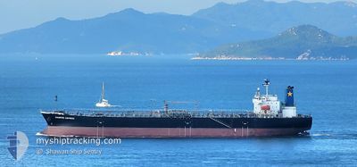
DIAMOND EXPRESS
Oil Products Tanker
Current Trip
| Time Travelled | 12 days |
|---|---|
| Remaining Time | --- |
| Distance Travelled | 1889.93 nm |
| Remaining Distance | --- |
| AVG Speed | 10.3 Knots |
| MAX Speed | 15.7 Knots |
| AVG Wind | 19.2 knots |
| MAX Wind | 36.7 knots |
| MIN Temp | 2.3°C / 36.14°F |
| MAX Temp | 29.9°C / 85.82°F |
| Dybgang | 11.3 m |
| Position Modtaget | 26 d siden |
Current Position
| Longitude | 134.71075° |
|---|---|
| Latitude | 33.53573° |
| Status | Under way using engine |
| Fart | 12.6 Knots |
| Kurs | 207° |
| Område | Philippine Sea |
| Station | T-AIS |
| Position Modtaget | 26 d siden |
Info
Information
The current position of DIAMOND EXPRESS is in Philippine Sea with coordinates 33.53573° / 134.71075° as reported on 2025-01-16 15:36 by AIS to our vessel tracker app. The vessel's current speed is 12.6 Knots and is heading at the port of CAI MEP.
The vessel DIAMOND EXPRESS (IMO: 9409493, MMSI: 477694500) is a Oil Products Tanker that was built in 2009 ( 16 år gamle ). It's sailing under the flag of [HK] Hong Kong.
In this page you can find informations about the vessels current position, last detected port calls, and current voyage information. If the vessels is not in coverage by AIS you will find the latest position.
The current position of DIAMOND EXPRESS is detected by our AIS receivers and we are not responsible for the reliability of the data. The last position was recorded while the vessel was in Coverage by the Ais receivers of our vessel tracking app.
The current draught of DIAMOND EXPRESS as reported by AIS is 11.3 meters
Weather
| Temperature | 9.2°C / 48.56°F |
|---|---|
| Wind Speed | 23 knots |
| Direction | 320° NW |
| Pressure | 1021.2 hPa |
| Humidity | 93.4 % |
| Cloud Coverage | 91 % |
Featured Company
Last Port Calls
| Port | Arrival | Departure | Time In Port |
|---|---|---|---|
| 2025-01-29 23:32 | 2025-01-30 19:38 | 20 h | |
| 2025-01-24 10:17 | 2025-01-26 00:07 | 1 d | |
| 2025-01-14 06:13 | 2025-01-16 03:55 | 1 d | |
| 2025-01-05 00:49 | 2025-01-06 02:09 | 1 d | |
| 2024-12-27 08:33 | 2024-12-28 15:07 | 1 d | |
| 2024-12-04 00:36 | 2024-12-05 04:27 | 1 d |
Last Trips
| Origin | Departure | Destination | Arrival | Distance | |
|---|---|---|---|---|---|
| 2025-01-26 07:07 | 2025-01-30 07:32 | 877.78 nm | |||
| 2025-01-16 12:55 | 2025-01-24 17:17 | 2304.02 nm | |||
| 2025-01-06 11:09 | 2025-01-14 15:13 | 946.62 nm | |||
| 2024-12-29 00:07 | 2025-01-05 09:49 | 1087.47 nm | |||
| 2024-12-05 13:27 | 2024-12-27 17:33 | 4202.04 nm | |||
| 2024-11-29 09:04 | 2024-12-04 09:36 | 610.50 nm |
Events
| Tid | Hændelsen | Detaljer | Position / Dest | Info |
|---|---|---|---|---|
| 2025-02-10 01:28 | STOP Sejllads | 9.1 nm, South of ZHOUSHAN |
29.81572 / 122.18045
VN CMT
|
Fart: Kurs: 145° |
| 2025-02-09 19:54 | START Sejllads |
29.73328 / 122.93362
VN CMT
|
Fart: 6 kn Kurs: 209° |
|
| 2025-02-09 01:03 | STOP Sejllads |
29.73748 / 122.94408
VN CMT
|
Fart: 0.3 kn Kurs: 328° |
|
| 2025-02-08 19:46 | START Sejllads |
29.54073 / 123.16142
VN CMT
|
Fart: 3.7 kn Kurs: 344° |
|
| 2025-02-08 16:04 | STOP Sejllads |
29.51215 / 123.11391
VN CMT
|
Fart: 0.1 kn Kurs: 342° |
|
| 2025-02-08 09:32 | START Sejllads |
29.75348 / 123.10555
VN CMT
|
Fart: 3.1 kn Kurs: 351° |
|
| 2025-02-08 08:56 | STOP Sejllads |
29.74116 / 123.10685
VN CMT
|
Fart: Kurs: 354° |
|
| 2025-02-08 03:07 | START Sejllads |
29.63800 / 123.20513
VN CMT
|
Fart: 5 kn Kurs: 351° |
|
| 2025-02-07 23:38 | STOP Sejllads |
29.58122 / 123.16623
VN CMT
|
Fart: Kurs: 359° |
|
| 2025-02-07 19:47 | START Sejllads |
29.83507 / 123.18197
VN CMT
|
Fart: 6.5 kn Kurs: 152° |