
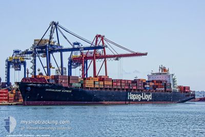
DUESSELDORF EXPRESS
Container Ship
Current Trip
| Time Travelled | 5 days |
|---|---|
| Remaining Time | 2 days |
| Distance Travelled | 1783.01 nm |
| Remaining Distance | 1185.43 nm |
| AVG Speed | 16.2 Knots |
| MAX Speed | 19.7 Knots |
| AVG Wind | 12.9 knots |
| MAX Wind | 28 knots |
| MIN Temp | 12.8°C / 55.04°F |
| MAX Temp | 26.2°C / 79.16°F |
| Dybgang | 10.5 m |
| Position Modtaget | 4 d siden |
Current Position
| Longitude | -48.72367° |
|---|---|
| Latitude | -28.83139° |
| Status | Under way using engine |
| Fart | 18.9 Knots |
| Kurs | 211.2° |
| Område | South Atlantic Ocean |
| Station | T-AIS |
| Position Modtaget | 4 d siden |
Info
Information
The current position of DUESSELDORF EXPRESS is in South Atlantic Ocean with coordinates -28.83139° / -48.72367° as reported on 2025-01-29 20:29 by AIS to our vessel tracker app. The vessel's current speed is 18.9 Knots and is heading at the port of RIO GRANDE. The estimated time of arrival as calculated by MyShipTracking vessel tracking app is 2025-02-05 22:01 LT
The vessel DUESSELDORF EXPRESS (IMO: 9143556, MMSI: 310768000) is a Container Ship that was built in 1998 ( 27 år gamle ). It's sailing under the flag of [BM] Bermuda.
In this page you can find informations about the vessels current position, last detected port calls, and current voyage information. If the vessels is not in coverage by AIS you will find the latest position.
The current position of DUESSELDORF EXPRESS is detected by our AIS receivers and we are not responsible for the reliability of the data. The last position was recorded while the vessel was in Coverage by the Ais receivers of our vessel tracking app.
The current draught of DUESSELDORF EXPRESS as reported by AIS is 10.5 meters
Weather
| Temperature | 13°C / 55.4°F |
|---|---|
| Wind Speed | 24 knots |
| Direction | 245° WSW |
| Pressure | 999 hPa |
| Humidity | 68.3 % |
| Cloud Coverage | 47 % |
Featured Company
Last Port Calls
| Port | Arrival | Departure | Time In Port |
|---|---|---|---|
| 2025-01-28 07:40 | 2025-01-29 00:14 | 16 h | |
| 2025-01-22 18:12 | 2025-01-23 10:07 | 15 h | |
| 2025-01-10 20:24 | 2025-01-11 22:33 | 1 d | |
| 2025-01-04 06:42 | 2025-01-05 00:10 | 17 h | |
| 2024-12-29 17:45 | 2024-12-31 11:04 | 1 d | |
| 2024-12-26 08:50 | 2024-12-27 13:01 | 1 d | |
| 2024-12-21 12:49 | 2024-12-23 06:21 | 1 d | |
| 2024-12-10 02:29 | 2024-12-11 07:57 | 1 d | |
| 2024-12-06 17:19 | 2024-12-07 13:39 | 20 h |
Last Trips
| Origin | Departure | Destination | Arrival | Distance | |
|---|---|---|---|---|---|
| 2025-01-23 10:07 | 2025-01-28 07:40 | 667.05 nm | |||
| 2025-01-11 22:33 | 2025-01-22 18:12 | 3497.15 nm | |||
| 2025-01-05 00:10 | 2025-01-10 20:24 | 933.41 nm | |||
| 2024-12-31 11:04 | 2025-01-04 06:42 | 1302.60 nm | |||
| 2024-12-27 13:01 | 2024-12-29 17:45 | 729.74 nm | |||
| 2024-12-23 06:21 | 2024-12-26 08:50 | 1350.84 nm | |||
| 2024-12-11 07:57 | 2024-12-21 12:49 | 3663.29 nm | |||
| 2024-12-07 13:39 | 2024-12-10 02:29 | 208.53 nm | |||
| 2024-11-26 13:15 | 2024-12-06 17:19 | 3356.13 nm |
Events
| Tid | Hændelsen | Detaljer | Position / Dest | Info |
|---|---|---|---|---|
| 2025-01-31 02:34 | START Sejllads | 6.26 nm, South of RIO GRANDE |
-32.13196 / -52.09996
BRRIG
|
Fart: 6.3 kn Kurs: 170° |
| 2025-01-30 14:58 | STOP Sejllads | 5.84 nm, South of RIO GRANDE |
-32.12469 / -52.10178
BRRIG
|
Fart: 0.1 kn Kurs: 18° |
| 2025-01-29 20:33 | Status er ændret | Default Under way using engine |
-28.84707 / -48.73465
BRRIG
|
Fart: 18.9 kn Kurs: 211.2° |
| 2025-01-29 20:29 | Udenfor Dækning |
-28.83139 / -48.72367
South Atlantic Ocean
BRRIG
|
Fart: 18.9 kn Kurs: 211.2° |
|
| 2025-01-29 19:17 | Status er ændret | Under way using engine Default |
-28.51444 / -48.48884
BRRIG
|
Fart: 18.5 kn Kurs: 204° |
| 2025-01-29 19:08 | Indenfor Dækning |
-28.51632 / -48.48983
South Atlantic Ocean
BRRIG
|
Fart: 18.7 kn Kurs: 203.9° |
|
| 2025-01-29 18:09 | Status er ændret | Default Under way using engine |
-28.18959 / -48.32824
BRRIG
|
Fart: 18.8 kn Kurs: 202.9° |
| 2025-01-29 18:05 | Udenfor Dækning |
-28.17216 / -48.31996
South Atlantic Ocean
BRRIG
|
Fart: 18.8 kn Kurs: 202.9° |
|
| 2025-01-29 18:03 | Status er ændret | Under way using engine Default |
-28.16012 / -48.31423
BRRIG
|
Fart: 18.6 kn Kurs: 203° |
| 2025-01-29 17:48 | Status er ændret | Default Under way using engine |
-28.08804 / -48.27964
BRRIG
|
Fart: 18.5 kn Kurs: 203.8° |