
EBURY TRADER
Cargo
Current Trip
| Time Travelled | --- |
|---|---|
| Remaining Time | --- |
| Distance Travelled | 5265.68 nm |
| Remaining Distance | --- |
| AVG Speed | 10.7 Knots |
| MAX Speed | 14.2 Knots |
| AVG Wind | 7.3 knots |
| MAX Wind | 24 knots |
| MIN Temp | 23.5°C / 74.3°F |
| MAX Temp | 30.6°C / 87.08°F |
| Dybgang | 13.1 m |
| Position Modtaget | 5 d siden |
Current Position
| Longitude | 76.05908° |
|---|---|
| Latitude | 8.71328° |
| Status | Under way using engine |
| Fart | 10.1 Knots |
| Kurs | 326.8° |
| Område | Laccadive Sea |
| Station | T-AIS |
| Position Modtaget | 5 d siden |
Info
Information
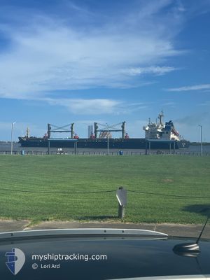
The current position of EBURY TRADER is in Laccadive Sea with coordinates 8.71328° / 76.05908° as reported on 2025-12-14 04:11 by AIS to our vessel tracker app. The vessel's current speed is 10.1 Knots
The vessel EBURY TRADER (IMO: 9596727, MMSI: 636023920) is a Cargo It's sailing under the flag of [LR] Liberia.
In this page you can find informations about the vessels current position, last detected port calls, and current voyage information. If the vessels is not in coverage by AIS you will find the latest position.
The current position of EBURY TRADER is detected by our AIS receivers and we are not responsible for the reliability of the data. The last position was recorded while the vessel was in Coverage by the Ais receivers of our vessel tracking app.
The current draught of EBURY TRADER as reported by AIS is 13.1 meters
Weather
| Temperature | 25.3°C / 77.54°F |
|---|---|
| Wind Speed | 8 knots |
| Direction | 89° E |
| Pressure | 1015.9 hPa |
| Humidity | 48.8 % |
| Cloud Coverage | 7 % |
Featured Company
Last Port Calls
Most Visited Ports (Last year)
| Port | Arrivals | |
|---|---|---|
| 2 | ||
| 1 | ||
| 1 | ||
| 1 | ||
| 1 | ||
| 1 |
Last Trips
| Origin | Departure | Destination | Arrival | Distance |
|---|
Events
| Tid | Hændelsen | Detaljer | Position / Dest | Info |
|---|---|---|---|---|
| 2025-12-18 00:13 | STOP Sejllads | 2.7 nm, South of PORBANDAR |
21.58820 / 69.58082
IN PBD
|
Fart: 0.2 kn Kurs: 139° |
| 2025-12-14 04:13 | Status er ændret | Default Under way using engine |
8.71722 / 76.05648
IN PBD
|
Fart: 10.1 kn Kurs: 326.8° |
| 2025-12-14 04:11 | Status er ændret | Under way using engine Default |
8.71328 / 76.05908
IN PBD
|
Fart: 10 kn Kurs: 328° |
| 2025-12-14 04:11 | Udenfor Dækning |
8.71328 / 76.05908
Laccadive Sea
IN PBD
|
Fart: 10.1 kn Kurs: 326.8° |
|
| 2025-12-14 04:04 | Indenfor Dækning |
8.71328 / 76.05908
Laccadive Sea
IN PBD
|
Fart: 10.1 kn Kurs: 326.8° |
|
| 2025-12-13 21:37 | Status er ændret | Default Under way using engine |
8.09245 / 76.89007
IN PBD
|
Fart: 8.6 kn Kurs: 303° |
| 2025-12-13 21:32 | Status er ændret | Under way using engine Default |
8.08657 / 76.89967
IN PBD
|
Fart: 8.6 kn Kurs: 302° |
| 2025-12-13 21:32 | Udenfor Dækning |
8.08657 / 76.89967
Laccadive Sea
IN PBD
|
Fart: 8.6 kn Kurs: 303° |
|
| 2025-12-13 21:21 | Status er ændret | Default Under way using engine |
8.07189 / 76.92218
IN PBD
|
Fart: 8.4 kn Kurs: 304.3° |
| 2025-12-13 16:32 | Status er ændret | Under way using engine Default |
7.71292 / 77.45552
IN PBD
|
Fart: 8.6 kn Kurs: 307° |