
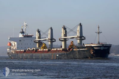
ECO BUSHFIRE
Bulk Carrier
Current Trip
| Time Travelled | 1 day |
|---|---|
| Remaining Time | 1 day |
| Distance Travelled | 301.56 nm |
| Remaining Distance | 315.14 nm |
| AVG Speed | 12.3 Knots |
| MAX Speed | 13.5 Knots |
| AVG Wind | 13.6 knots |
| MAX Wind | 20 knots |
| MIN Temp | 26.3°C / 79.34°F |
| MAX Temp | 29°C / 84.2°F |
| Dybgang | 6.1 m |
| Position Modtaget | 1 m siden |
Current Position
| Longitude | -48.35050° |
|---|---|
| Latitude | -28.49737° |
| Status | Under way using engine |
| Fart | 13.5 Knots |
| Kurs | 182.6° |
| Område | South Atlantic Ocean |
| Station | T-AIS |
| Position Modtaget | 1 m siden |
Info
Information
The current position of ECO BUSHFIRE is in South Atlantic Ocean with coordinates -28.49737° / -48.35050° as reported on 2025-02-28 15:40 by AIS to our vessel tracker app. The vessel's current speed is 13.5 Knots and is heading at the port of RIO GRANDE. The estimated time of arrival as calculated by MyShipTracking vessel tracking app is 2025-03-01 16:12 LT
The vessel ECO BUSHFIRE (IMO: 9561344, MMSI: 538003632) is a Bulk Carrier that was built in 2011 ( 14 år gamle ). It's sailing under the flag of [MH] Marshall Is.
In this page you can find informations about the vessels current position, last detected port calls, and current voyage information. If the vessels is not in coverage by AIS you will find the latest position.
The current position of ECO BUSHFIRE is detected by our AIS receivers and we are not responsible for the reliability of the data. The last position was recorded while the vessel was in Coverage by the Ais receivers of our vessel tracking app.
The current draught of ECO BUSHFIRE as reported by AIS is 6.1 meters
Weather
| Temperature | 26.9°C / 80.42°F |
|---|---|
| Wind Speed | 20 knots |
| Direction | 20° NNE |
| Pressure | 1015.9 hPa |
| Humidity | 81.5 % |
| Cloud Coverage | 76 % |
Featured Company
Last Port Calls
| Port | Arrival | Departure | Time In Port |
|---|---|---|---|
| 2025-02-26 17:51 | 2025-02-26 18:41 | 50 m | |
| 2025-02-17 09:42 | 2025-02-19 07:20 | 1 d | |
| 2025-01-14 00:46 | 2025-01-17 17:02 | 3 d | |
| 2025-01-02 07:26 | 2025-01-05 18:48 | 3 d | |
| 2024-12-08 14:35 | 2024-12-25 20:15 | 17 d |
Most Visited Ports (Last year)
| Port | Arrivals | |
|---|---|---|
| 3 | ||
| 2 | ||
| 1 | ||
| 1 | ||
| 1 | ||
| 1 |
Last Trips
| Origin | Departure | Destination | Arrival | Distance | |
|---|---|---|---|---|---|
| 2025-02-19 04:20 | 2025-02-26 14:51 | 584.94 nm | |||
| 2025-01-17 20:02 | 2025-02-17 06:42 | 6760.54 nm | |||
| 2025-01-05 19:48 | 2025-01-14 03:46 | 1810.27 nm | |||
| 2024-12-25 23:15 | 2025-01-02 08:26 | 1494.55 nm | |||
| 2024-11-15 21:06 | 2024-12-08 17:35 | 6063.53 nm |
Events
| Tid | Hændelsen | Detaljer | Position / Dest | Info |
|---|---|---|---|---|
| 2025-02-28 07:41 | Status er ændret | Under way using engine Default |
-26.94376 / -47.63658
BR RIG
|
Fart: 13.2 kn Kurs: 204° |
| 2025-02-28 07:20 | Status er ændret | Default Under way using engine |
-26.87498 / -47.60183
BR RIG
|
Fart: 13 kn Kurs: 204.2° |
| 2025-02-28 07:17 | Status er ændret | Under way using engine Default |
-26.86321 / -47.59588
BR RIG
|
Fart: 13.1 kn Kurs: 205° |
| 2025-02-28 07:13 | Indenfor Dækning |
-26.86321 / -47.59588
South Atlantic Ocean
BR RIG
|
Fart: 13 kn Kurs: 204.2° |
|
| 2025-02-27 21:32 | Status er ændret | Default Under way using engine |
-25.07744 / -46.64877
BR RIG
|
Fart: 11.3 kn Kurs: 209.6° |
| 2025-02-27 21:28 | Udenfor Dækning |
-25.06608 / -46.64274
South Atlantic Ocean
BR RIG
|
Fart: 11.3 kn Kurs: 209.6° |
|
| 2025-02-27 19:29 | Destination er ændret | BR RIG BR SSZ |
-24.72005 / -46.46659
BR RIG
|
Fart: 11.2 kn Kurs: 205.8° |
| 2025-02-27 19:29 | ETA er ændret | 2025/03/03 08:00 2025/02/21 08:00 |
-24.72005 / -46.46659
BR RIG
|
Fart: 11.2 kn Kurs: 205.8° |
| 2025-02-27 19:21 | Status er ændret | Under way using engine Default |
-24.69790 / -46.45519
BR SSZ
|
Fart: 11.1 kn Kurs: 205° |
| 2025-02-27 19:18 | Indenfor Dækning |
-24.70358 / -46.45804
South Atlantic Ocean
|
Fart: 11.2 kn Kurs: 205.7° |